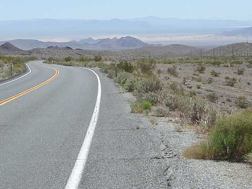
This stretch of Highway 127 is one of those great downhills that seems to go on forever, very enjoyable with views of mountains and sand dunes in the distance.
Approaching the Dumont Dunes area, Highway 127 is straight-ahead
I'm too busy experiencing the pleasure to notice the fine details. Miles pass. The traffic is still light, but when it does pass, it's very fast-moving.
Occasionally, a big rig comes roaring down the hill behind me. Each time, I notice it coming about a mile before it reaches me. I ride along obliviously each time one passes me. One time, three in a row pass by, perhaps travelling together as a team.
More miles pass. I'm not counting how many. I didn't study maps of this area too much, so I didn't realize I'd be in a scenic valley of sorts, as I approach the Dumont Dunes off-road vehicle area coming up on my left.
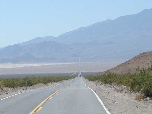
Past Dumont Dunes, Highway 127 curves, finally
I'm still heading downhill, but it's slowly levelling out. The road draws a straight line into the distance in front of me, which looks a bit daunting. I can see that I will be heading uphill soon enough. But the open spaces of the desert are often deceiving, and the hill probably isn't a big deal.
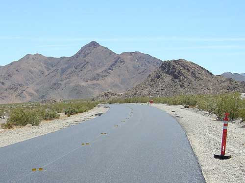
I've just entered an extensive area of new asphalt so fresh that most of the two-lane highway doesn't even have a new centre-line striped on it yet. Reflective markers and pylons delineate the middle and edges of the fresh pavement. The fresh blacktop gives off its characteristic tar scent.
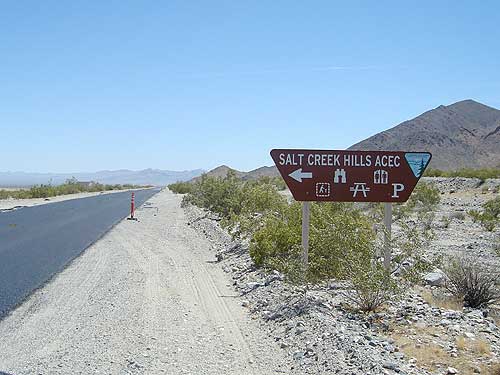
South of Dumont Dunes along Highway 127 is the Salt Creek ACEC (Area of Critical Concern)
The day has warmed up significantly. The fresh black pavement is very black and is absorbing and giving off a lot of heat.
The sun is hot, but I think the pavement is hotter. I'm getting lightly cooked from all sides. This valley probably retains heat.
With my downhill running out, I'm pedalling more and more just to maintain 15 miles per hour. I'm starting to wonder if my tires will get fatigued from all the heat beneath them. Hopefully not!
OK, it's over now. I've reached the lowest point on this road, at about 420 feet. It's time to start rising again, ever so slowly.
It's requiring significant effort, but after the many miles of joyous downhill that I have just experienced, I feel refreshed and ready to tackle anything, even while wilting under the hot sun!
Today, I'm psyched-up to cover a lot of miles. I'm in shape enough now to do it comfortably on my ninth day out here on the ten-ton bike. I wasn't expecting this road to be so scenic, and I'm really enjoying it out here.
I've been staring at the straight-ahead road for a while now, wondering which way it will turn before it smashes into the mountain in front of me in the distance.
As I get finally close to that mountain, I see that the road veers to the left and goes downhill a bit to skirt the mountain's edges. Signs point to the Salt Creek Hills Area of Critical Concern (ACEC) to my left.