Packing up is typically slow and unorganized, but as always, I manage to stuff it all in and leave the campsite.
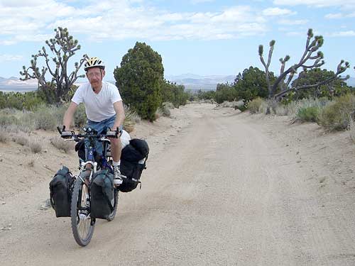
Riding down New York Mountains Road
I'm up around 5600 feet, where it tends to be cooler and windier, but it seems that the surrounding mountains and rocks helped to prevent some of the wind from blowing through the campsite last night. I remember hearing occasional loud gusts of wind last night that seemed to blow over me without touching down, making noises like an airplane flying overhead.
I leave and start heading down New York Mountains Road eastward to Ivanpah Road. Oh, a small four-way intersection.
I look north and immediately recognize the view from Internet photos I had seen prior to this trip. This here is the Caruthers Canyon Road that I was looking for yesterday, and where I camped out last night was not.
I'm tempted to head up that road to check out the scenery and see what I missed. But it's already noon, and I do want to make it to Nipton before the general store there closes at 18h.
Sand along New York Mountains Road
So I skip the detour and continue pedalling as planned. Heading down New York Mountains Road in this direction turns out to be a mountain-biker's treat.
Only a slight downhill, and pedalling is still required, but the slope is enough to make it an easy ride. It gets fairly technical at times as I endeavour to avoid ruts and sand patches, or sail over them without stopping. I alternate between the left and right tire track of the road depending on whichever appears to be in the best condition at a given location.
It's constant navigation with the eyes focused on the road surface, and a certain amount of speed is needed to sail through the sandy patches with stopping.
I frequently fishtail in the slippery spots, but then regain control, but sometimes, the fishtailing causes me to lose balance altogether and I have to stop and restart. I find myself walking through the sandiest patches.
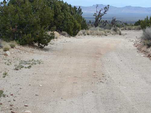
The lighter, greyer areas of the road to the right are sandy, while the slightly darker, more reddish areas o the left are harder clay-like surfaces that are better for riding.
The eyes get trained rapidly to respond to the subtle colour changes of the road and what it means. The lighter beige areas are sandy, while the darker, more reddish, stretches are harder clay-like surfaces that provide ample traction.
Crossing over from the right tire track to the left through the median of sand between them can be like hitting a patch of ice, and a challenge to do without falling.
I'm so used to the bone-rattling washboard surface of the road that I barely notice it anymore. I haven't been on pavement in a few days now.
It's all a lot of fun, augmented by the beauty of the many Joshua trees and Mojave yuccas along the route. As the route progresses and the elevation gets a bit lower, a lot of creosote bush gets mixed into the landscape.
After four miles or so, this most enjoyable phase of the ride comes to an end as I reach the junction of Ivanpah Road, which is wider and graded, and will take me close to Nipton, some 30 miles away.