Pedalling onward in the 18-25 mph range, I glide along nicely through the wide open space, enjoying the newfound pavement.
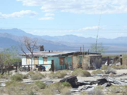
As I get closer to the house, I realize that it's abandoned
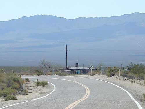
I'm approaching the "town" of Ivanpah, which seems to consist of just one house near the road. I can also see a trailer or two sitting alone a quarter-mile or so up a side road that extends along the railway tracks.
During my last trip out here in 2000, I chatted with a guy while at the showers at Nipton who told me he lived here in Ivanpah in a trailer with no plumbing. I wonder if that's where he lives over there.
As I ride by the lone house at Ivanpah, I notice that it's abandoned and boarded-up. I'm a big fan of abandoned buildings due to their inherent non-pristine historic character. I wonder how long the house has been empty and how long it served as home for a family of desert dwellers.
I really should stop and explore this old house, but I'm enjoying my downhill too much to do that right now.
After the bend in the road at Ivanpah, a long straight-away across the valley awaits me
It would also be worthwhile to ride up that side road along the tracks to see if those buildings up there are occupied or not. Curiosity unrequited.
With such an open landscape, the two big bends in the road here seem unnecessary, but they add character.
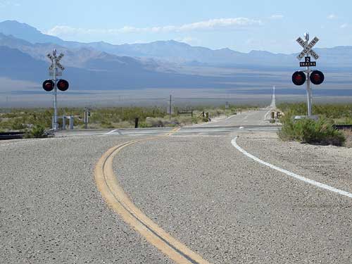
After the second bend in the road, Ivanpah Road crosses the train tracks and a typical long straight desert road through creosote-bush scrub is in front of me. With so little else here, the train crossing is dramatic.
It's nice to see that I still have a little bit of downhill left after the train tracks before I reach the very bottom of Ivanpah Valley. After that, I'll have a slight uphill until I reach the other side of the valley.
I reach a sign that says "Saddle Horn Road." I stop here for a water-and-Clif-bar break here. It's warm down here and I'm thirsty and running out of energy.
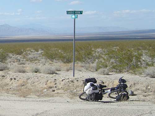
The 10-ton bike takes a rest at the on Ivanpah Road at the junction of Saddle Horn Road
I'm also running low on water. I will probably run out of water before I reach Nipton. The water that I have left is hot from the sun and leaves me wanting more.
I've probably been drinking a little less water than I need to, partly out of the need to conserve, partly because it's not refreshing, and this is a no-no out here in the hot desert. But I should be at Nipton soon enough, in another 13 miles, and able to drink cold water again then. And beer too!!
My chocolate-brownie Clif bar is tasty, despite the heat, but my big slugs of hot water don't go down quite so well.
There doesn't seem to be much around Saddle Horn Road except a single building that I can see a mile or so down that road. And big powerlines.
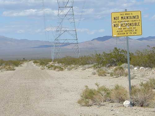
Saddle Horn Road follows the power lines; bullet holes in the sign remind you that you are in the desert
I could follow this road as a shortcut to Nipton and shave off five miles or so from my ride. I've never checked out this road, but I suspect that it degrades into a sandy surface that would actually be much slower to ride than just sticking to the longer paved route via Ivanpah Road and Nipton Road.
Indeed, a sign here warns that the road is unmaintained and that the County of San Bernardino is not responsible for problems suffered due to use of the road.
I wonder if a specific incident once took place in the area that inspired the gigantic San Bernardino County to erect such a sign.
Having spent years "participating" in so-called bicycle advocacy in the San José area, it's not hard for me to imagine career bureaucrats from Big Engineering requiring that signs like this be installed here and there. Always in the name of safety, of course, but above all, to protect the agency that employs them.
I find myself wondering why this Saddle Horn Road actually has a name and a sign while so many roads out here are nameless and can be difficult to locate. None of my maps label it with a name. There's probably a really interesting history behind the nomenclature here.