I wonder how far I am from Tecopa. I pull out my map again and am not exactly sure where I am.
I guess I'm on Smith Talc Road
I pass a few side roads that are even rougher than the one I'm on, so I ignore those and just stay on the downhill track that seems to be the most travelled, presuming that this is the correct route. If not, well, there is an endless number of places to camp around here should I decide to do so.
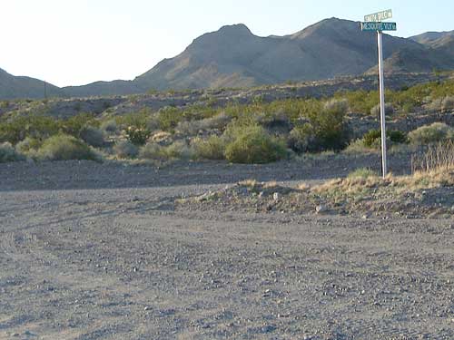
I reach a crude intersection with a sign indicating Smith Talc Road, named after a nearby talc mine. This is on my map, so I know now that I'm headed in the right direction for sure. I'm amused by these urban-looking street signs that appear once in while here in these remote areas.
Onward and downward, the steep downhills have levelled out a lot. After several miles of technical mountain-biker downhill, the gravelly double tire tracks have slowly widened and become a rough road that is two lanes wide in places.
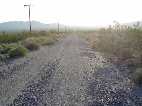
Washboard surface on Smith Talc Road, a good place to ride in the middle of the road since there isn't any other traffic around besides me
I think I'm on Furnace Creek Road now. I can visualize coming around a curve somewhere and seeing the little town of Tecopa off in the distance, but nothing like that is happening yet because Tecopa is still many miles away.
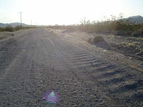
This wider road is heavily washboarded with a light layer of gravel on the surface, and a lot like Cedar Canyon Road in Mojave National Preserve. As long as I'm still going downhill, it's a decent ride.
Now that the road is less steep, I'm always pedalling, but I'm still rolling along at a decent speed—mostly riding around 20 mph, sometimes faster.
I've been riding downhill for long enough now that I keep thinking that I must be hitting the bottom of the valley, but I'm still not. Of course, I don't really want this joy to end anyway, except that I do want to make it to Tecopa Hot Springs by dark.
I pause to laugh at myself because coming up this little hill on Furnace Creek Road feels like such a big ordeal after 50 miles!
I still haven't seen any cars around, so I take the liberty of riding in the middle of the road, or on the wrong side—wherever the road appears to be smoothest and least gravelly.
The sun is beginning to set and I've had the sun shining directly into my eyes for a while now during my westward ride.
The sun is so bright at times that I can barely see the washboard texture of the road any more, even though I certainly feel it. The sun is hotter down here than it was higher up, and I'm starting to sweat again from the pedalling.
Just when I start thinking that maybe I'll coast most of the into Tecopa, my wide dirt road suddenly turns to the right (north) and starts going uphill. Hmmm... I stop and get out my road map to check it. Am I going in the right direction? I guess so.
At this pause, I realize how tired I am. This little uphill, which is no big deal at all, really feels like a slap in the face. I get back on the bike, and the slow uphill that scared me levels out, turns another big corner, then starts to go a bit downhill again. Phew!