Excelsior Mine Road here is paved and there's virtually no traffic, which suits me just fine.
Four cars coming down Kingston Road, the road which separates Mesquite Mountains Wilderness and North Mesquite Mountains Wilderness
After Clark Mountain, there is a series of Bureau of Land Management (BLM) wilderness lands along this road.
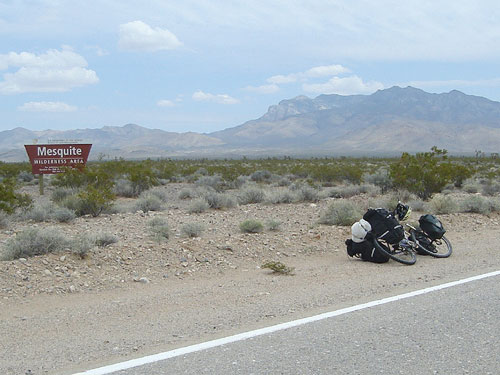
The first of these is the Mesquite Mountains Wilderness Area. I remember reading that this wilderness parcel doesn't receive much visitation because it's so close to more alluring areas like Clark Mountain and the Kingston Range.
The Mesquite Mountains Wilderness Area ends where Kingston Road forks off on an angle to my right. Beyond Kingston Road sits the North Mesquite Mountains Wilderness Area.
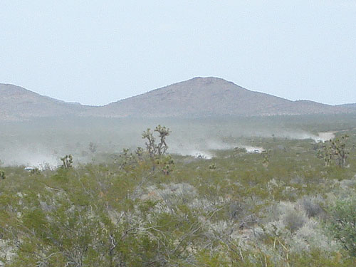
I'm not at that intersection just yet, but I can see four dustballs blowing across the creosote-bush scrub.
Each dustball corresponds to a motor vehicle heading down the dirt Kingston Road toward me.
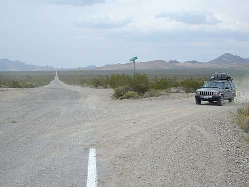
Car camper arriving at Excelsior Mine Road from Kingston Road; Kingston Range is off in the distance to the left, North Mesquite Mountains to the right
I reach the junction of Excelsior Mine Road and Kingston Road at about the same time as the first of the four dustball vehicles. I stop and pull out my camera. This is the lowest point on Excelsior Mine Road, at about 3300 feet elevation.
Each vehicle is heavily equipped for camping, and each driver waves and honks at me while passing, fellow campers that they are.