Home 7119

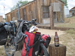 Cima Store is open today, so I stop for a bag of chips and a bottle of blogger Morongo Bill's esteemed Sioux City Sarsaparilla
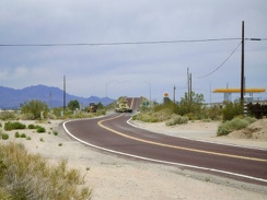 Cima Road rises up to a bridge that crosses over Interstate 15 and I stop at the gas station store here to fuel up on supplies
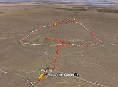 Cima Dome / Teutonia Peak hike route as viewed in Google Earth
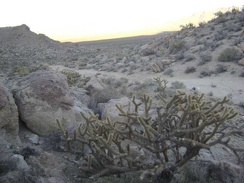 Cholla cactus along the old Coyote Springs Road
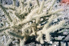 Cholla cactus
 Cholla cacti and barrel cacti pick up the late-afternoon sun while I walk across this area above Cave Spring
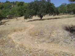 China Hole Trail winds across a meadow on its way up.
 China Hole Trail rises quickly out of the canyon.
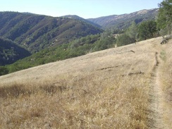 China Hole Trail pops out of the shady area and winds its way across an open meadow on the way down into the canyon.
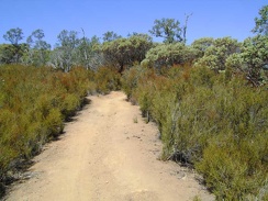 China Hole Trail passes through a lot of chamise again before entering another manzanita-dominated area
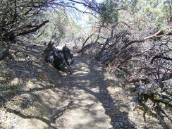 China Hole Trail passes briefly through a stand of manzanitas
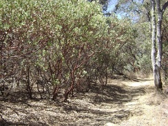 China Hole Trail levels out a bit and is easier riding for a while.
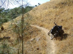 China Hole Trail exits the oak woodland on the crest and begins winding its way downhill across grassland
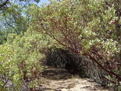 China Hole Trail enters into a tunnel of manzanitas.
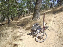 China Hole Trail ends when it reaches Manzanita Point Road.
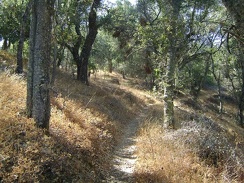 China Hole Trail drops down 700 feet into the canyon over two miles of nice single-track
 China Hole campsite this morning.
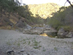 China Hole at sunset, looking northeast toward The Narrows.
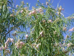 Chilopsis linearis flowers in close-up
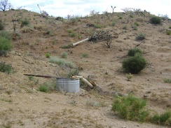 Chicken Water Spring, to my surprise, drips into this shiny, new steel basin
 Chicken Water Spring Road is quite indistinct here and doesn't look like it has been driven often in recent years
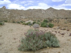 Chicken Water Spring is off to my right, but I decide to walk straight ahead for a short loop around this end of the valley
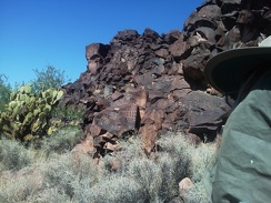 Chalkboard?
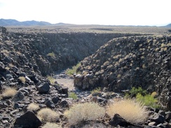 Centuries of erosion have created this drainage canyon through the south end of Broadwell Mesa in the Kelso Dunes Wilderness
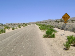 Cedar Canyon Road's famous "pavement ends" sign
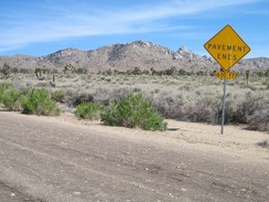 Cedar Canyon Road's famous "pavement ends" sign, Mojave National Preserve
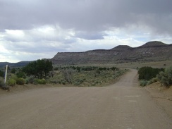 Cedar Canyon Road turns and heads briefly north toward Pinto Mountain before resuming its westward trek
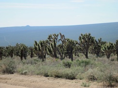 Cedar Canyon Road rises through a healthy joshua tree forest, with Cima Dome still in the background when I look behind me
 Cedar Canyon Road junction, another much-needed break, at 3725 feet on Kelso-Cima Road
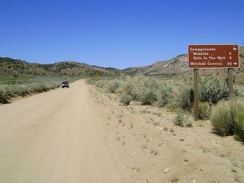 Cedar Canyon Road is scenic, but I'm always so happy when I reach the junction of Black Canyon Road at 5000 feet
 Cedar Canyon Road is now visible: that horizontal line down below
 Cedar Canyon Road east of the Mid Hills is mostly unpaved, except for this short stretch by a cattle guard
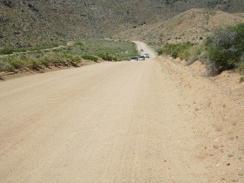 Cedar Canyon Road dips down into Cedar Wash for a couple of miles
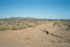 Cedar Canyon Road crosses the historic Old Mojave Road
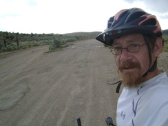 Cedar Canyon Road crosses a cattle guard and offers a detour for those not wishing to cross the cattle guard
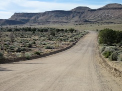 Cedar Canyon Road bends again and heads toward Pinto Mountain for a few minutes
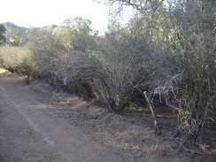 Ceanothus along Red Creek Road on Paradise Flat.
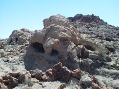 Cave Spring rock igloos
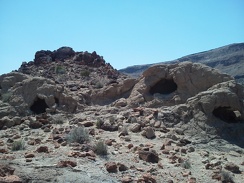 Cave Spring igloos
 Cattle-guard on Nipton Road at I-15
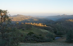 Cattle pond near Wagon Road
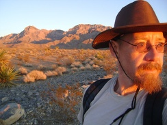 Catching the last hot-red rays of sunset as I walk down Rex Mine Road, with the Providence Mountains behind me
 Catching some shade on Bear Spring Road (much of the road is exposed to the sun and not shady at all).
 Castle Peaks Road heads across the land toward a slot between the rolling hills at upper-left
 Castle Peaks Road ends after 30 minutes; I start riding the Barnwell-Searchlight railway grade and find this stray balloon
 Castle Peaks Road beyond the dry reservoir continues to deteriorate
 Canteen Trail keeps heading upward.
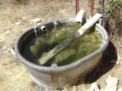 Canteen Spring is full but not flowing.
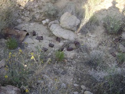 Can dump at the mine site at the end of the middle fork of Globe Mine Road
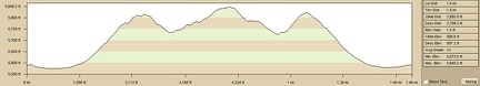 Campground Peaks hiking route elevation profile
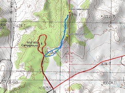 Campground Peaks hiking route (in blue)
 Camp slowly gets packed up, and I lazily leave my Pine Spring campsite around 11h30
 Camp is set up near Indian Springs!
 Camouflaged in the rocks is a small concrete dam to retain water running down from the hills
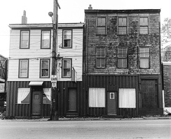 Camille's Fish n Chips, Barrington Street, Halifax, 1984
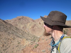 Cady Peak, behind my hat, is not all that far away, but I'm not really on the route up to the peak
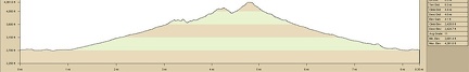 Cady Mountains hike elevation profile
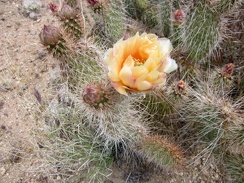 Cactus-flower close-up, next to Wee Thump Wilderness, Nevada
 Cactus buddies
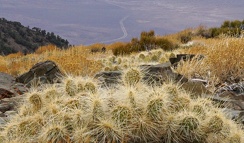 Cactus
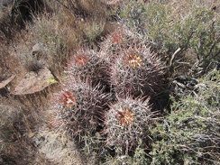 Cactus
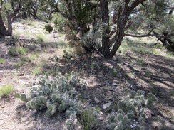 Cacti and a few blue phacelia flowers enjoy the shade under this pinyon pine in the McCullough Mountains
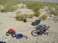 By 9h, the contents of my campsite on Cornfield Spring Road has been decisively packed into my bloated saddlebags
 By 9h, it's too hot in the tent, and I have no choice but to get up and start today's hike to Keystone Spring
 Butterfly
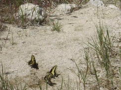 Butterflies like this moist sand along the edge of the drying-up creek bed
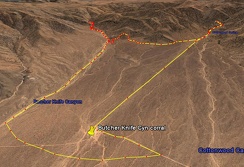 Butcher Knife Canyon hike as viewed in Google Earth
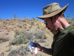 But first, I'll stop to finish off this last delicious piece of orange-flavored chocolate
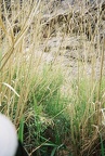 Bushwhacking my way through more reeds
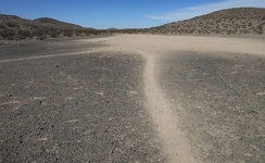 Burro trails
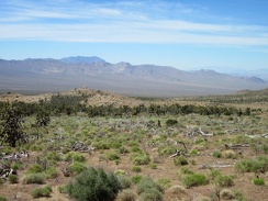 Burned joshua trees are scattered across this plain, but fragments of the old juniper forest survived the 2005 brush fires
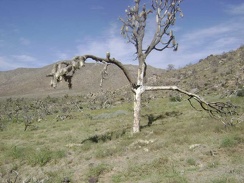 Burned joshua tree near Butcher Knife Canyon, Mojave National Preserve
 Burned desert willow (chilopsis linearis) in Bull Canyon wash, Mojave National Preserve
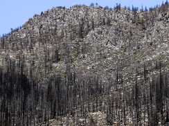 Burned conifers, Stanislaus National Forest, 2020
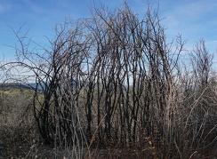 Burned brush, Henry Coe State Park
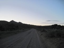 Bumpy, bumpy, slowly uphill pedaling on the upper part of Black Canyon Road
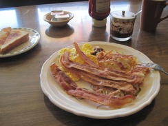 Bummer, no Chinese breakfast on the menu (who would order such "weird stuff"?), so I order scrambled eggs and bacon
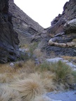 Bull Canyon winds around another interesting bend
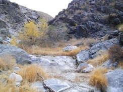 Bull Canyon widens a little after passing through the narrows
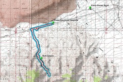 Bull Canyon hike route from campsite on Kelso Dunes power-line road
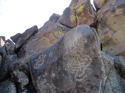 Bulb
Bulb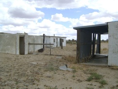 Buildings at Rock Tank, Aiken Mine Road, Mojave National Preserve
 Bugs abound at Keystone Spring, as happy to have water as I am
 Buddha Rock, Mojave National Preserve
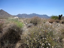 Buckwheats are still flowering along this stretch of Ivanpah Road
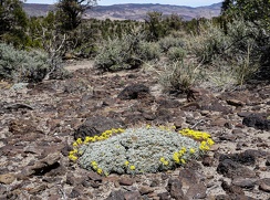 Buckwheat, Humboldt-Toiyabe National Forest
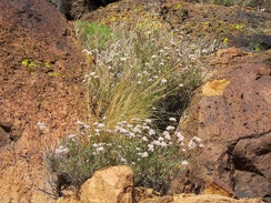 Buckwheat flowers pop out between dark rocks that absorb the hot sun in Saddle Horse Canyon
 Bubbles in the rocks
 Brrr! It's really cold up here at Mid Hills campground tonight
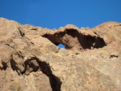 Broadwell Natural Arch South
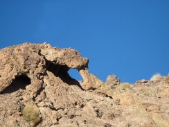 Broadwell Natural Arch North
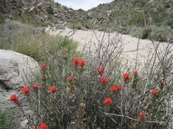 Brilliant Indian Paintbrush never fails to get one's attention!
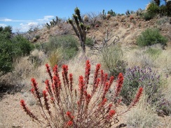 Bright-red Indian paintbrush near the bottom of Juniper Spring wash
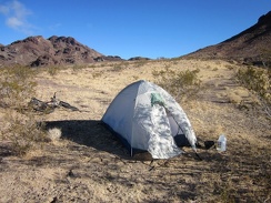 Bright, sunny morning, cool breeze, perfect for the hike that I've planned up the adjacent Sleeping Beauty hills
 Bright sunshine at the bottom of the Lava Tube ladder
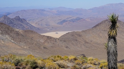 Bright sunshine and a bit of smoke in the air as I look down toward "The Racetrack" in Death Valley National Park
 Bright sun warms up this cold November morning at Hole-in-the-Wall Campground, Mojave National Preserve
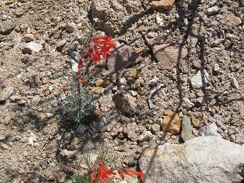 Bright red hummingbird flowers growing in the gravelly drainage west of Pinto Mountain
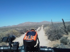 Breezes keep the tent somewhat cool after the hot sun wakes me at 7h30, then I ride over to Hole-in-the-Wall Visitor Centre
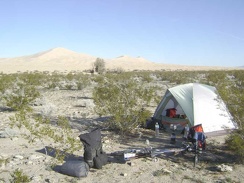 Breaking camp on the final morning of a trip produces mixed emotions
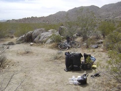 Breaking camp and packing up
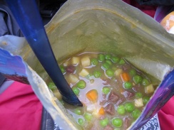 Breakfast this morning is a hot meal, not my usual routine of granola, dried fruit and nuts
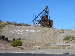 Breakfast in Searchlight means McDonald's again (ugh); I admire the old Colton Mine headframe on the way back to my motel room
 Breakfast at Emigrant Campground
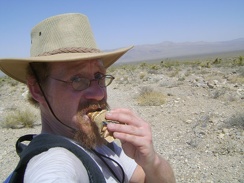 Break time! A Clif bar, and more water, which is already rather warm
 Break time on the lower-middle section of Willow Ridge Trail!
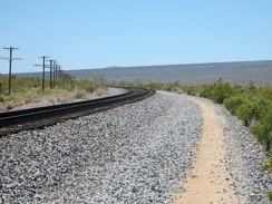 Brant Road hugs the train track as it curves to follow the route toward Cima, Mojave National Preserve
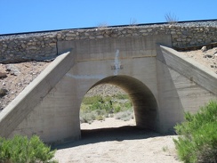 Brant Road dips down again to cross a wash, with the adjacent train tracks crossing the wash on an old concrete bridge
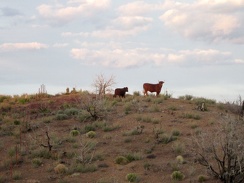 Bovines along Wild Horse Canyon Road
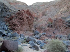 Boulders strewn about in Piute Canyon
 Boulders frame this view over to Hackberry Mountain from the south flank of Table Mountain
 Boulder with heavy-duty wire tied around it
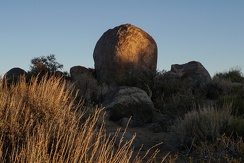 Boulder glow
 Borrego Canyon splits into a north and south fork; I choose to follow the south fork
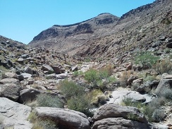 Borrego Canyon is quite rocky, making for slow hiking, as I thought might be the case
 Borrego Canyon is quite pristine, except for the cow grazing and this fresh roll of barbed wire
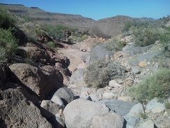 Borrego Canyon hiking: climb over the rocks
 Borrego Canyon hike route, Mojave National Preserve, elevation profile
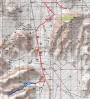 Borrego Canyon hike route, Mojave National Preserve
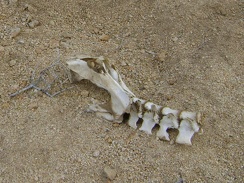 Bones in wash near Silver Lead Spring, Mojave National Preserve
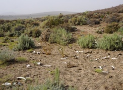 Bone scatter
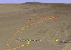 Bolder Spring hike route viewed in Google Earth
 Board Spring Road veers off County Line Road into the brush in the middle of the photo on a slight downhill along the edge of the mountain.
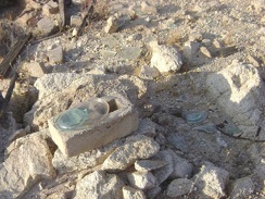 Bluish turquoise glass
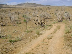 Bluejay Mine Road, Mojave National Preserve
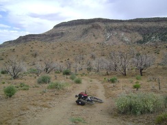 Bluejay Mine Road snakes around below Wild Horse Mesa
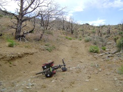 Bluejay Mine Road rises out of the wash, sort of, but is really bumpy, and a bit uphill, so I'm now walking more than riding
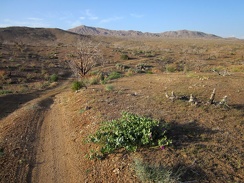 Bluejay Mine Road improves as it rolls downward, a most excellent mountain-biking road
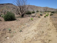 Bluejay Mine Road gets a bit better after rising out of the sandy wash
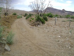 Bluejay Mine Road enters a wash and I look at the tracks I've carved behind me
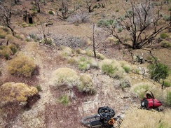 Bluejay Mine Road ends here, so I stash my bike in the brush, lock it up, and begin today's hike
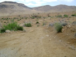 Bluejay Mine Road appears to my right about six miles from Mid Hills campsite 22, at about 4740 feet elevation
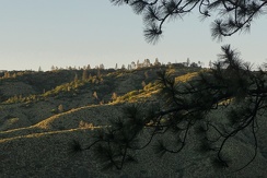 Blue Ridge, Henry Coe State Park
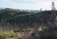 Blue Ridge, Henry Coe State Park
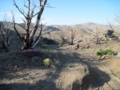 Blue Jay Mine Road is slightly downhill during most of its 1.7 miles back to Wild Horse Canyon Road
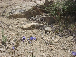 Blue flowers in the Bolder Spring wash
 Blue dicks
 Blue delphiniums (Delphinium parishii) flowering near some yellowish hopsage (Grayia spinosa)
 Blooming daturas decorate the train tracks along Kelso-Cima Road
 Bladderpod (Isomeris arborea) flowering and fruiting on the hillside behind my tent near Indian Springs
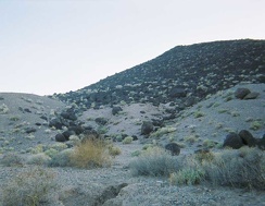 Black rocks that look like giant charcoal briquets
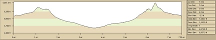 Black Diamond Spring hike from Barnett Mine, Mojave National Preserve
 Black Canyon Road's grade here ranges from three to seven per cent, with a bit of loose sand on a hard washboard surface
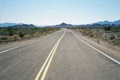 Black Canyon Road winds through the Colton Hills as it approaches Essex Road
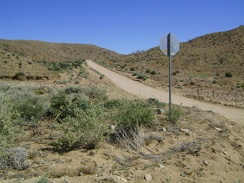 Black Canyon Road rises up from Cedar Canyon Road toward the Mid Hills, Mojave National Preserve
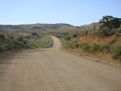 Black Canyon Road is often straight, but it meanders when passing through Black Canyon
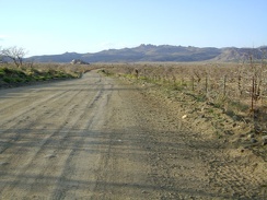 Black Canyon Road flattens out as it crosses Round Valley, Mojave National Preserve
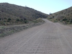 Black Canyon Road climbs up above the wash while passing through the canyon
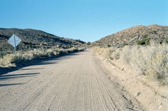 Black Canyon Road climbs slowly the next eight miles toward Mid Hills Campground
 Bla, I can't ride through this deep kitty litter, it's getting dark, and I'm not down at Devil's Playground yet
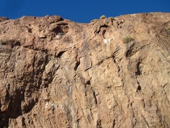 Birds use these two cavelets high up in the rock wall, and one of them is occupied by a nest
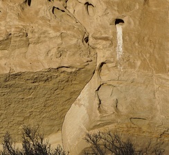 Bird residence
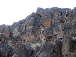 Bird droppings on rocks above the natural tank suggest that ledges up there might be used as nests
 Bird
Bird Bill's dog keeps me company while he prepares our meals
 Bike standing on the edge of County Line Road at the trailhead of the Hartman Trail (closed to bikes)
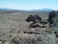 Bighorn-sheep-head rock?
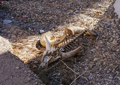 Bighorn sheep pieces
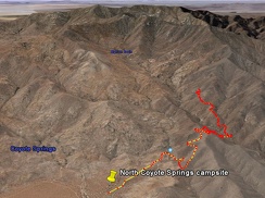 Bighorn Basin Mine hike as viewed in Google Earth (5.25 miles)
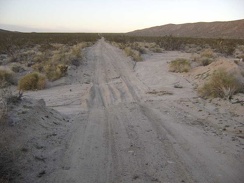 Bigger sandy drainages cross Jackass Canyon Road on the way down
 Bigelow's monkeyflowers and pine cones
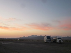 Big rigs park at the Ludlow gas station with the Sleeping Beauty mountains as a sunset backdrop
 Big pine cones litter the trail near Bear Spring.
 Big manzanita along the trail.
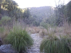 Big grasses in the dry creek bed at China Hole, looking southwest down the canyon.
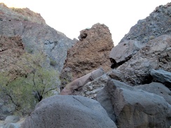 Big boulders in Piute Canyon
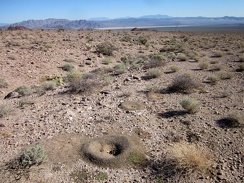 Big ant hill at the mouth of my chosen canyon in the Cady Mountains with a nice view of Broadwell Dry Lake
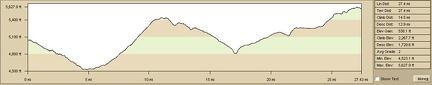 Bicycle route: Mail Spring to Mid Hills Campground via New York Mountains Road
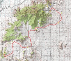 Bicycle route: Mail Spring to Mid Hills Campground via New York Mountains Road
 Bicycle route: Button Mountain to Baker via Aiken Mine and Lava Tube, Mojave National Preserve (Day 16)
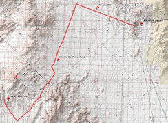 Bicycle route to Castle Peaks, Mojave National Preserve from Searchlight, Nevada
 Bicycle route profile: Button Mountain to Baker via Aiken Mine and Lava Tube, Mojave National Preserve (Day 16)
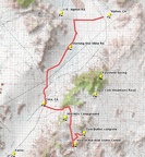 Bicycle route from Twin Buttes campsite to Nipton via Cima: Day 15
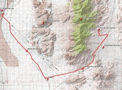 Bicycle route from Primm, Nevada to Pine Spring area, McCullough Mountains, Nevada
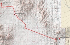 Bicycle route from Pine Spring, McCullough Mountains to Searchlight
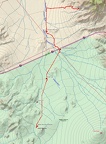 Bicycle route from Pachalka Spring to Button Mountain, via Aiken Mine Road, Mojave National Preserve (Day 15)
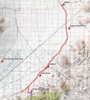 Bicycle route from Nipton to Brant Hills
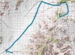 Bicycle route from my Cornfield Spring Road campsite to Mid Hills campground, via Kelso-Cima Road (Day 3)
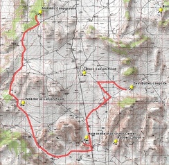 Bicycle route from Mid Hills Campground to Twin Buttes area
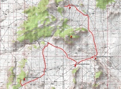 Bicycle route from Mid Hills Campground to Pinto Valley, Mojave National Preserve
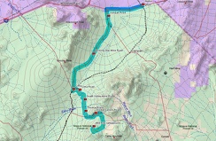 Bicycle route from Mid Hills campground to Nipton via Cima and Morning Star Mine Road (Day 9)
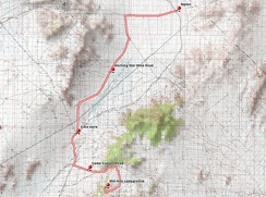 Bicycle route from Mid Hills campground to Nipton via Cima and Morning Star Mine Road
 Bicycle route from Mid Hills campground to Howe Spring (Day 6)
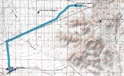 Bicycle route from Ludlow to Bristol Mountains campsite
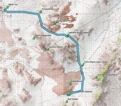 Bicycle route from Kelso Dunes area to Baker via Kelbaker Road
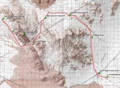 Bicycle route from Devil's Playground to Cornfield Spring Road via Jackass Canyon and Kelso Depot
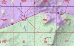 Bicycle route from Cima Dome (Sunrise Rock) to Pachalka Spring, Mojave National Preserve (Day 12)
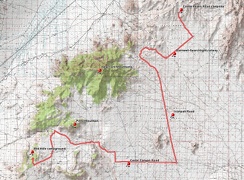 Bicycle route from Castle Peaks campsite to Mid Hills campground via Cedar Canyon Road
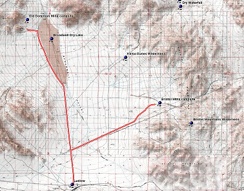 Bicycle route from Bristol Mountains to Broadwell Dry Lake campsite via Ludlow
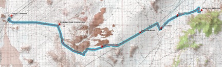 Bicycle route from Brant Hills to Baker via old Mojave Road, Mojave National Preserve
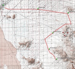 Bicycle route from Baker to Devil's Playground campsite northwest of Old Dad Mountain
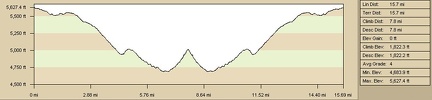 Bicycle route elevation profile from Mid Hills campground to Blue Jay Mine via Wild Horse Canyon Road, Mojave National Preserve
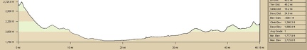 Bicycle route elevation from Cady Mountains to Barstow via Route 66
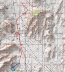 Bicycle route (red) and hiking route (blue), Cave Spring, Mojave National Preserve
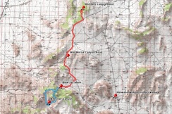 Bicycle route (in red) from Mid Hills campground to Blue Jay Mine via Wild Horse Canyon Road, Mojave National Preserve
 Beyond Willson Camp, some of the rise on Wagon Road is very gentle and easy to ride as it rolls along the ridges
 Beyond Willow Spring, my goal is to hike over the hills and be back at my campsite at the end of Castle Peaks Road before dark
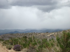 Beyond the purple sage, it looks like the area around Death Valley Mine might be getting a shower right now
 Beyond the old lava, Kelbaker Road continues to rise slowly
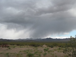 Beyond the Nipton campground, I see storm clouds over the Castle Peaks, those pointy distant mountains