Home 7119

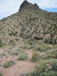 Well, since I'm at the base of one of the Castle Peaks outcrops, it's time to decide whether to continue upward or not
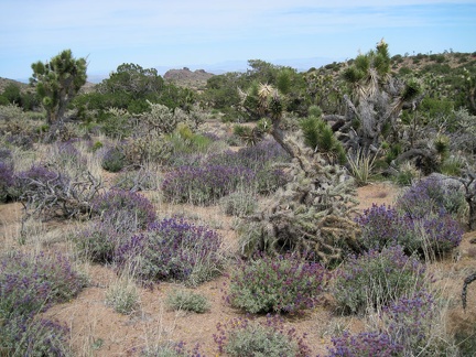 I decide not to climb up to the Castle Peaks, and instead hike down a wash and across the plateau toward Taylor Spring
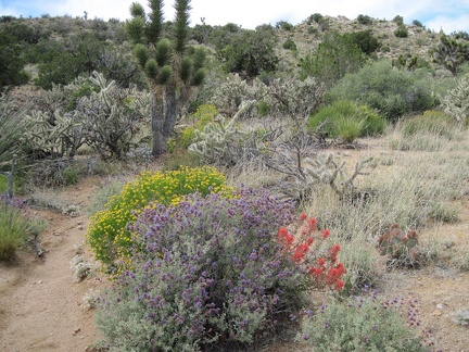 Occasional colour juxtapositions make for a scenic hike down this wash east of the Castle Peaks
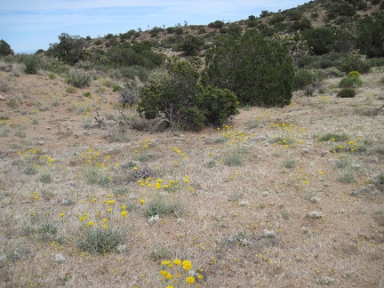 I walk through a patch of yellow desert marigolds (the large flowers) and goldfields (the tiny yellow ones)
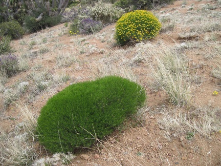 This plant (snakeweed, I think) is so odd for its dense, rounded shape
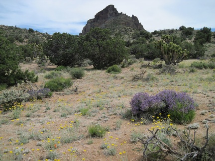 More purple desert sage and yellow desert marigolds as I glance up at the Castle Peaks
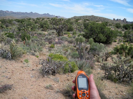 A GPS check shows that Taylor Spring lies somewhere past the large rounded hill ahead
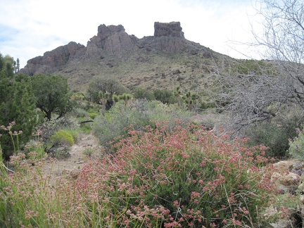 A patch of pink buckwheat flowers sits in my view of the Castle Peaks as I hike down the wash
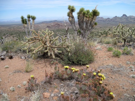 A little further along the ridge, I gaze across the plateau over Malpais Spring toward the area of Searchlight, Nevada
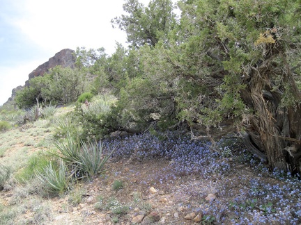 A patch of phacelias bloom under the shade line of an old juniper tree
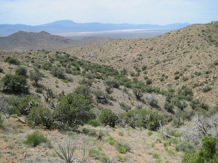 From this ridge in the New York Mountains, I recognize Ivanpah Dry Lake and Clark Mountain in the distance
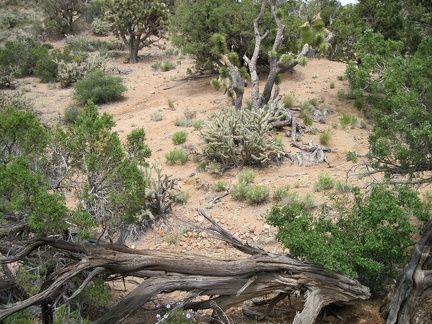 I walk along this ridge in the New York Mountains, parts of which are quite lush in a Mojave Desert way
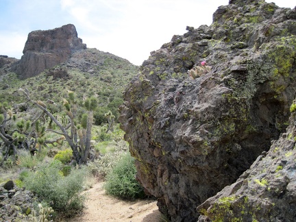 As I approach a ridge in the New York Mountains, I notice pink cactus flowers popping out of a boulder
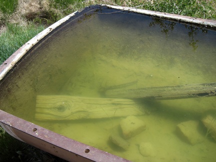 The water in the Indian Spring cistern is clean, aside from minor algal growth in the tank
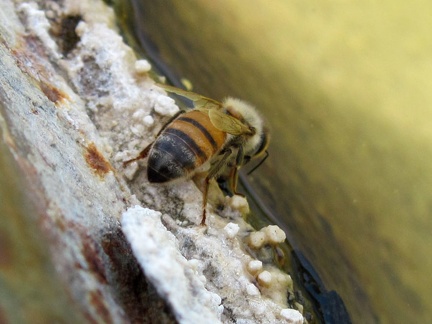 A bee sits on the edge of the Indian Spring cistern, enjoying the water's edge
 When I arrived here at Indian Spring, a flurry of doves took flight and left; this one watches me from a nearby branch
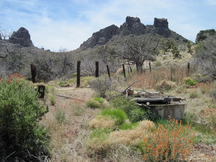 Now that I know there's good water here at Indian Spring, I'll be back tomorrow to fill up
 Beyond Indian Spring, I start hiking up the remnants of an old road that leads upward
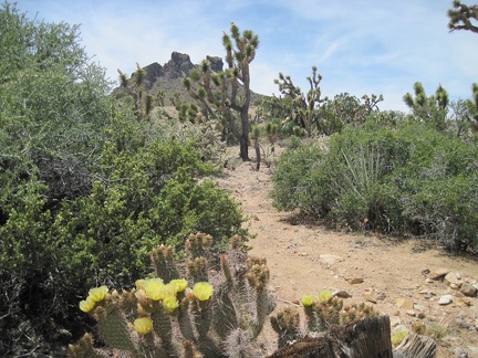 I hike up the wash beyond the slot canyons above Malpais Spring, then hike cross-country over to Indian Spring
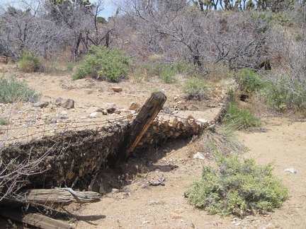 At Indian Spring in the New York Mountains is an old fence that has collected a lot of rock and sand over the years
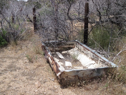 At Indian Spring in the New York Mountains is a dry, abandoned cistern
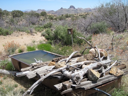 Indian Spring, New York Mountains, Mojave National Preserve has water!
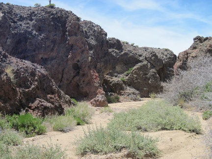 I'm enjoying the rocky constrictions in Malpais Spring wash, and I find myself hiking toward another one
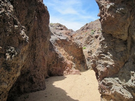 Deposits of sand and silt fill the drainage between the rocks
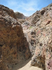 I reach a small dry waterfall to climb
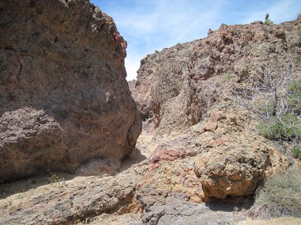 Just beyond the dry waterfall is a narrow, curving slot to walk through
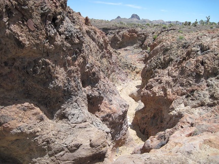 I take a look back toward my tent and Hart Peak after climbing out of the slot canyon
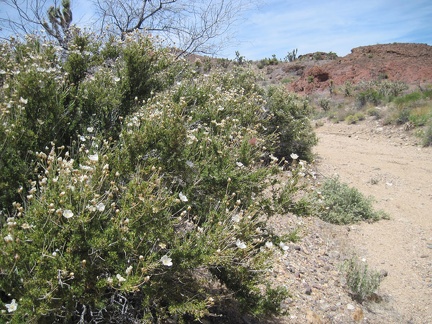 The white blooms of Cliff rose line some stretches of the upper part of Malpais Spring canyon
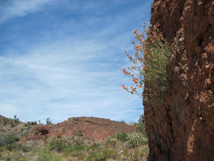 Orange desert mallow flowers bloom out the side of reddish rock in upper Malpais Spring canyon
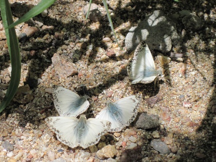 Quite a few moths flutter about in the moist area around Malpais Spring
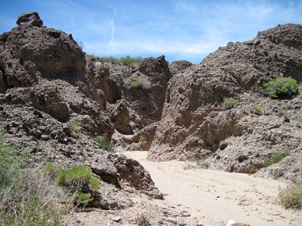 Above Malpais Spring are more interesting eroded areas to walk through
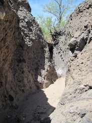 One of several slots to walk through in the canyon above Malpais Spring, Mojave National Preserve
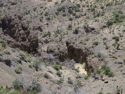 I climb up the hill above the slot canyon and look back down into the area above Malpais Spring
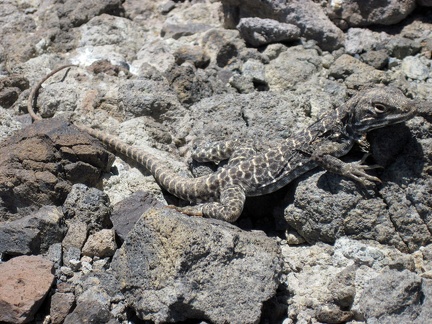 Atop a rocky outcrop above Malpais Spring, I notice a lizard near my feet, who thinks I don't notice him
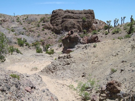 The walls of Malpais Spring canyon are less tall as it rises up to meet the highlands
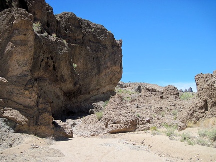 I pass a big rock wall in Malpais Spring wash
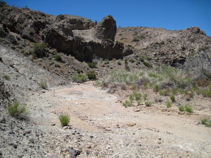 A rock outcrops juts out from the wall of Malpais Spring wash like an arrowhead
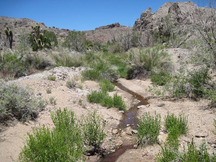 I get excited when I discover this little stream; I'm close to the source of Malpais Spring
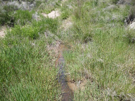 Near the source of Malpais Spring is a moist, grassy area that's probably underwater during wetter periods
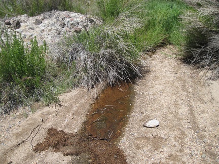 The stream from Malpais Spring is very shallow, so I try digging a hole deep enough to accommodate the end of my water filter
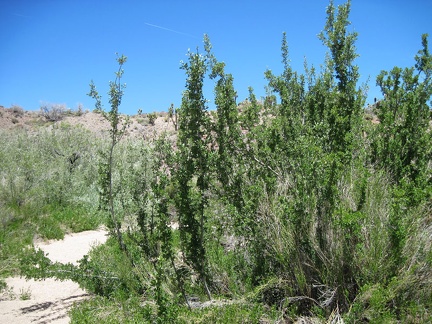 Just above Malpais Spring is another thicket area with lots of willows, and these upright bushes that I don't recognize
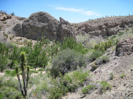 I climb up the canyon wall a bit to get an overview of the Malpais Spring area
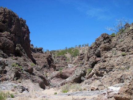 I follow the pipe up the wash toward Malpais Spring
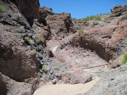 I walk up a wide slot in the Malpais Spring canyon, still following the pipe
 As I climb down into the canyon leading to Malpais Spring, I'm greeted by pink cactus and range ratany flowers
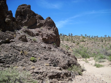 A few steep rock outcrops edge the Malpais Spring canyon
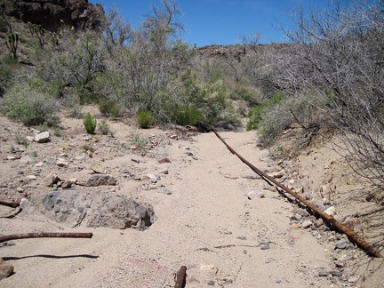 Here's an old pipe, presumably leading to the source of Malpais Spring
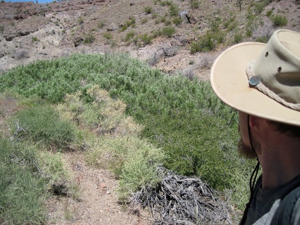 After a short distance, I climb up out of the canyon to circumvent a thicket of willow, desert willow and catclaw
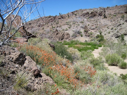 Once past the big thicket, I climb back down into the Malpais Spring wash past a patch of orange desert mallows
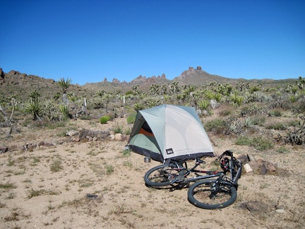 A peaceful morning of solitude at the top of Malpais Spring Road
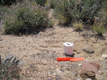 After coffee and the usual breakfast of granola, nuts and dried fruit, it's time to dig a cat hole
 Before starting the hike to nearby Malpais Spring, I lock my bike to a joshua tree, for what it's worth
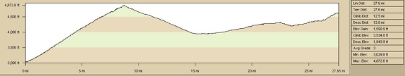 Elevation profile of Nipton to Malpais Spring bicycle route via Walking Box Ranch Road
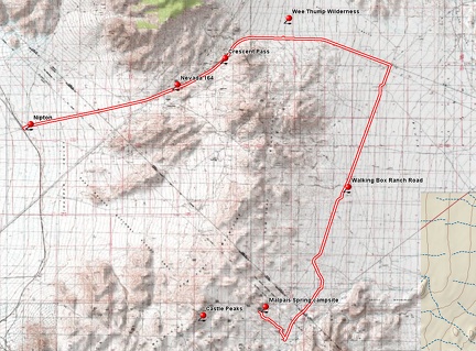 Nipton to Malpais Spring bicycle route via Walking Box Ranch Road
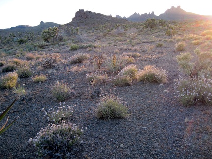 Looking toward the Castle Peaks, the buckwheat flowers pick up the sunset light differently
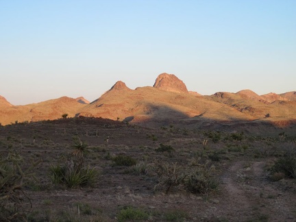 The nearby Castle Mountains and Hart Peak radiate in the sunset near Malpais Spring
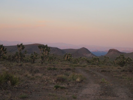 Pink-orange haze sets in over Nevada, east of my campsite near Malpais Spring
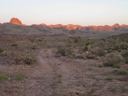 The sun sets, little by little, minute by minute, on the Castle Mountains and Hart Peak
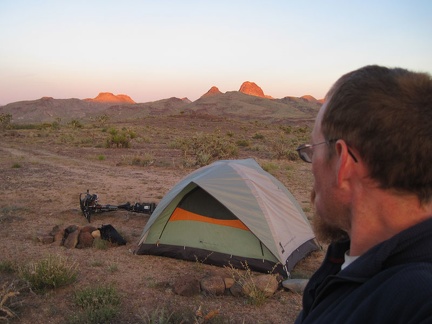 The upper turrets of the Castle Mountains and Hart Peak soak up the very last rays of the day
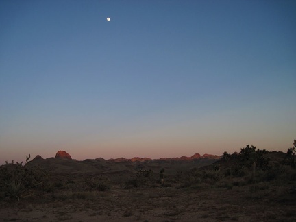 The moon is full enough tonight to cast shadows here near Malpais Spring, Mojave National Preserve
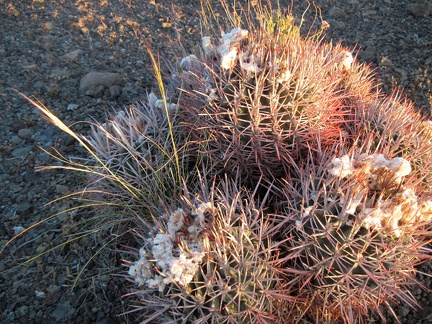 Fluffy white stuff on a small barrel cactus at the top of Malpais Spring Road
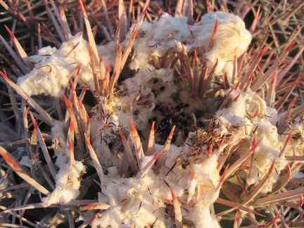 A close-up of the white fluff on the barrel cactus
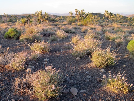 The pale buckwheat flowers look pinker in the blush of sunset near Malpais Spring, Mojave National Preserve
 Malpais Spring Road tops out on a plateau at about 4600 feet elevation, so I park the bicycle and start looking for a campsite
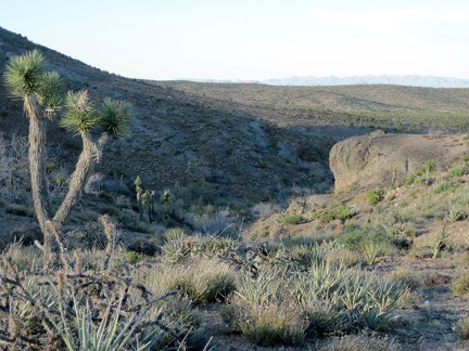 I go for a short walk to check out the area at the top of Malpais Spring Road; this will be home for a night or two
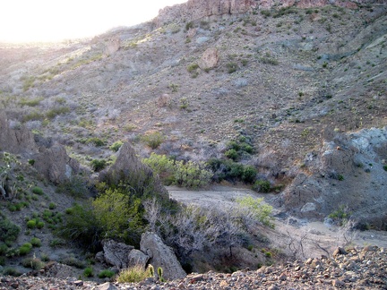 I look westward up the gorge toward Malpais Spring and get excited about tomorrow's hike up into that area
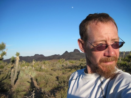 OK, so where do I set up the tent here on Malpais Spring Road?
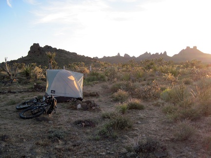 I put on my sweater and long pants and decide to set up camp in the turn-out at the top of Malpais Spring Road
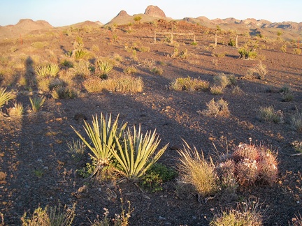 The plateau at the top of Malpais Spring Road and a few old stretches of range fence receive the orange glow of end-of-day sun
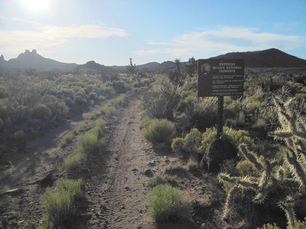 I pass one of those small "Entering Mojave National Preserve" signs on my approach to Malpais Spring
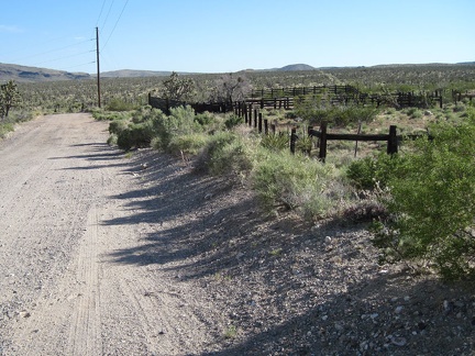 I pass an old corral on Walking Box Ranch Road and check my GPS for directions here
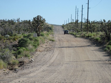 I approach the sole motor vehicle that I've seen today on Walking Box Ranch Road
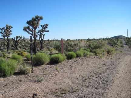 I pass an extremely modest post on Walking Box Ranch Road which marks my re-entry into California from Nevada
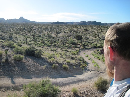 I almost missed the old road to Malpais Spring, here it is; I've been watching for it and checking my pre-recorded GPS points
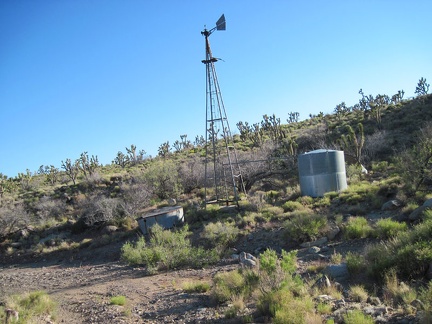 Stagecoach Well sits in the wash along the road to Malpais Spring, Mojave National Preserve
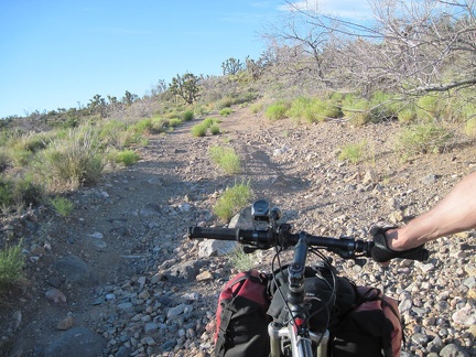 Rising out of the wash just past Stagecoach Well, the road is really rough, with loose rock on the surface
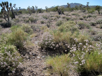 Fields of pinkish-white buckwheat flowers bloom along Walking Box Ranch Road, with Nevada's McCullough Mountains in the distance
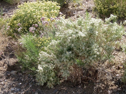 The pinkish-white buckwheat flowers dominate the Walking Box Ranch Road area, but they are not the only showy plants
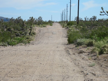 Walking Box Ranch Road is mostly straight and slightly uphill, but occasional humps over desert topography add interest
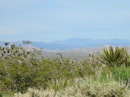 Views down to the town of Searchlight, Nevada open up occasionally along Walking Box Ranch Road
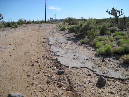 Fragments of old pavement on Walking Box Ranch Road
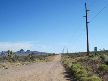 I pass the six-mile marker on Walking Box Ranch Road
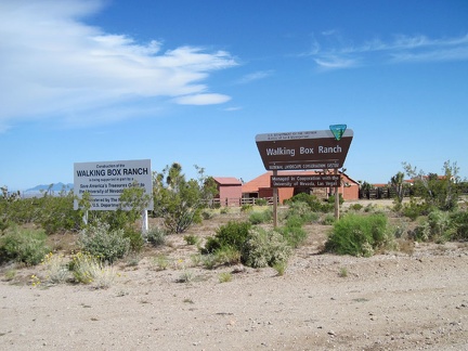 The historic Walking Box Ranch is being restored, but is not yet open to the public
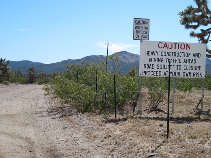 A sign warns of mining traffic near the start of Walking Box Ranch Road
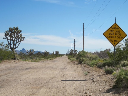 One lane only on Walking Box Ranch Road: for a Mojave Desert dirt road, it's actually pretty good
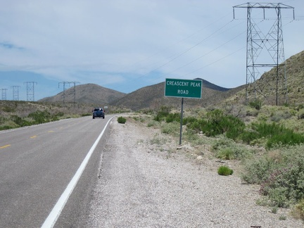 Riding east toward Crescent Pass on Nevada 164, I pass under the power lines that cross Mojave National Preserve
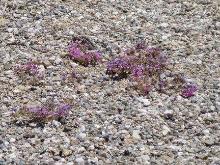 I notice some tiny purple flowers growing in the gravel on the shoulder of Nevada 164
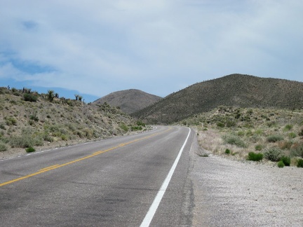 I approach Crescent Pass on Nevada 164, whose high point is at about 4870 feet elevation
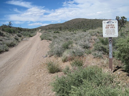 Near Crescent Pass, I stop to look at a dirt road that leads toward the McCullough Mountains
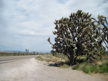 After crossing Crescent Pass on Nevada 164, I'm coasting downhill when I see this huge joshua tree by the highway
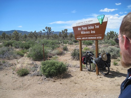 Wee Thump Joshua Tree Wilderness: I take a short energy-bar and water break at the turnout along Nevada 164
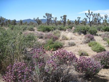 Purple desert sages dominate the foreground as I go for a short walk in the Wee Thump Joshua Tree Wilderness Area
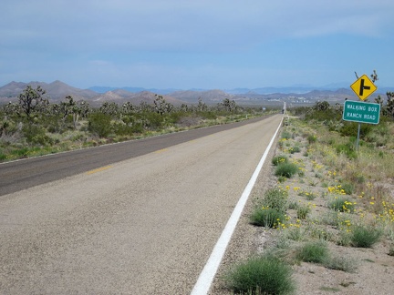 I've just coasted blissfully down 6 miles of Nevada 164 and reach unpaved Walking Box Ranch Road, where I'll turn off
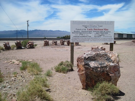 Across the road from the Nipton General Store is a rock-display yard
 I head east up Nipton Road toward Crescent Pass, Nevada, up in the hills at centre-left
 At the Nevada border, I notice that my 10-litre MSR water bag is dripping a bit from the nozzle
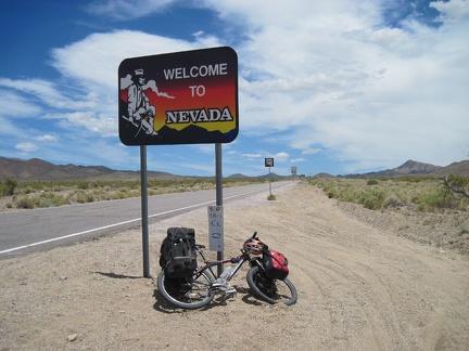 After half an hour, I stop for a few minutes on the way up the hill: I'm in Nevada now
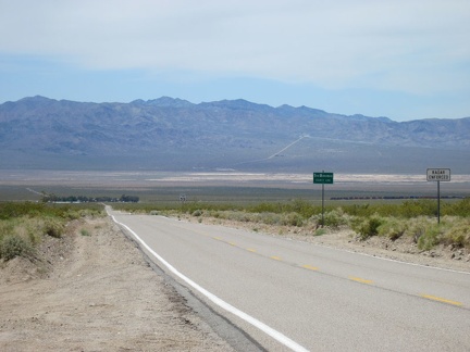 From the Nevada-California border on Nipton Road/Nevada 164, I look back down the hill to the tiny town of Nipton
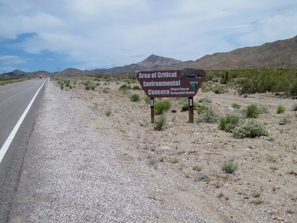 Just beyond the "Welcome to Nevada" sign is an "Area of Critical Environmental Concern" sign
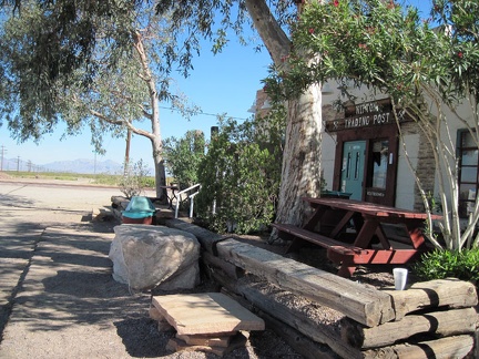 I'm up reasonably early and walk over to the Nipton store for some breakfast snacks and coffee
 I enjoy the morning shade of the eucalyptus trees at Nipton campground on this cool morning
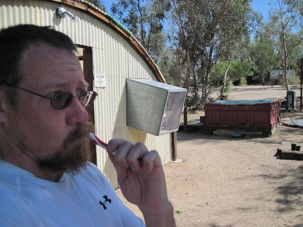 Time to brush my teeth and pack up for the ride from Nipton to Malpais Spring, Mojave National Preserve
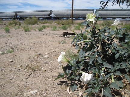 A datura blooms at Nipton campground while a long freight train squeals by
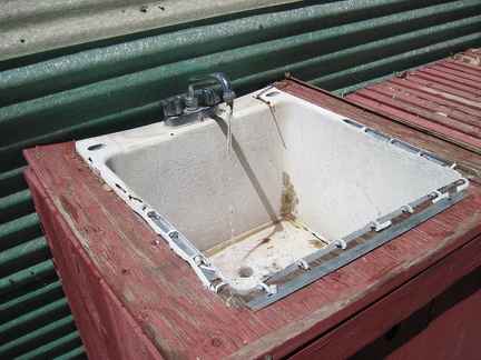 The outdoor sink at Nipton is decomposing after many years of service in the hot Mojave sun
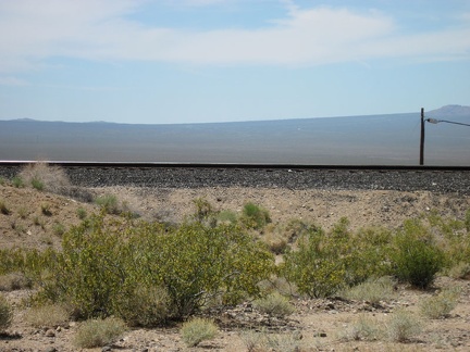 From Nipton campground, I look across the train tracks and up Ivanpah Valley toward Cima
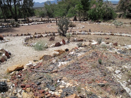 The cactus garden in front of the Hotel Nipton is artfully built of multi-coloured rock
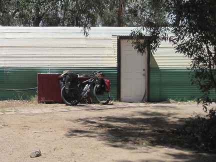 The 10-ton bike awaits departure at Nipton's outdoor sink after the final, heavy addition of my water supply
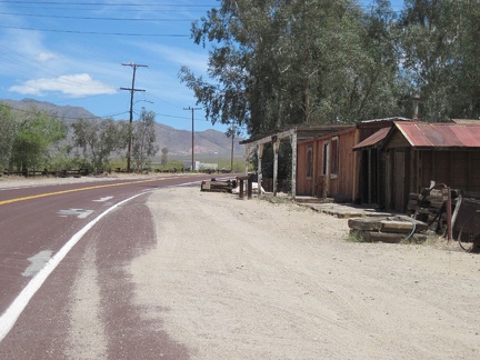 The 10-ton bike and I wobble up Nipton Road away from the campground and pass a few antique buildings while leaving town
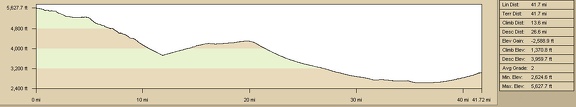 Elevation profile of bicycle route from Mid Hills campground to Nipton via Cima and Morning Star Mine Road
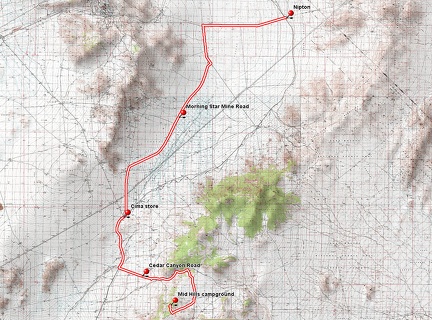 Bicycle route from Mid Hills campground to Nipton via Cima and Morning Star Mine Road
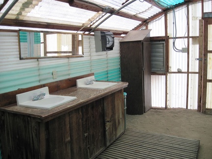 The washrooms in the fibreglass-clad quonset hut at Nipton are aging, but doing reasonably well
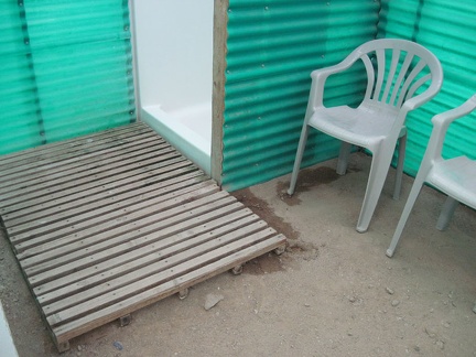 One of the shower stalls for campers at Nipton
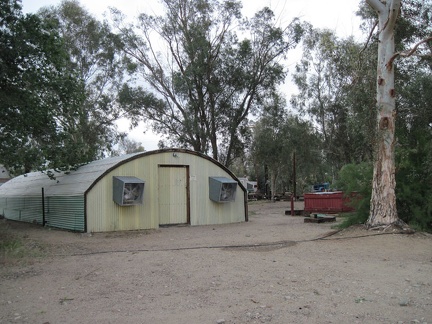 The quonset hut at the Nipton campground houses toilets, sinks and showers; an outdoor hot tub is nearby, to the right
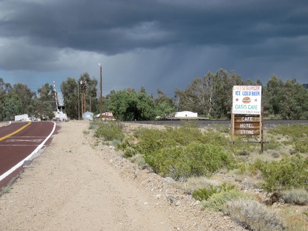 I ride 3 miles on Ivanpah Rd, then 7 miles across Ivanpah Valley on Nipton Road, and arrive at Nipton, population 20
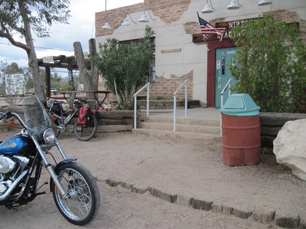 I pull up at the Nipton store and sign up for a campsite for the night
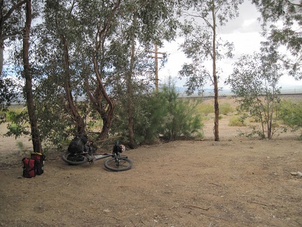 The tent camping area at Nipton is right along the tracks, which provides stimulating late-night noise when freight trains pass
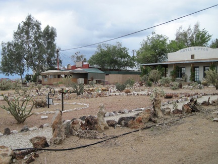 Adjacent to the tent-camping area is the Nipton Bed-and-Breakfast and the café
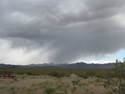 Beyond the Nipton campground, I see storm clouds over the Castle Peaks, those pointy distant mountains
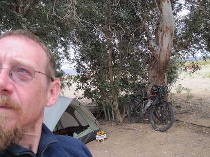 I set up my tent in the shade of some eucalyptus trees and buy some cold beer at the Nipton store
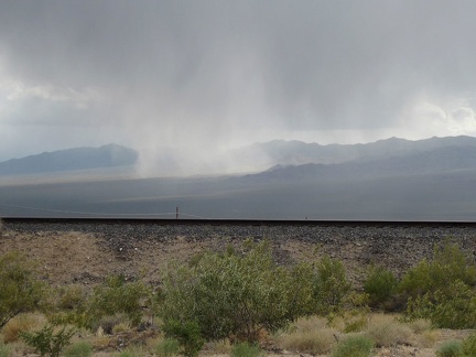 From Nipton, I see rain clouds over the area of Morning Star Mine Road, site of my nice downhill ride a couple of hours ago
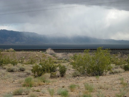 It looks like there might be rain over in the New York Mountains as well, in the area of Garvanza Spring
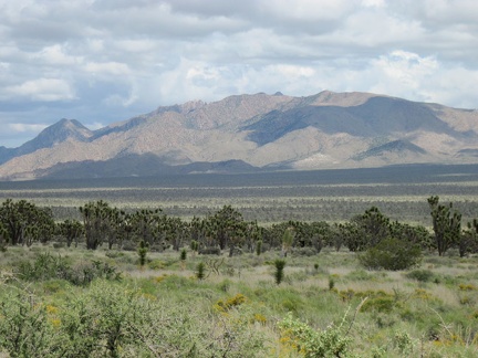 From the upper stretch of Morning Star Mine Road, I enjoy the views across miles of joshua-tree forest to the New York Mountains
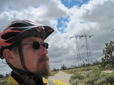 I stop briefly off Morning Star Mine Road where the power lines cross
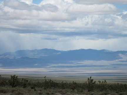 Looking across Ivanpah Valley from upper Morning Star Mine Road, I wonder if maybe I will experience rain after all
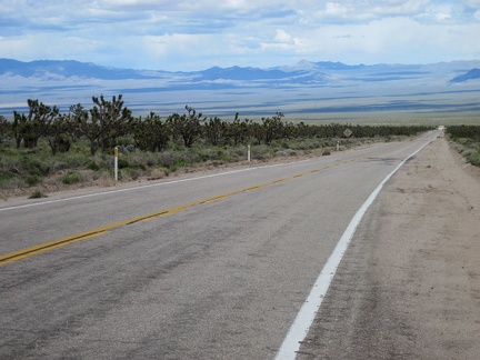 I begin the stimulating descent down Morning Star Mine Road into Ivanpah Valley, and I don't stop until I reach the bottom
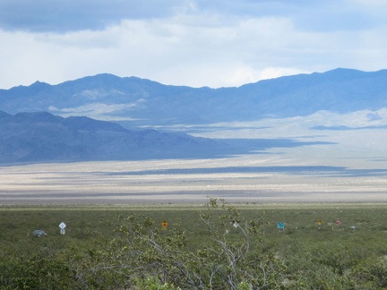 Near the bottom of Morning Star Mine Road, signs and cars pop up through the creosote-bush scrub
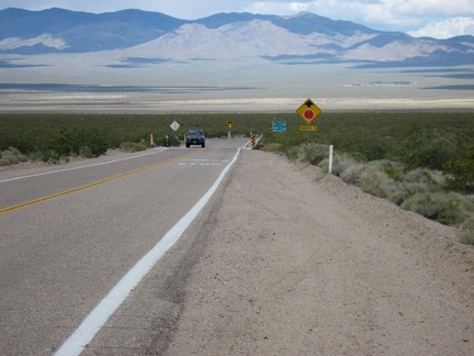 I reach that stop sign in the middle of nowhere at the bottom of Morning Star Mine Road, at the junction of Ivanpah Road
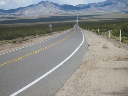 I pause at the end of Morning Star Mine Road to look east up Ivanpah Road into the New York Mountains
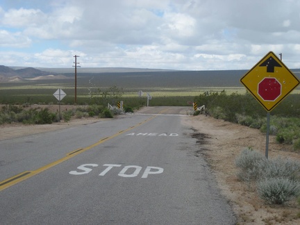 I cross a cattleguard, then the train tracks, then turn right (north) on Kelso-Cima Road at the stop sign
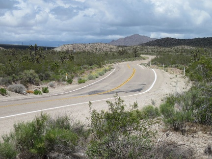 I ride almost five miles up the gentle grade of Kelso-Cima Road to the Cima Store, gaining about 450 feet in elevation
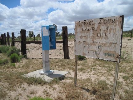 Outside the Cima Store is a pay phone and a very worn sign telling us to preserve our desert (good message)
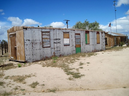 Also by the Cima Store sits an old boxcar or trailer
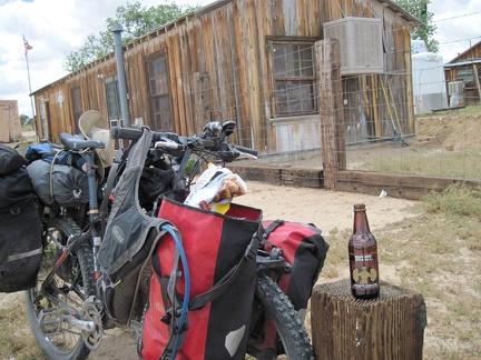 Cima Store is open today, so I stop for a bag of chips and a bottle of blogger Morongo Bill's esteemed Sioux City Sarsaparilla
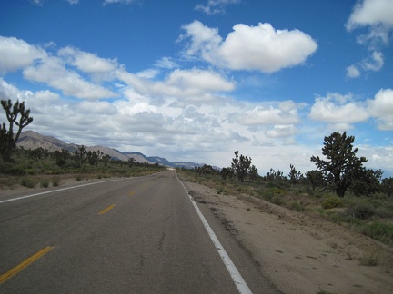 I finish my snacks from the Cima Store and start riding Morning Star Mine Road, which is flat at first
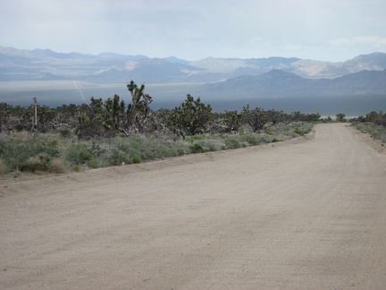 I'm now in the small area of Cedar Canyon Road where I can usually get cell-phone reception
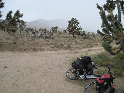 I turn down the little road off Cedar Canyon Road for a short break and watch the rain clouds approach
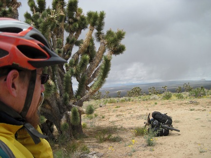 I shove my cell phone up to my mouth and enjoy the reception here, as well as the view of Cima Dome in the distance
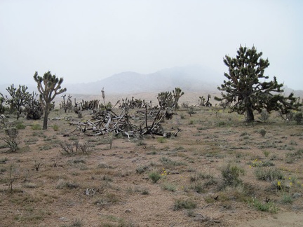 The moist clouds blow past; what first looks like a bit of pollen in the breeze are a few snowflakes
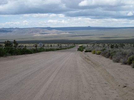 After my cell-phone break, I speed down the final 2.75 miles of Cedar Canyon Road at about 20 mph; pavement begins just ahead
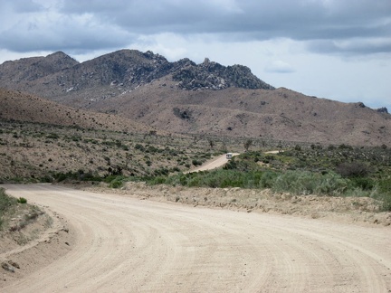 Riding west on Cedar Canyon Road, I get views of the Eagle Rocks area from down below
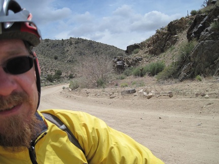 Riding through Cedar Canyon is scenic, but my fingers are getting cold!
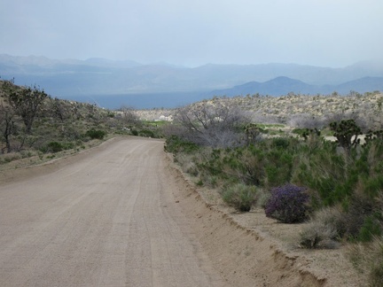 The road pops out of Cedar canyon and begins its way down the foothills toward Kelso-Cima Road
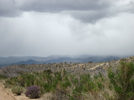 Beyond the purple sage, it looks like the area around Death Valley Mine might be getting a shower right now
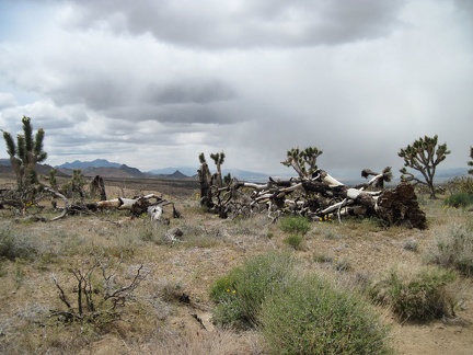 Many fallen joshua trees are seen along Cedar Canyon Road where the 2005 brush fires burned
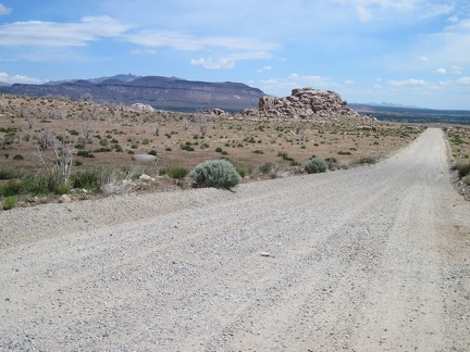 I head east, downhill, a couple of miles on Wild Horse Canyon Road until it reaches Black Canyon Road beyond the pinnacle ahead
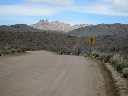 I ride through the shade of a dark cloud as I descend Black Canyon Road toward Cedar Canyon Road
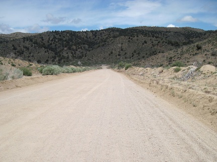 The north end of Black Canyon Road is a nice straight downhill to the "T" intersection at Cedar Canyon Road
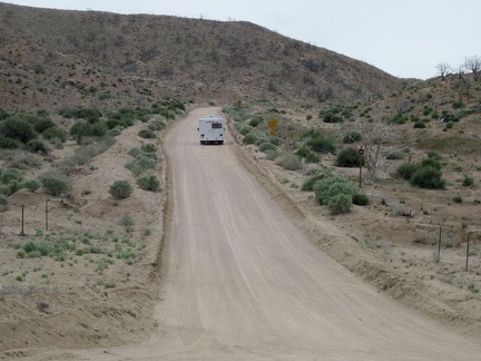 I watch a small RV rattle its way up, at about 5 miles per hour, the washboarded hill of Black Canyon Road that I just descended
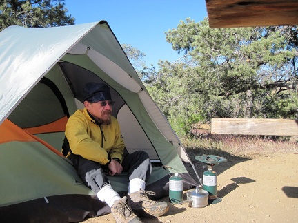 I'm up early this morning, enjoying the warm morning sun on my very cold tent; it must have dropped down into the 30s last night
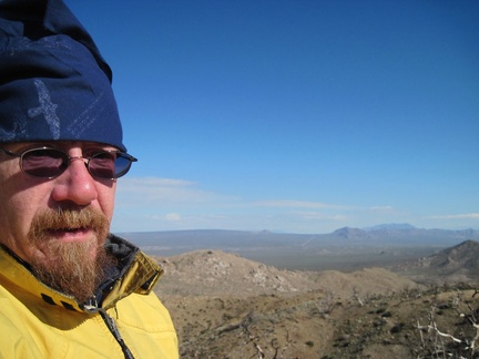 I walk up the hill near my campsite to take in the views from around 5600 ft elevation before leaving Mid Hills campground
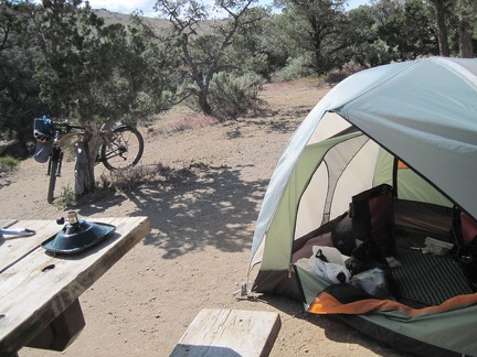 After spending five nights at Mid Hills campground, the contents of my tent have become quite disorganized
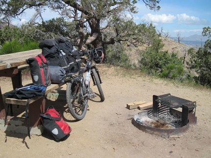 The 10-ton bike is ready to leave Mid Hills campground for Nipton
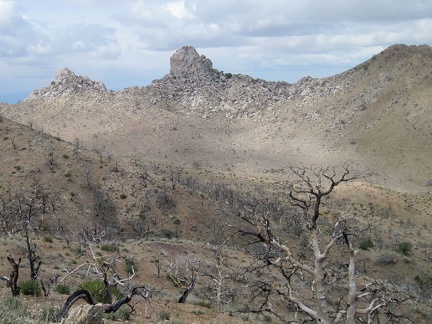 One last look at Eagle Rocks before I leave Mid Hills campground
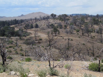 Goodbye Mid Hills campground for this year
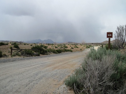 As I exit Mid Hills campground, I notice what looks like rain clouds over in the area of the Providence Mountains
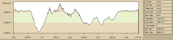 Eagle Rocks hike from Mid Hills campground elevation profile
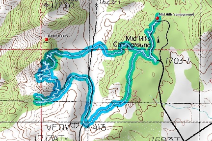 Eagle Rocks hiking route from Mid Hills campground
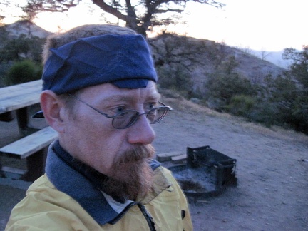 Brrr! It's really cold up here at Mid Hills campground tonight
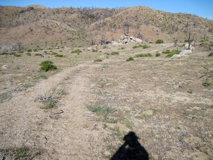 Instead of climbing straight up the hills back to Mid Hills campground, I head south briefly on an old road
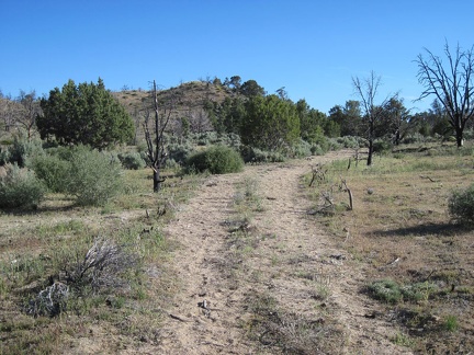 The old road that heads south from Eagle Rocks passes through an area that escaped the 2005 brush fires
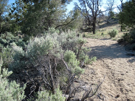 When I reach a patch of mature, unburned sagebrush, I turn east (left) and begin hiking cross-country to Mid Hills campground
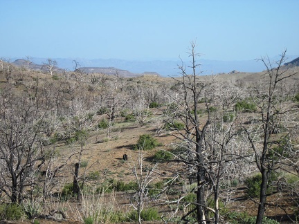 On the way back to Mid Hills campground, I reach an open area with views spanning all the way down to Wild Horse Mesa
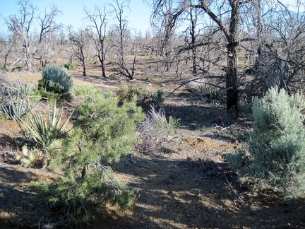 Hiking cross-country back to Mid Hills campground, I exit the boundary of the unburned area
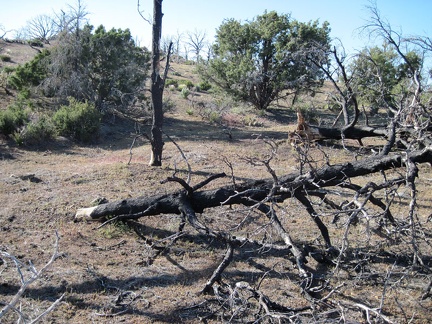 Five years after the 2005 brush fires here, many of the burned trees are finally falling down
 A mound cactus and a desert four o'clock grow in the burned area near Mid Hills campground, Mojave National Preserve
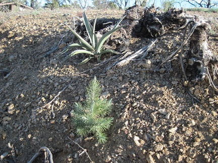 Hurray, this might be a pinon pine seedling growing in the burned area of Mid Hills campground
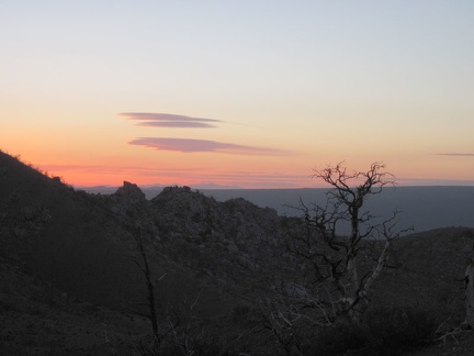 I walk up the hill near my tent to catch another great sunset from Mid Hills campground
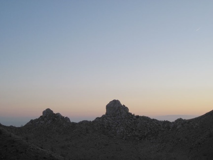 Eagle Rocks pinnacles at sunset, from Mid Hills campground, Mojave National Preserve
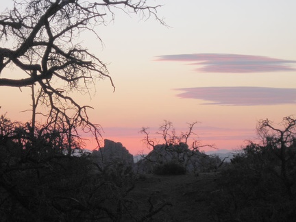 Close-up of sunset behind Eagle Rocks
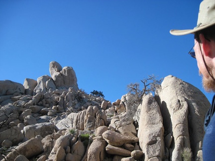 I take a final look up at the Eagle Rocks before starting the hike back to Mid Hills campground
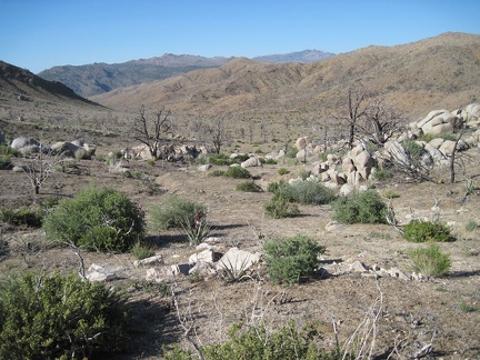 Just east of the south end of Eagle Rocks, I head east (right) across the broad canyon
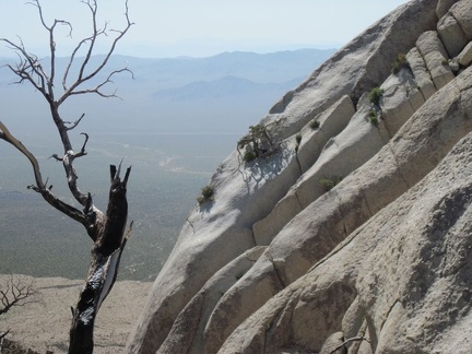 It's amazing how a few trees manage to grow in the cracks between rocks in the steep slopes of Eagle Rocks
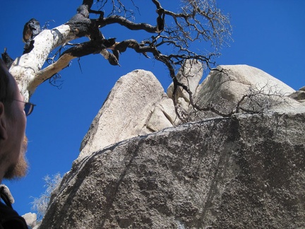 I look up through another burned-tree canopy toward rock towers at Eagle Rocks
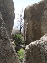 Peering between boulders at Eagle Rocks, Mojave National Preserve
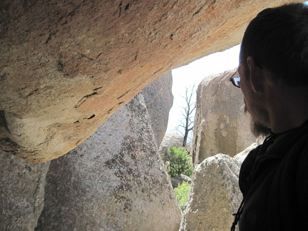 I back up a few feet under a big boulder, still looking at the slot between the rocks in front of me
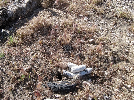 I haven't seen any large animals here today, but this scat shows that some are indeed here somewhere
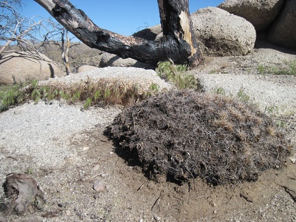 A completely burned mound cactus at Eagle Rocks, Mojave National Preserve
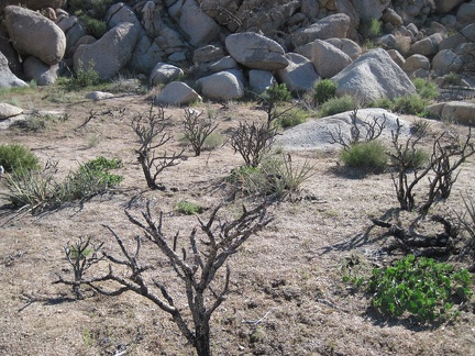 I walk across this flat area, between cholla cactus skeletons, to the next pile of rocks
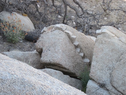 This rock has teeth!
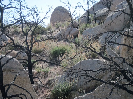 At the south end of Eagle Rocks sits a patch of blooming desert mallows
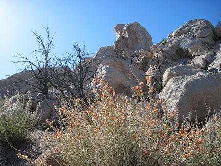 Desert mallow close-up at Eagle Rocks, Mojave National Preserve
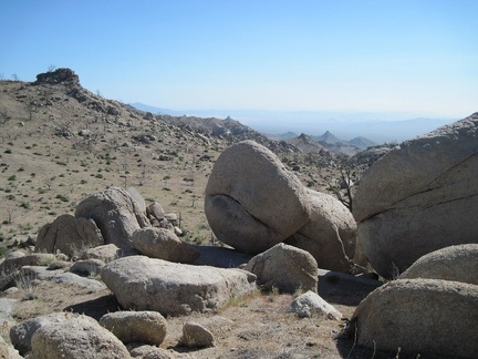 I'm at the south end of the Eagle Rocks now, looking southwest toward the pointy hills around Wildcat and Chicken Water Springs
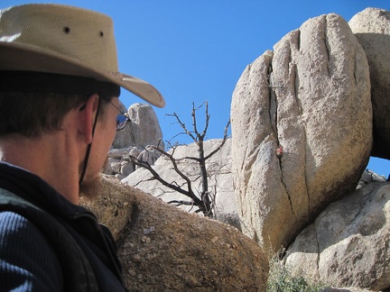 What's that red speck poking out of that boulder?
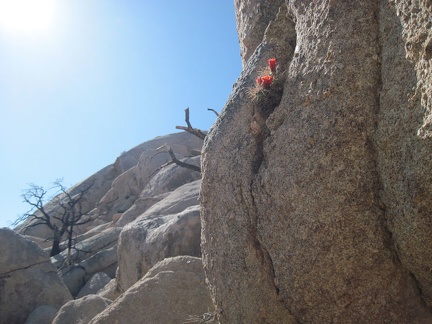 Somehow, a Claret cup cactus is managing to eke out an existence in that crack in the boulder
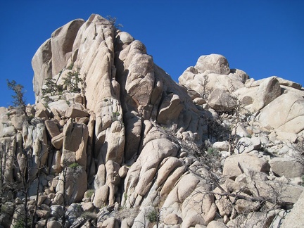 I'm constantly fascinated by the ability of some trees to grow in the upper reaches of the boulders, where soil is almost absent
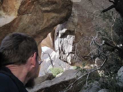 Under boulders at Eagle Rocks, I peer out toward the sunshine
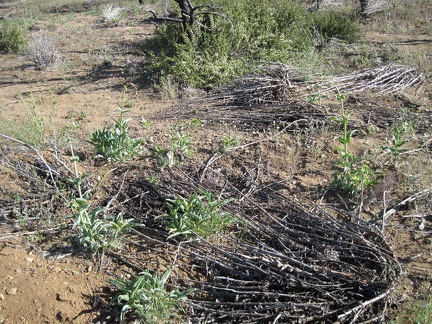 I run across a patch of young Palmer's penstemons in the burned area on the way back to Mid Hills campground
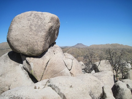 A boulder crowns other boulders at Eagle Rocks, Mojave National Preserve
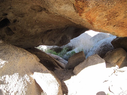 Rock-scrambling at Mojave National Preserve's Eagle Rocks can include scrambling under boulders, not just over them
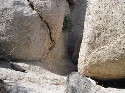 A manzanita grows out of a crack in the boulders at Eagle Rocks
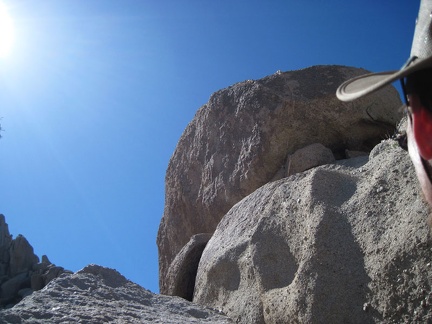 Well, here's a rock summit at Eagle Rocks that I don't think I can climb
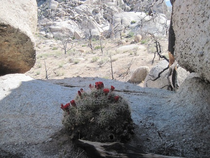 A Claret cup cactus blooms in a shady area of Eagle Rocks where I wouldn't expect to find one
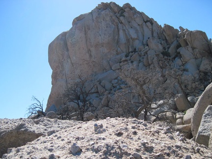 I might be able to climb this Eagle Rocks pinnacle from the right side
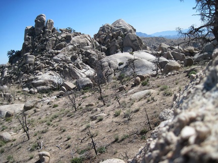 I reach a somewhat open area in the Eagle Rocks on the way to the next pinnacles
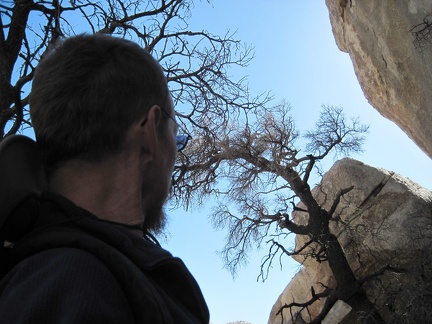 In the shade of some big rocks, I look up through the canopy of a couple of burned trees
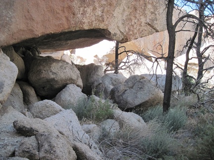 A substantial rock overhang at Eagle Rocks, Mojave National Preserve
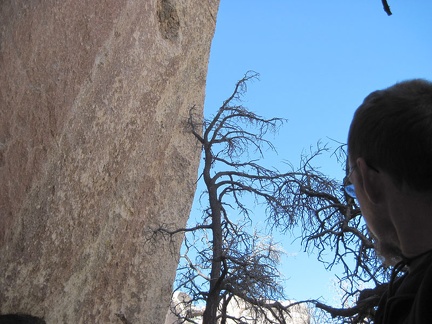 This area of Eagle Rocks is a lot of fun
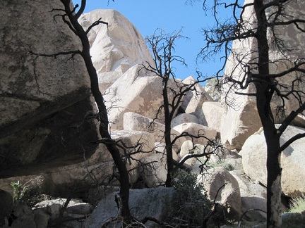 More burned trees at Eagle Rocks, Mojave National Preserve
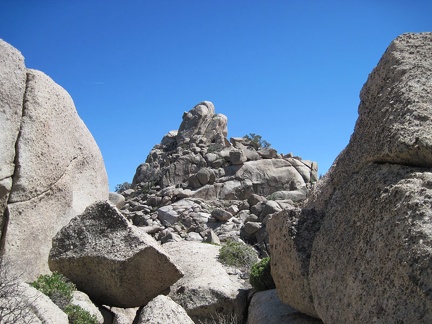 It looks like there's a saddle on each side of the Eagle Rocks pinnacle above
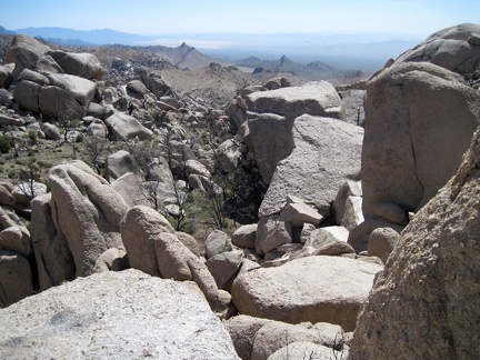 From this saddle in the Eagle Rocks, I look into the haze southwest across Mojave National Preserve