Home 7119

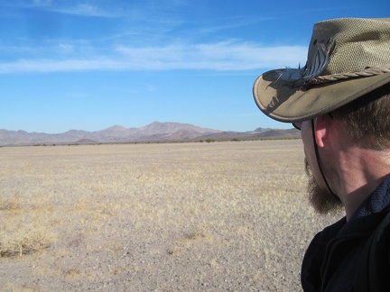 I'm surprised when I find myself briefly hiking across a flat, prairie-like expanse in the Kelso Dunes Wilderness
 Zooming in, I can make out the tidbit of civilization that is Ludlow, California along old Route 66 and I-40
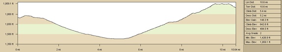 Elevation profile of bicycle route from Ludlow to Bristol Mountains campsite
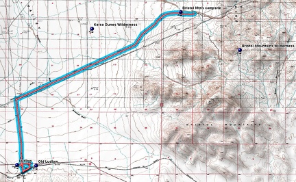 Bicycle route from Ludlow to Bristol Mountains campsite
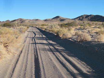 Uh oh, another sandy area on the Bristol Mountains powerline road, and the sand looks deeper than anything I've seen today
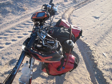 Well, it looks like almost a mile of this sand lies ahead of me, and it would take some time to push the bike through it all
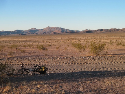 I start backtracking a little, looking for a good campsite here in the Bristol Mountains foothills
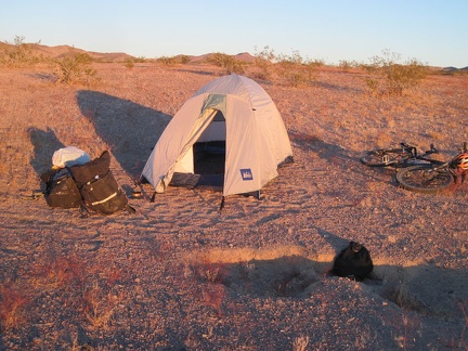 I choose a spot about 150 feet in from the road; I don't like to be too close to the road in case visitors should pass by
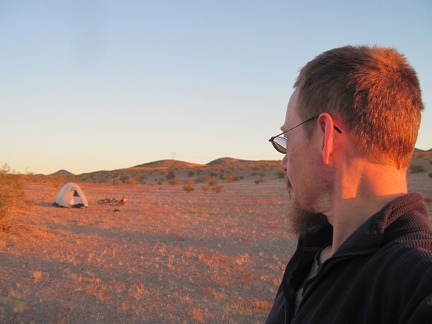 I go for a short walk around my campsite in the Bristol Mountains foothills to enjoy the glowing end-of-day light
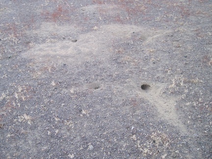 While walking around, I notice a lot of these small animal burrows around my campsite
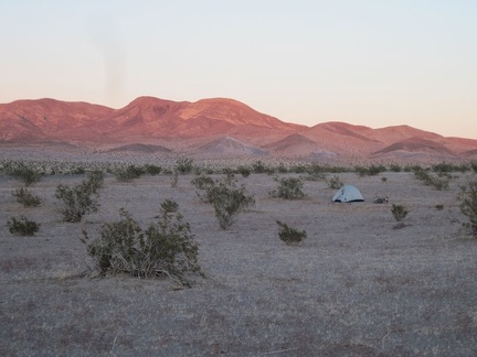 The end of sunset in the Bristol Mountains makes the creosote bushes appear in a darker, lusher green than usual
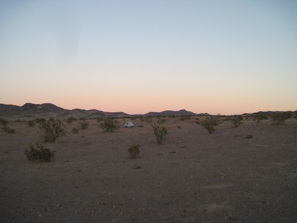 The sun is setting here in the Bristol Mountains foothills, quickly
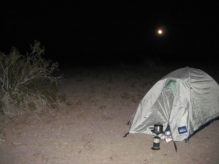 After dark, the moon rises in the background and I boil water for tonight's add-water-to-bag meal
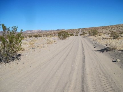 Ugh, the Bristol Mountains powerline road is getting rather sandy!
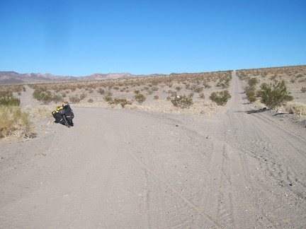 The Bristol Mountains powerline road splits here into a high road and low road, which rejoin each other beyond the hill
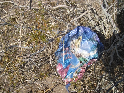 I knew I'd find a happy-birthday balloon sooner or later out here in the wilderness...
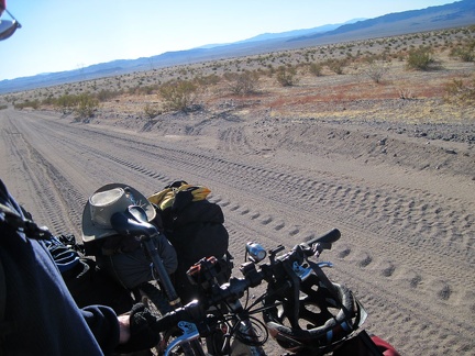 The Bristol Mountains low road has a nice coating of kitty litter on the surface in many places
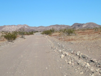 A wave of optimism strikes when I reach this rather smooth, and very ridable, stretch of the Bristol Mountains powerline road
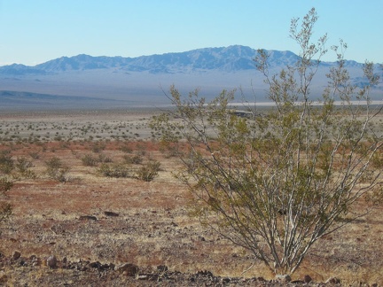 As I enter the Bristol Mountains foothills, I've been noticing swaths of a small brick-red plant
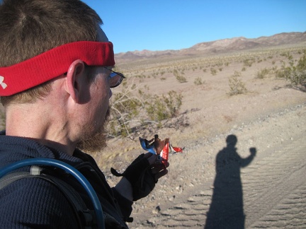 It's time for an energy-bar break to power up for whatever might be ahead of me
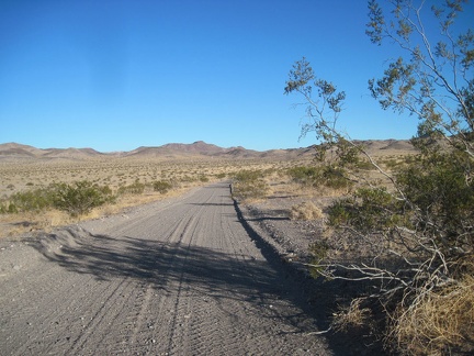 The Bristol Mounatins powerline road is looking good again, with a just bit of kitty litter on its surface
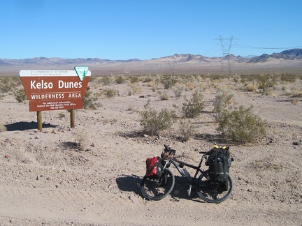 After two miles on the unpaved Crucero Road, I arrive at a billboard advertising the Kelso Dunes Wilderness Area
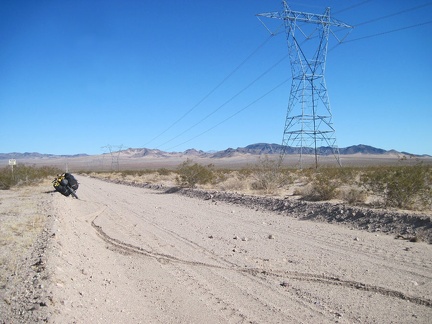 Something doesn't feel quite right on the 10-ton bike, so I pull over on the sandy power-line road for a moment
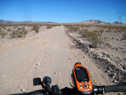 I plow ahead on the powerline-pipeline road that separates the Kelso Dunes Wilderness from the Bristol Mountains Wilderness
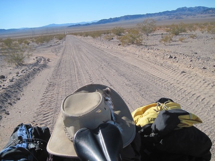 I look behind me to check my progress as I slowly ride up the Bristol Mountains powerline road into the foothills
 After a mile or so on Crucero Road, I notice a turn-out and decide to check it out
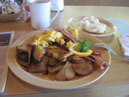 I'm not disappointed by my leisurely breakfast at the Ludlow Café
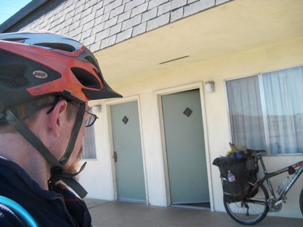 After I shower and repack my saddlebags, I quit the Ludlow Motel
 Before leaving Ludlow, I go for a short ride around the old Ludlow ghost town just south of the freeway
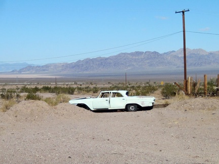 This old car is parked permanently in old Ludlow, California
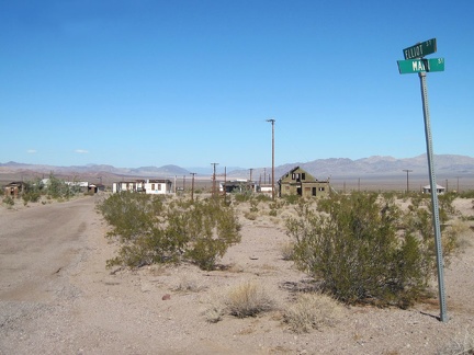 I stop at the corner of Elliot and Main in old Ludlow to take in views of what's left of this town
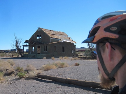 This old house along Ludlow's Route 66 still stands, but for how much longer?
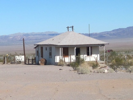 Almost all of the buildings on old Route 66 east of the Ludlow Café are abandoned
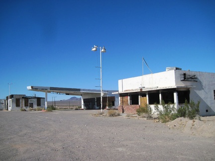 Old Ludlow's commercial strip consists of three buildings today, all abandoned
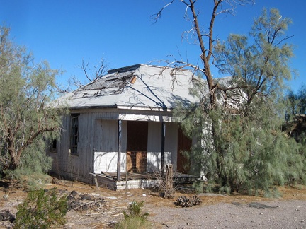 This old house in old Ludlow on Route 66 is almost hidden by the surrounding athel trees, presumably planted as a wind break
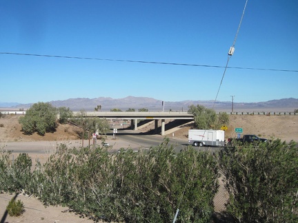 After my brief tour around old Ludlow, I stop at the gas station store to pick up a couple more bottles of water
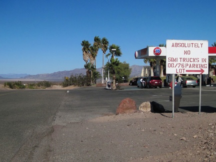 After riding under the freeway at Ludlow, I pass "the other gas station," which also houses the Dairy Queen
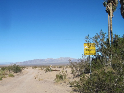 No more pavement for me today, nor tomorrow!
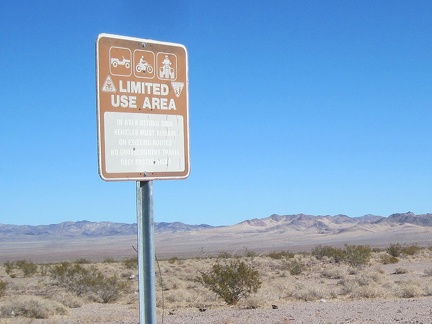 I pass a "Limited Use Area" sign on Crucero Road shortly after leaving pavement
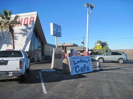 I'm up early (for me) and walk over to the Ludlow Café next door to the motel for breakfast
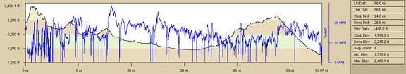 Barstow to Ludlow bicycle route elevation and speed profile
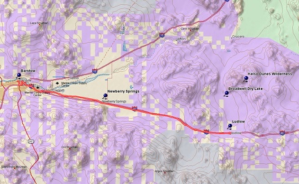 Barstow to Ludlow bicycle route on old Route 66
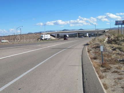 I enter Interstate 40 eastbound, riding on the shoulder of course
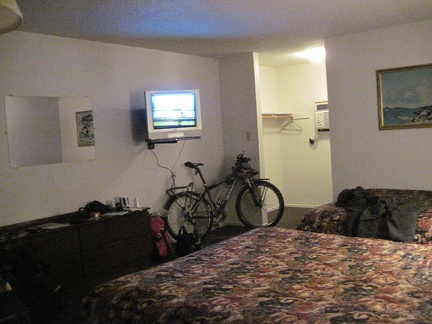 I check in at the Ludlow Motel: bland, but cleaner and more spacious than last night's accommodations in Barstow (and $10 more)
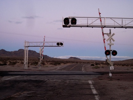 The sun fades away as old Route 66 crosses the train tracks at-grade near Pisgah siding
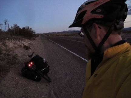 Well, I can't deny any longer that it's about to get dark here on Route 66
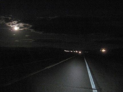 I pedal the final 10 miles to Ludlow in darkness, quite enjoyable with the almost-full moon peering through the clouds
 The water-stained menu in my room at the Ludlow Motel advertises the offerings of the Ludlow Café next door
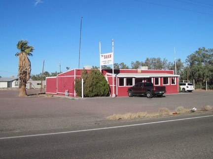 Route 66 in Newberry Springs sports a number of old buildings, some abandoned, some not: welcome to "The Barn"
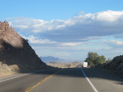 Riding down Route 66 through Newberry Springs, a tour bus that just passed me has pulled over on the side of the road
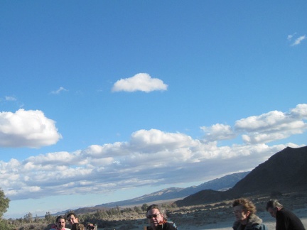 As I pass the little crowd of people by the tour bus, I realize that the thing they are photographing is me
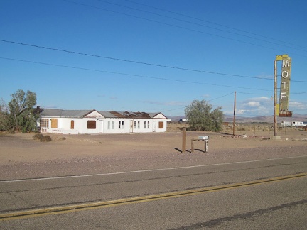 Next to the Bagdad Café in Newberry Springs is the abandoned Henning Motel
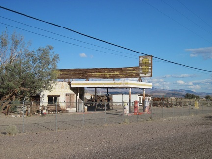 I stop to take a quick look at an abandoned gas station in Newberry Springs, which also once housed a restaurant
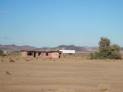 Newberry Springs has a lot of abandoned houses, but the presence of many newer houses shows that the town is not dead
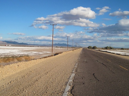 Just east of Newberry Springs are several dry lakes with white minerals coming up to the surface
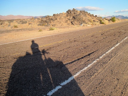 Route 66's road surface gets really rough east of Newberry Springs; I'm glad I'm riding a mountain bike with suspension!
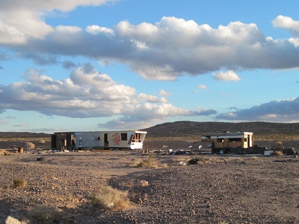 It looks like these two abandoned and semi-demolished trailers near Route 66 east of Newberry Springs have been visited often
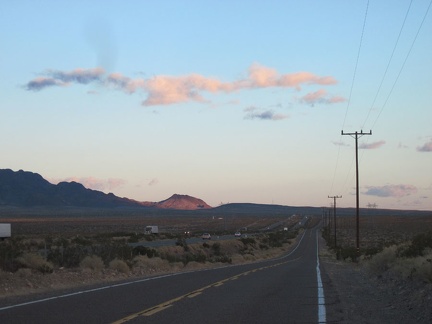 Route 66 closely parallels the I-40 freeway the rest of the way to Ludlow, my destination today
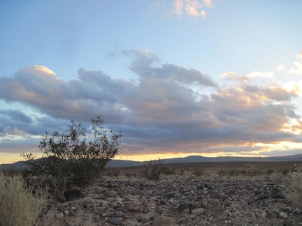 The clouds to my right and behind me are picking up some nice lighting as the sun starts to set on Route 66
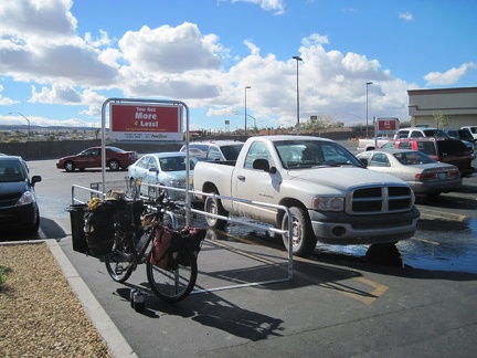 Before leaving Barstow, I make a quick stop at Food For Less to buy a couple of propane bottles
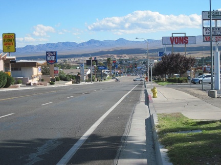 I ride back to Barstow's Route 66 through residential areas and coast down a nice hill on my way out of town
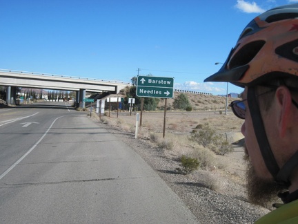 On the outskirts of Barstow, the road dead-ends at a Marine Corps base, so I turn back and get on the freeway for a few miles
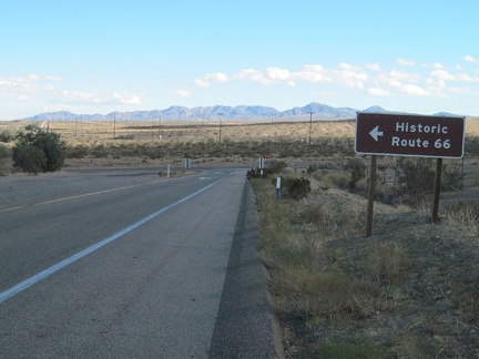 After approximately 2.5 miles on the freeway, I reach Nebo Street and one of those "bicycles must exit" signs
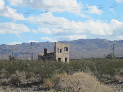 As I approach the Daggett area, I notice this crumbling concrete structure not far from old Route 66
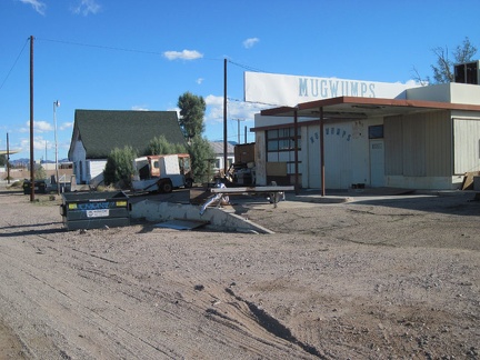 Mugwumps? I pass a former old gas station labeled "Mugwumps," near Daggett's stop sign
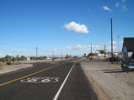 Route 66 reaches a stop sign as it passes through the little town of Daggett, California
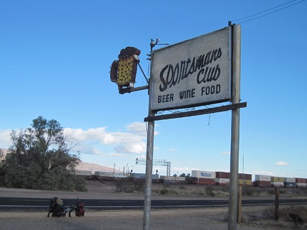 While riding through Daggett, I stop to check out the old sign for the now-defunct Sportsmans Club
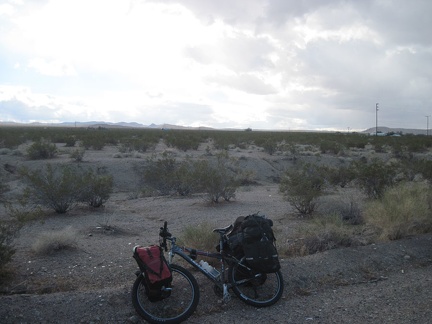 Although it's mostly sunny, some dark clouds are still floating around and mistly lightly upon me from time to time
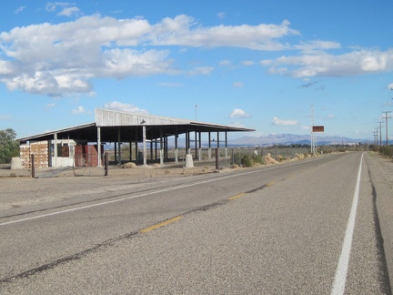 Also on Route 66 near Daggett is an old California Agricultural Inspection Station, long abandoned
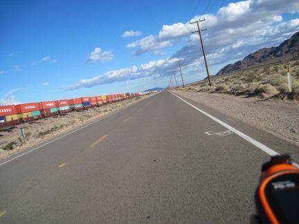 Riding east on Route 66 away from Daggett, one of many long freight trains passes by
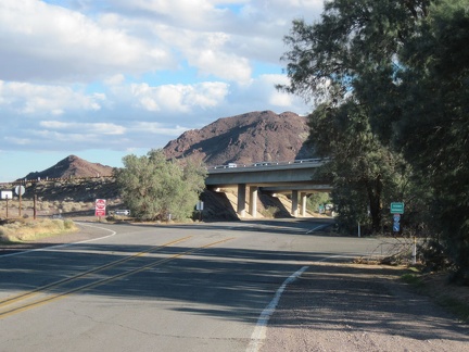 After several long, straight miles, old Route 66 curves and ducks under the freeway as it enters Newberry Springs
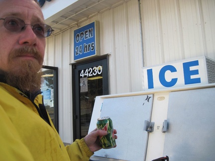 I take advantage of the gas-station store at Newberry Springs for welcome a caffeine boost: a can of Mountain Dew
 I stop in at Barstow's Mojave River Museum for a quick visit before riding on toward Ludlow
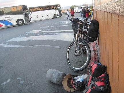 The Amtrak bus deposited me yesterday at Barstow Station, just before sunset
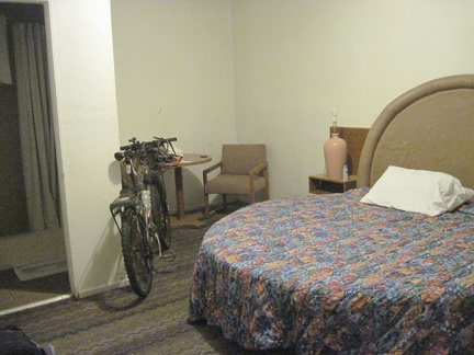 My cabin room at the Route 66 Motel is small and a bit run-down, but the round bed adds unique character
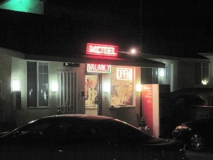 Route 66 Motel, Barstow, California
 Several old cars and other antique Route 66 paraphenalia decorate the grounds of Barstow's Route 66 Motel
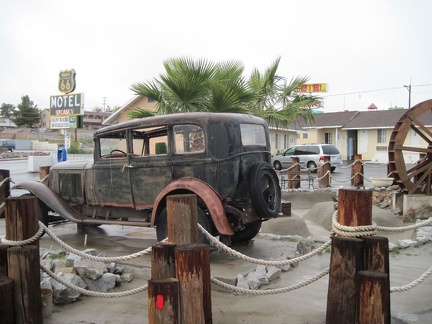 Another old car in the courtyard of Barstow's Route 66 Motel
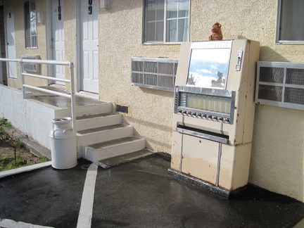 Among the many antiques on the Route 66 Motel property is this cigarette machine
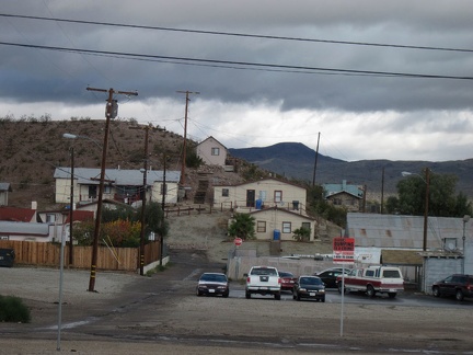 Barstow's downtown area has many older, modest dwellings built along desert hillsides
 A 24-hour donut shop on Barstow's Route 66 is closed due to the water contamination
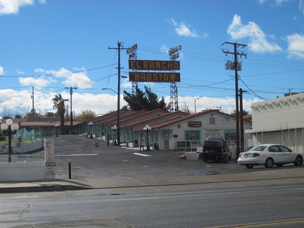 El Rancho Barstow is one of many older motels along Route 66 in central Barstow
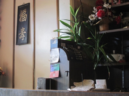 I grab some breakfast at Barstow's Village Café, which is probably cooking with the bad city water, since they're still open
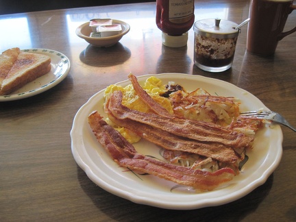 Bummer, no Chinese breakfast on the menu (who would order such "weird stuff"?), so I order scrambled eggs and bacon
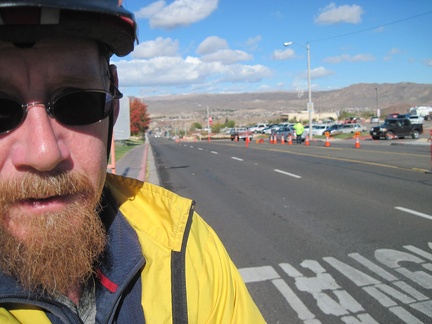 The rain stopped, the sun shining, I leave Route 66 Motel and detour a mile up Barstow Rd to the Mojave River Museum
 Outside the Mojave River Museum in Barstow is an old exterior cage-style jail cell
 Yesterday, I took the Amtrak San Joaquin train with my bicycle down California's Central Valley
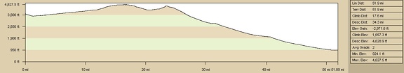 Elevation profile of bicycle route from Brant Hills to Baker via old Mojave Road, Mojave National Preserve
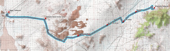 Bicycle route from Brant Hills to Baker via old Mojave Road, Mojave National Preserve
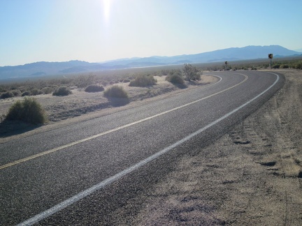 I stop briefly at Kelbaker Road's 10-mile curve, which means just 10 more miles until I reach Baker
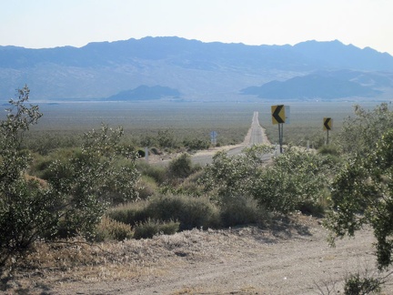 From Kelbaker Road's 10-mile curve, the town of Baker doesn't look like it's still 10 miles away
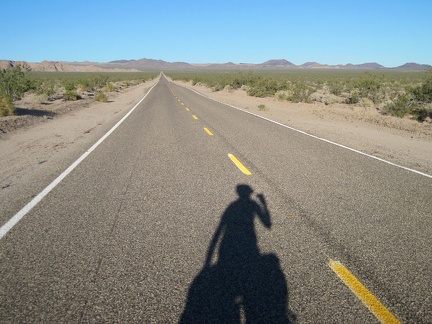 On the way to Baker, I look back at the cinder cones and the Kelbaker Hills several times
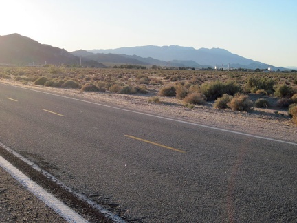 There it is: Baker, California, the end (and beginning) of this trip
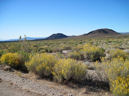 I pass lots of desert senna flowers exuding their sweet scent as I ride down Kelbaker Road
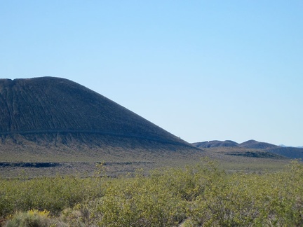 I zoom in across an expanse of yellow creosote-bush blooms to one of the nearby cinder cones
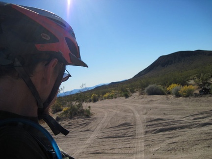 I reach the junction of Aiken Mine Road, ending the enjoyable ride down the old Mojave Road
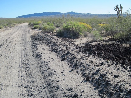 Scattered lava rock, sand, and washboard texture define the half-mile-long ride on Aiken Mine Road, my final unpaved road
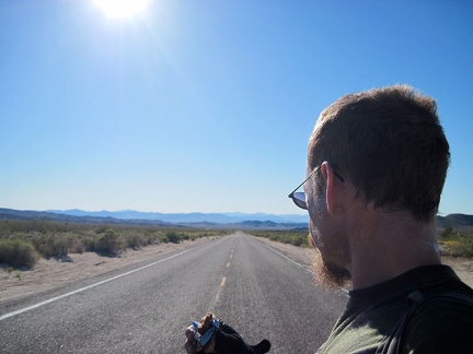 I take an energy-bar break when I reach the pavement of Kelbaker Road at 3000 feet elevation
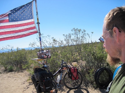 I arrive at the famous Mojave Road mailbox in the middle of nowhere and sign its guest book
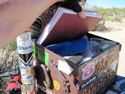 I pull out the guest book from the Mojave Road mailbox and sign in
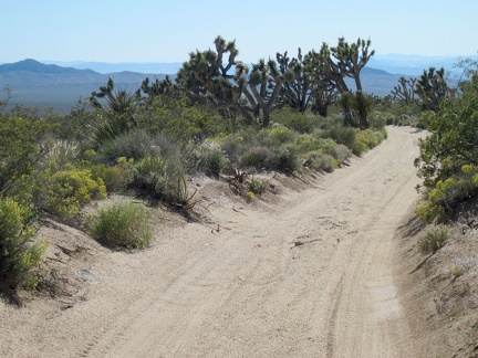 The old Mojave Road gets a bit more sandy as I head westward (and downward) after my stop at the Mojave Road mailbox
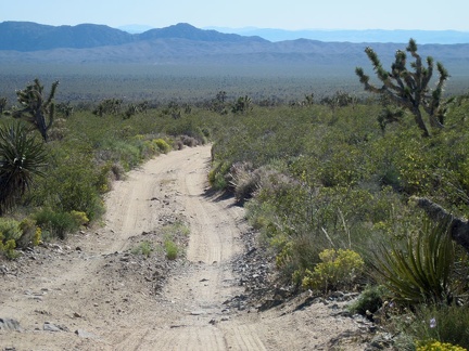 I like the occasional rocky stretches on the old Mojave Road because they add traction to the sandy road
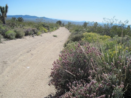 A few purple sages bloom on this part of the old Mojave Road amongst the yellow flowers
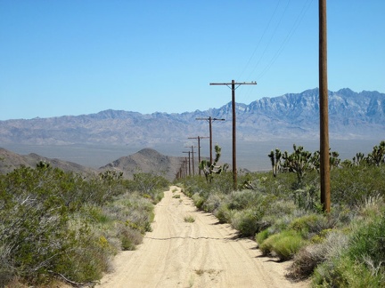 I pause when I cross the junction of Rainbow Wells Road to enjoy the view across to the Providence Mountains
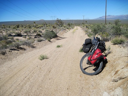 I take a break near the Mojave Road junction for an energy bar, water, and to apply more sunscreen
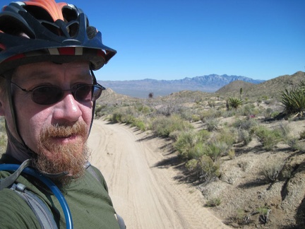 I turn here and begin the short climb up to the summit of the old Mojave Road, after which the big downhill of the day begins
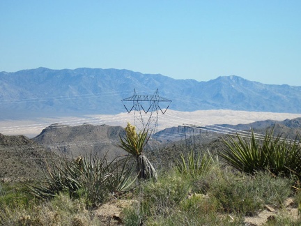 From the summit of the Mojave Road at about 4550 feet, I have a nice view across the Marl Mountains to the Kelso Dunes
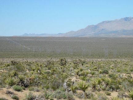 Nice view across the flank of Cima Dome and the powerline road that I just finished riding, from the summit of the Mojave Road
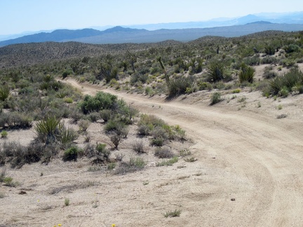 I'm ready to start the Mojave Road downhill ahead of me
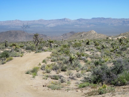 The old Mojave Road heads briefly southwest; I'm heading toward the Old Dad Mountain area for a short while
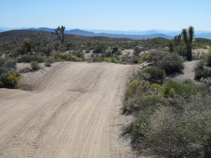 Parts of the old Mojave Road are like a roller coaster, rising and falling gently over the desert terrain
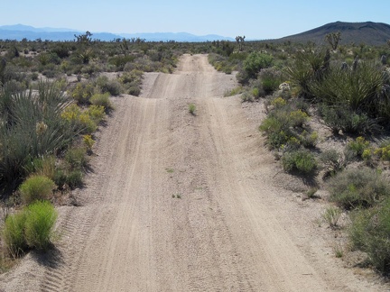 Up, down, up, down, on the old Mojave Road; my fat tires hiss in the sand
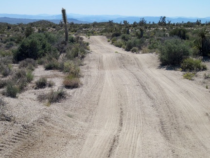 The old Mojave Road continues rolling onward downhill; the loose sand on the road surface makes it feel a bit like skiing
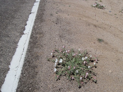 One of several primroses blooms on the shoulder of Cima Road
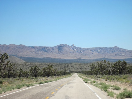 Before turning off at the unpaved powerline road, I take a look behind me back down toward Cima
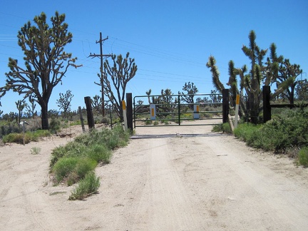 I start riding up the powerline road, pass an electrical substation, then reach a closed gate
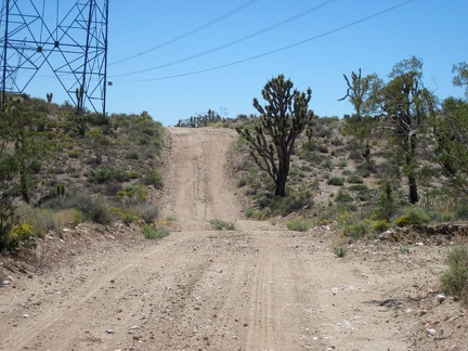 The powerline road starts out evenly, but I run into a short steep hill, as expected
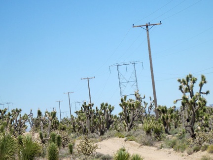 The power lines here add extra height to the joshua-tree forest
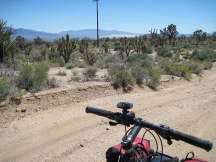 I'm high enough now on the flank of Cima Dome that I can see across Kelso Valley to the Granite Mountains
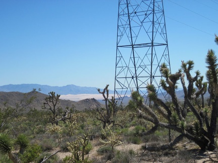 I zoom in past the transmission tower for a closer view of the Kelso Dunes
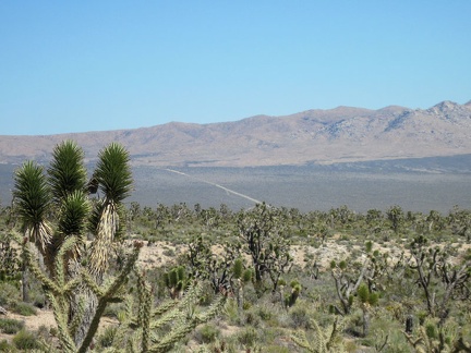 To the east I can see Macedonia Canyon Road climbing the fan out of Kelso Valley into the Mid Hills
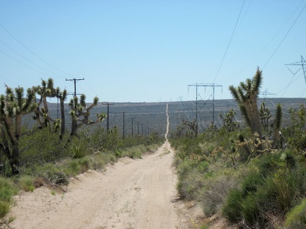 I've crossed the high point of the powerline road and now have a bit of downhill ahead of me; this will be a fun change
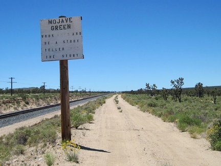 A handmade sign warns of the dangers of the Mojave Green rattlesnake
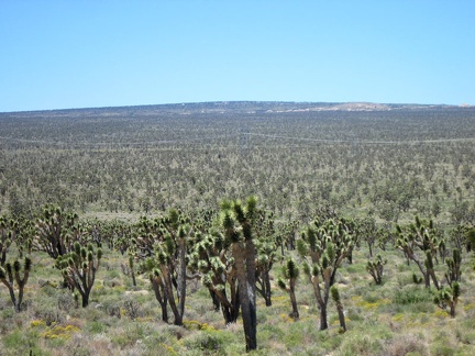 Across upper Ivanpah Valley is the summit of Cima Dome, so subtle that it can only be perceived from a distance
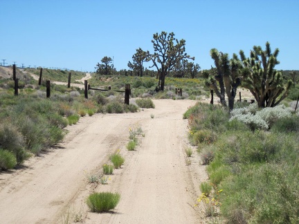 Roughly two miles before Cima, I cross an intersection with an unsigned dirt road to my right; I continue straight ahead
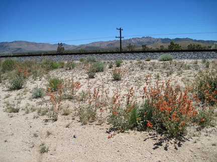 Nice to see a few cheerful orange desert-mallow flowers again, this time framing my glance toward Butcher Knife Canyon
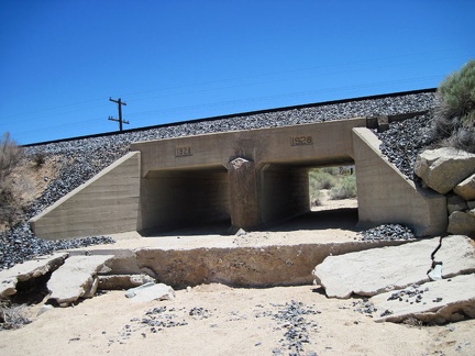 The double culvert under this trestle along Brant Road near Cima bears two different date inscriptions
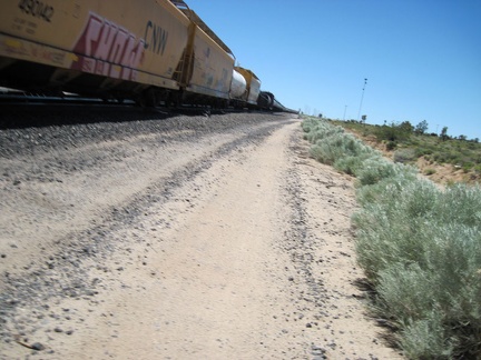 As I approach Cima, another freight train churns by, a few feet away from me as I ride along Brant Road
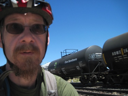 Several of the tanks whooshing by me are labelled as "corn sweetener"
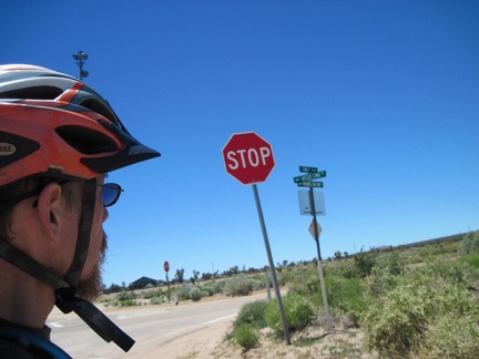 I reach the end of the unpaved Brant Road and rejoin asphalt near the three-way stop at Cima, and automobile traffic
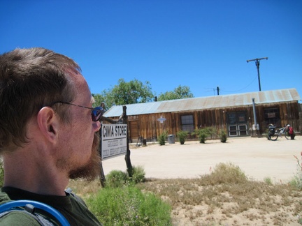 I take a break at the Cima Store; it's open!
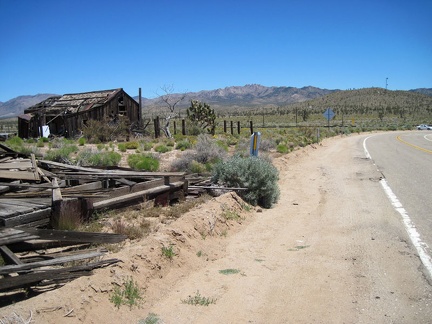 I start the 1.5-mile ride up Cima Road to the powerline road, passing an abandoned house on the way out of "town"
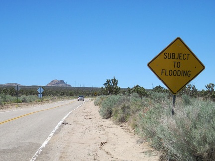 Despite the fairly high elevation (over 4000 feet here), Cima Road is apparently subject to flash floods during heavy rains
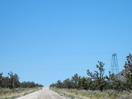 Approaching the power lines that cross Cima Road, I start looking for the dirt road that I'll follow somewhere at my left
 I look across the train tracks from Brant Road toward the Sacaton Spring area
 Brant Road hugs the train track as it curves to follow the route toward Cima, Mojave National Preserve
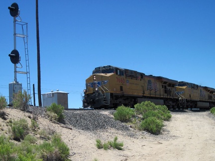 The conductor of an oncoming train toots his horn and waves at me at Joshua siding, Mojave National Preserve
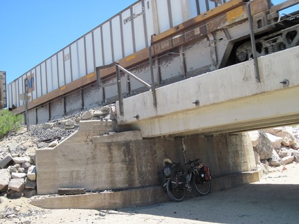 The 10-ton bike hides in the shade of the trestle at Joshua siding while a freight train rumbles overhead
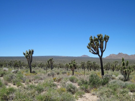 This is a pensive, scenic ride on Brant Road toward Cima
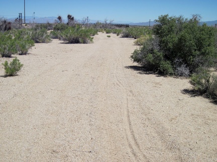 I ride through the sandy area at the end of the road and arrive at the train tracks in Ivanpah Valley
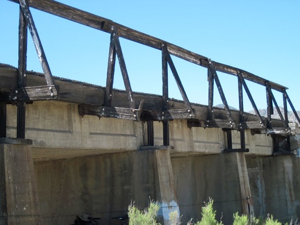 Several of the rail supports are crooked and one has cracked
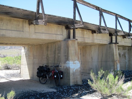 The 10-ton bike breaks briefly under the train trestle at Brant Road
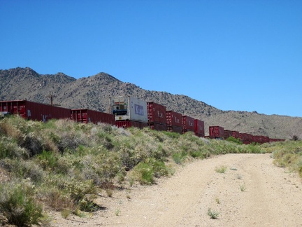 I start riding up lonesome Brant Road toward Cima, my next stop, and a train passes
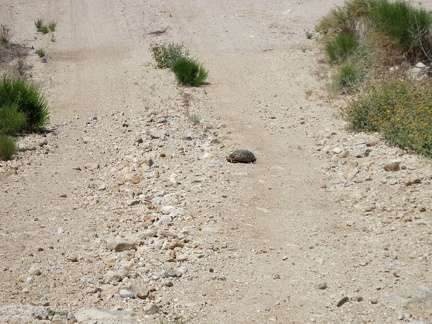 I slam on the brakes while coasting down to a wash crossing on Brant Road, due to a "special rock" in the road
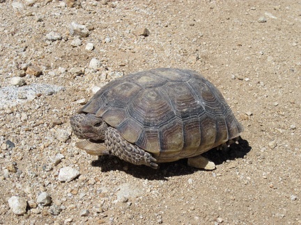 The tortoise appears to see me approaching
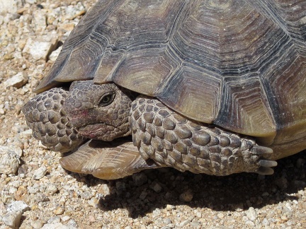 Close up, I notice that the tortoise is pinkish around his mouth, and it doesn't look like part of his natural complexion
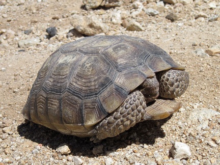 Tortoises shouldn't be touched, but they also shouldn't be left in a rocky road where a passing car might inadvertently crush it
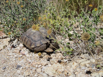 I pick up the tortoise and put him down amidst some flowers, encelias perhaps, off the road
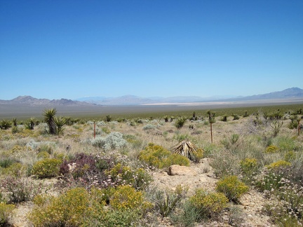 A bit further up Brant Road, I stop to look across the tortoise's habitat, and down toward Ivanpah Dry Lake
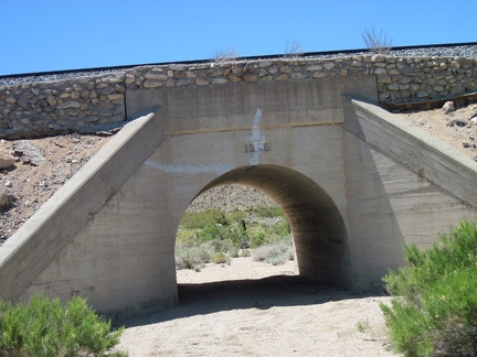 Brant Road dips down again to cross a wash, with the adjacent train tracks crossing the wash on an old concrete bridge
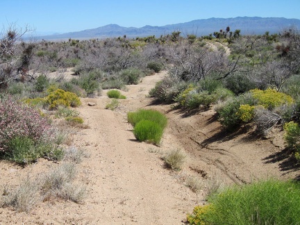 I finally get past the rocky part of the road to a more ridable stretch
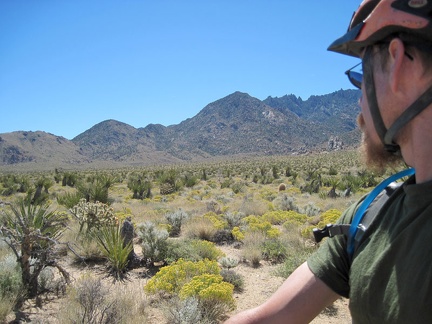 As I approach the bottom of the road, I look back up toward the New York Mountains and the area where I camped last night
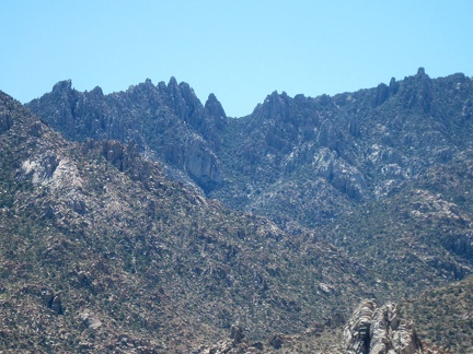 I zoom in for a closer look at the New York Mountains
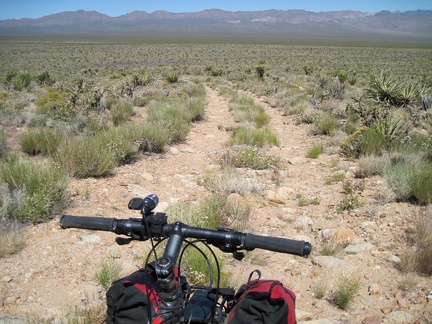 The 10-ton bike packed up, off I go down the hill toward Ivanpah Valley
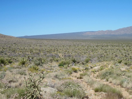 The old road doesn't stand out much as it crawls down the fan toward the Ivanpah Valley train tracks
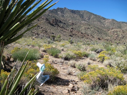 On my way back to the tent after brushing my teeth, a yucca spine impales the tube of toothpaste protruding from my pocket
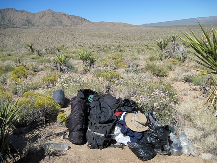 The job is almost done: tent disassembled, my supplies hop into my saddlebags one item at a time
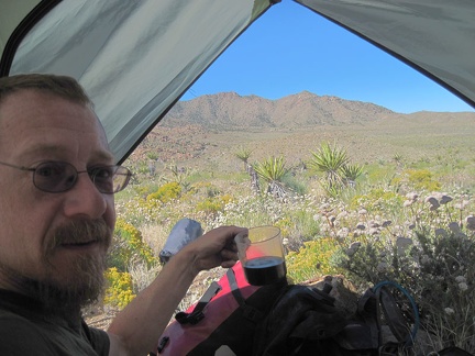 I enjoy cold coffee and eat breakfast while packing up to leave Ivanpah Valley
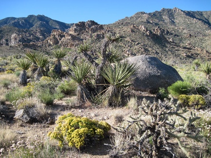 I wake up early and look outside to another warm sunny day: sadly, the final morning of this trip
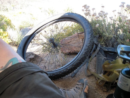 The first major task of the day is to fix my flat front tire, so I can actually go somewhere
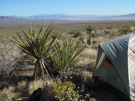 A colourful and very long freight train crosses the Ivanpah Valley a couple of miles down the fan from my tent
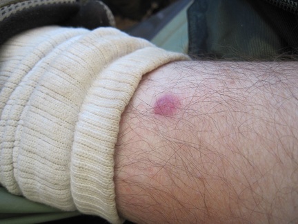 Something seems to have bitten my leg yesterday, but I don't remember it happening
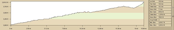 Elevation profile of bicycle route from Nipton to Brant Hills
 Bicycle route from Nipton to Brant Hills
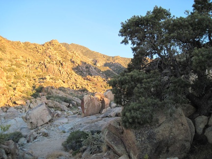 I pause to take a look at a mature pinon pine along the old road
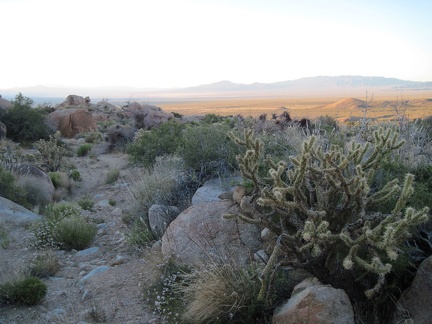 I walk down the old road, enjoying the sunset
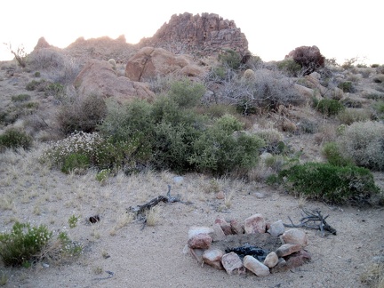 A fire ring exists for those who come up here to camp
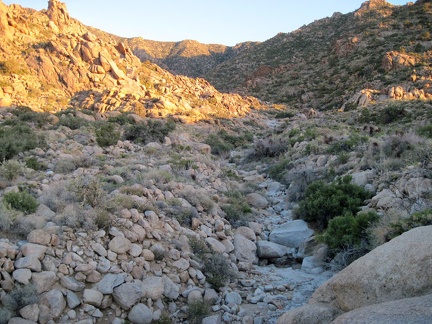 I look back up the dry creek bed and at the hills behind collecting the sunset
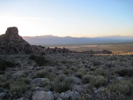 I pass the last of the pinnacles as I descend down the fan toward my campsite perched above Ivanpah Valley
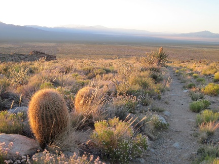 A few barrel cacti grow in the transition zone here between creosote-bush desert and the woodlands of the New York Mountains
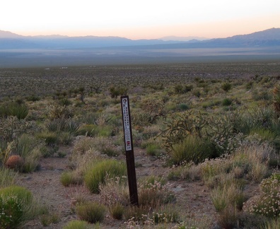 A Wilderness marker blocks an old road on the way back to my campsite above Ivanpah Valley
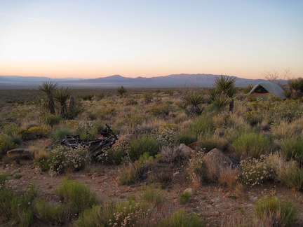 I make it back to my tent overlooking Ivanpah Valley just before dusk
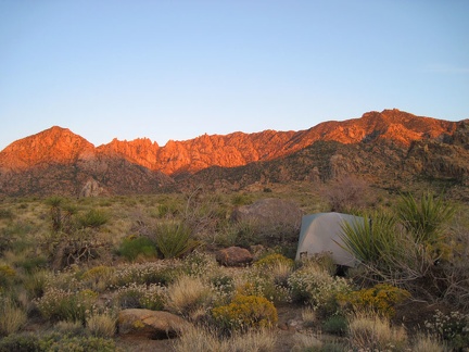 The final moments of sunset cast red across the New York Mountains hilltops
 This crossing of the old road over the stream is still in really good condition
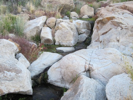 Water trickling down the rocks creates a small brook
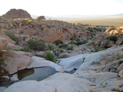 I notice another small, clean pool of water in the rock just below
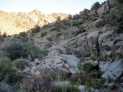 An even larger pool of water sits in the shade a little higher up
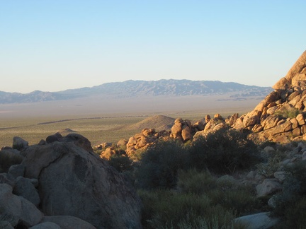 A long freight train slowly crosses the Ivanpah Valley below
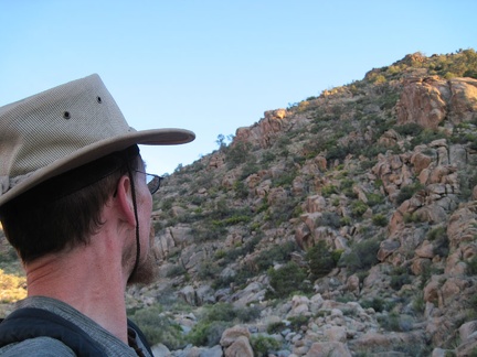 I look at these rocky hills and think it would be fun to climb one of them during the brief time I'm here
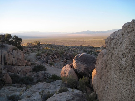 Sunset is approaching, so it's time to turn around and start the mile-long walk back to the tent
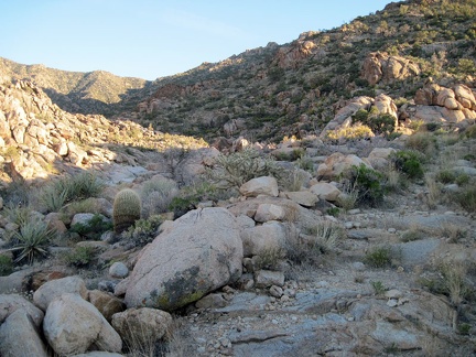 I continue my walk up the old road, which is increasingly grown-in
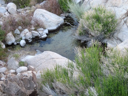 Lo and behold, a pool of water!
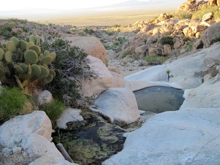 Actually, a couple of pools of water remain in the rocks
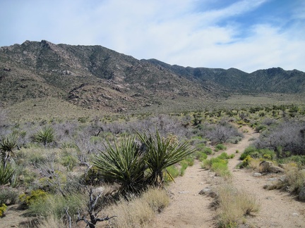 The old road winds across the fan, then turns sharply left to begin its climb into the New York Mountains
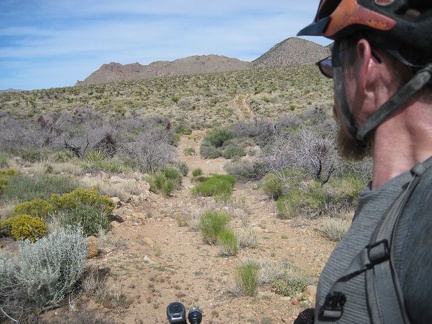 The road is discernable, but obviously not used very often
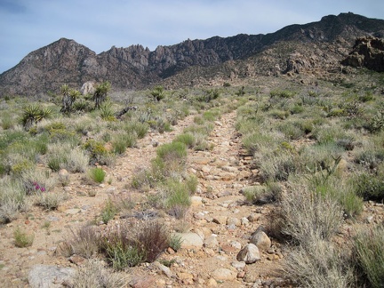 The uphill road isn't steep, but it's too rocky for me to ride on the 10-ton bike, so I get off and walk
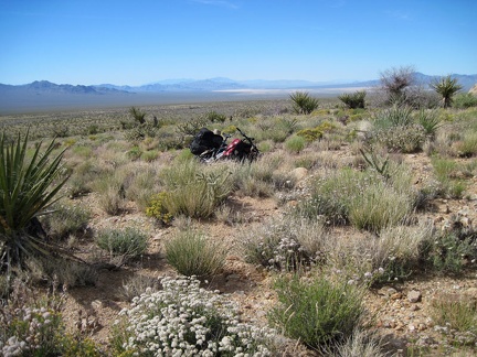 On the way up the hill, my front tire goes flat despite my Slime-filled inner tube
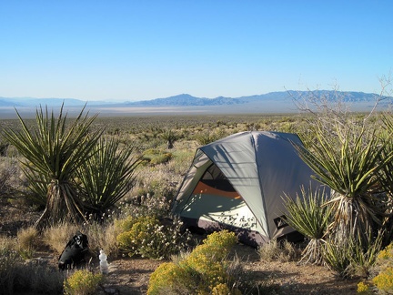 Finding a campsite is tricky in this area above Ivanpah Valley because there are hardly any open spaces between plants
 After a short rest in the tent and an energy bar, it's time for a walk up into the nearby New York Mountains foothills
 Some pinnacles and rock piles make for another classic New York Mountains landscape
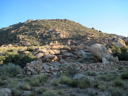 An interesting find is this old rock wall
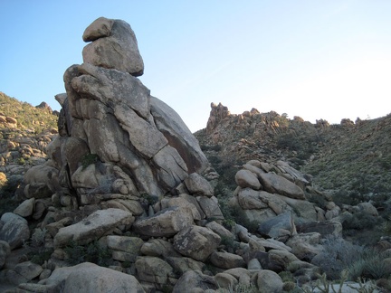 The top of this rock pile reminds me of a vulture's head
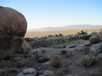 I walk around the old rock wall and look down across the Ivanpah Valley
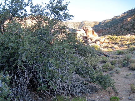 Upon further inspection, a scrubby shrub looks like it might be some kind of oak tree
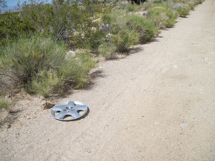 Someone lost a hubcap here on Brant Road
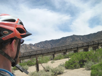 I reach the first of two roads that lead up toward the New York Mountains off Brant Road
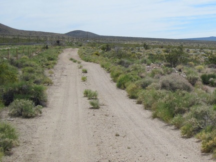 I continue riding up the road toward Brant siding, where there is supposed to be another road leading up into the hills
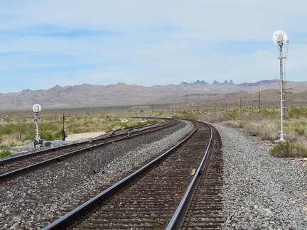 I reach what is indicated on my maps and GPS as Brant siding, but find no road crossing over or under the tracks
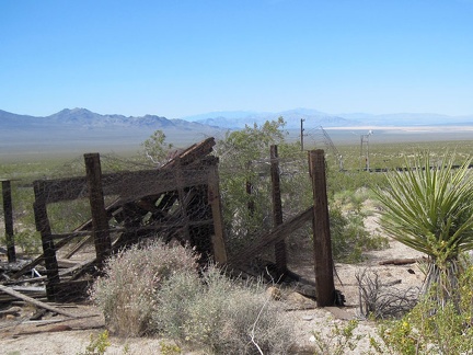 I discover an old structure and corral on the other side of the tracks at Brant siding
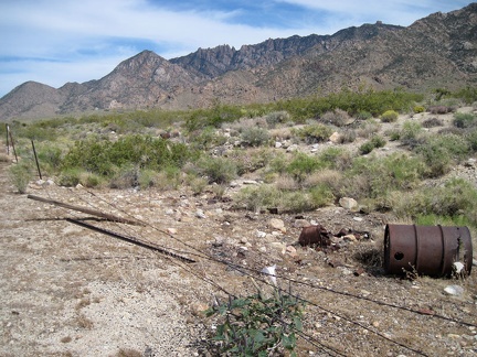 Scattered old trash is also found on the other side of the tracks at Brant siding