Home 7119

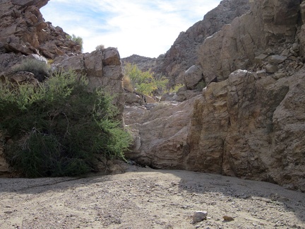 I'm enjoying the hike up this part of Hyten Spring Wash with its occasional little dry waterfalls to climb over
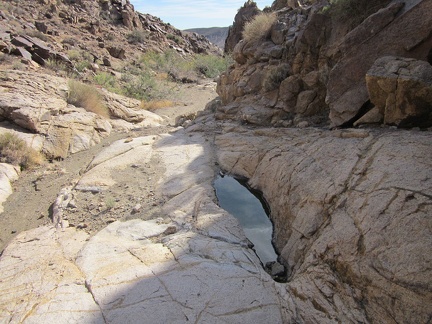 As for a pool of water at Hyten Spring, this litle tank in the rock is all I find today
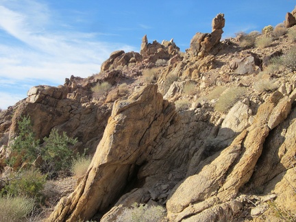 Interesting rock spikes along the wall of the wash, Kelso Dunes Wilderness
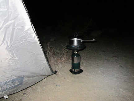 Time to boil water for tonight's instant meal: Mountain House Teriyaki Chicken and Rice
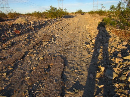 Back on the powerline road, less than two miles of hiking to go
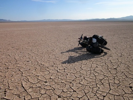 20 minutes later, I stop for another break further out on Broadwell Dry Lake
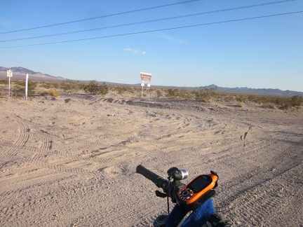 I stop briefly on Crucero Road as I pass the powerline road leading toward the Bristol Mountains Wilderness
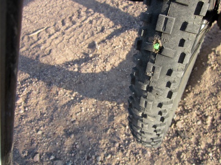 A cactus thorn punctures my tire and some Slime spurts out to fill the wound
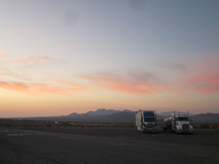 Big rigs park at the Ludlow gas station with the Sleeping Beauty mountains as a sunset backdrop
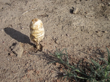 I stop just before starting the ride across Broadwell Dry Lake to check out a couple of big mushrooms
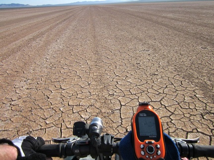 There's nobody else out here on Broadwell Dry Lake today, so it's very peaceful
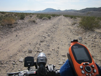 First, I ride down the bumpy powerline road 1.7 miles back to Crucero Road
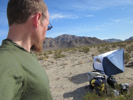 There's a bit of a wind this morning as I pack up to leave Kelso Dunes Wilderness; my now-empty tent blows over
 Hyten Spring hike elevation, Kelso Dunes Wilderness
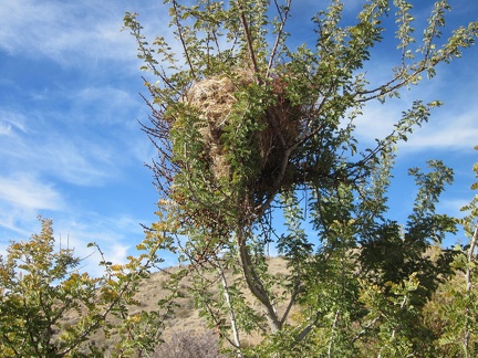 A bird's nest in a catclaw bush in Kelso Dunes Wilderness
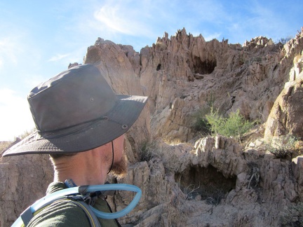 A series of cavelets is clustered in a hill along this wash in the Kelso Dunes Wilderness
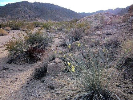 On my way down out of the Bristol Mountains, I pass a few Rush milkweeds in flowers
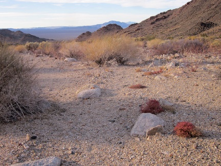 Further down in a Bristol Mountains wash are a number of low, reddish buckwheat tufts
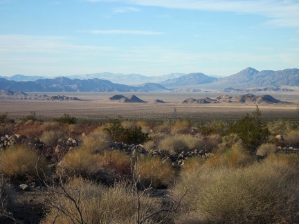 Further down Hyten Spring Wash, I get expansive views across Crucero Valley
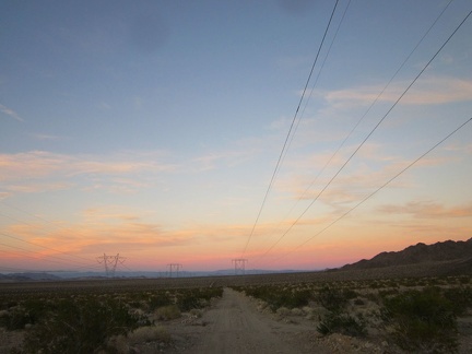 I spend a lot of time snapping photos as the sun goes down on the powerline road
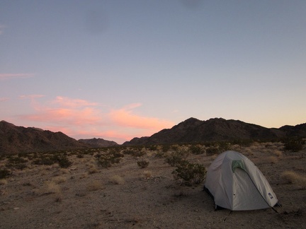 To my surprise, I'm back at my tent at 16h40, before total darkness; I was expecting to need my flashlight on the way home
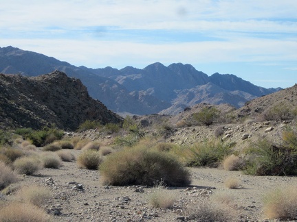 For the return hike back to my tent, I follow a different wash down to the powerline road from Hyten Spring
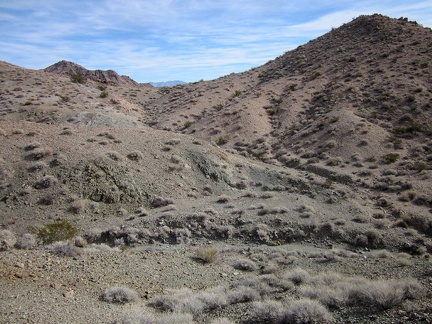 I've just passed an open area where I had to choose which route I'll take to Hyten Spring
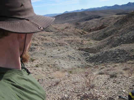 This is the high-elevation point of my day, at roughly 3000 feet in the Bristol Mountains, a bit above nearby Hyten Spring
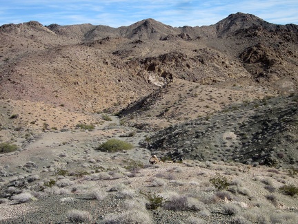 After climbing over a couple of hills, I drop down into a little canyon ahead where I should find Hyten Spring
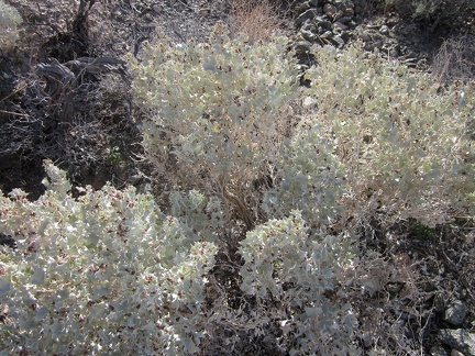 On the way down the hill to Hyten Spring, I stop to look at some of the Desert holly plants that grow here
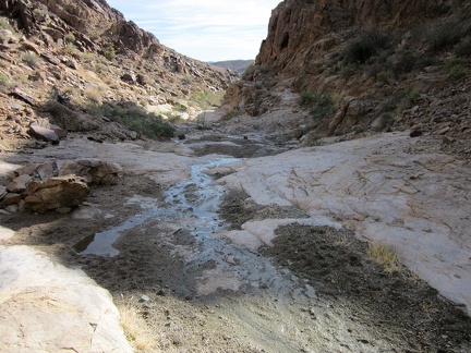 And here it is: Hyten Spring, Bristol Mountains, Kelso Dunes Wilderness
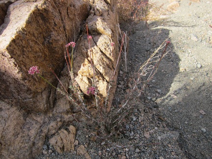 A few pink buckwheat flowers near Hyten Spring, Kelso Dunes Wilderness
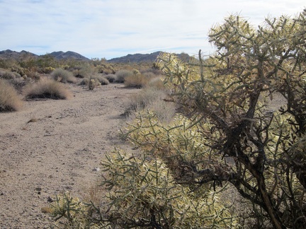 I pass a number of cholla cacti on the way up the wash into the Bristol Mountains
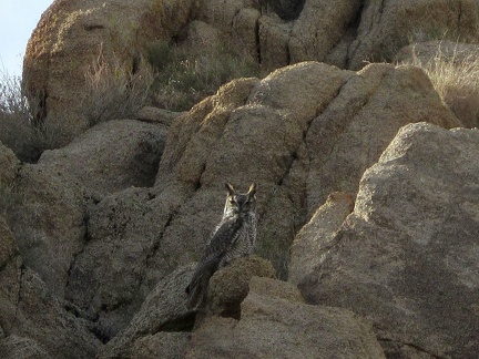 I hear some noise, look up, and notice an owl, noticing me
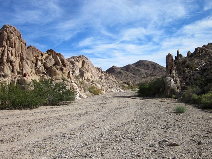 This hike is progressing slowly; I'm finally entering the mountain zone as I walk through this gateway
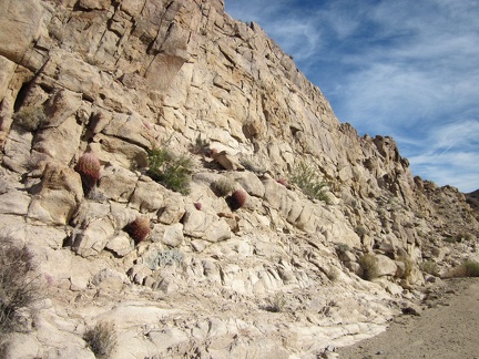 A number of small barrel cacti adorn this rock wall in Hyten Spring Wash in the Bristol Mountains
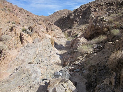 The rocky terrain gets more interesting as I slowly get higher up this Bristol Mountains wash
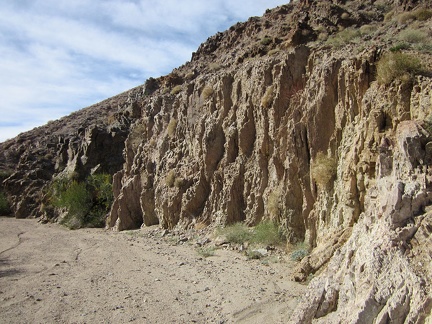 Another cool rock wall in Hyten Spring wash
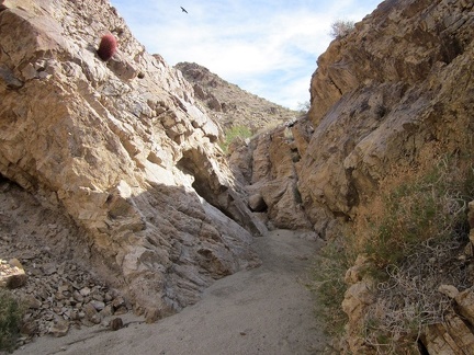 I notice several hawks and ravens flying around as I continue hiking up the wash toward Hyten Spring
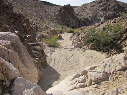 I climb up a small dry waterfall in Hyten Spring Wash and look back down
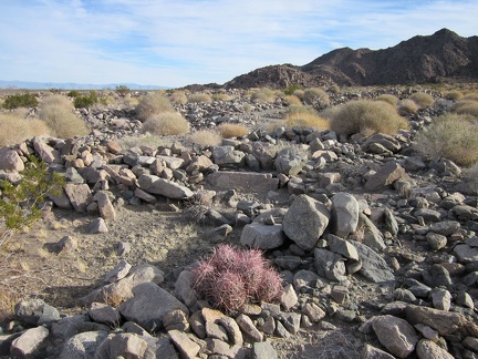 Before reaching the wash that leads up to the Hyten Spring area, I hike cross-country around the left end of the mountains ahead
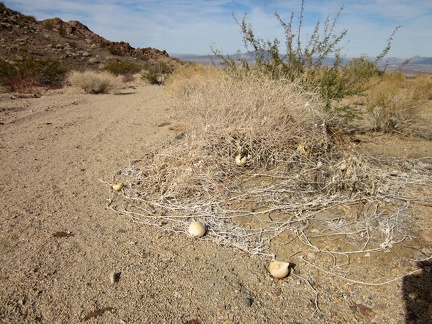 I start hiking up Hyten Spring Wash and encounter several coyote melons left from earlier this year
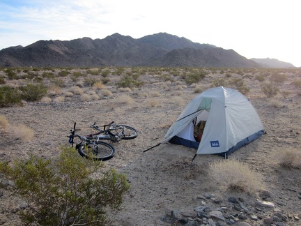 I'm up early this morning for the hike to Hyten Spring that I didn't get around to doing last year
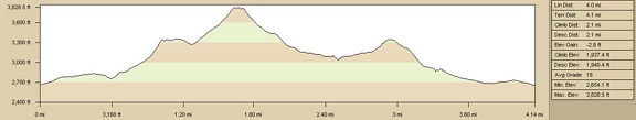 Sleeping Beauty hike, elevation profile
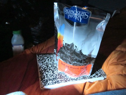 The star of the show this evening is Backpacker's Pantry Beef and Broccoli Stir-Fry
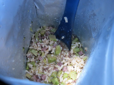 In the bag, Backpacker's Pantry Beef and broccoli Stir-Fry doesn't look like much, but it's good!
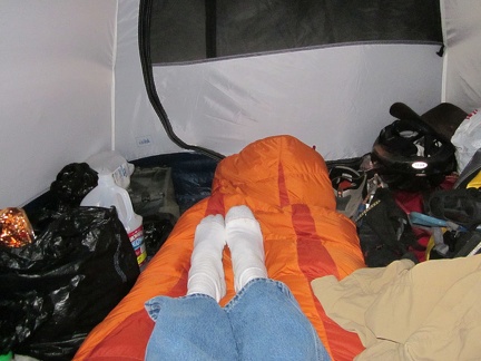 A relaxing evening in the tent, with my sweaters on, and I sleep really well in my new, warm winter sleeping bag
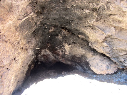 Closer inspection of the little cave shows smoke stains on the roof
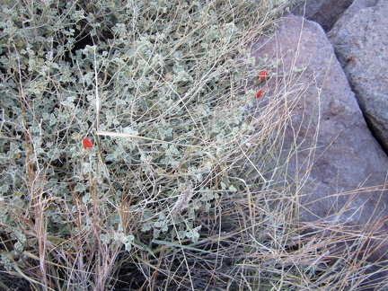 A few very early Desert mallow blossoms are about to open in this Sleeping Beauty canyon
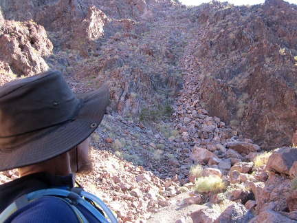 A river of rock flows down a hill toward this Sleeping Beauty canyon
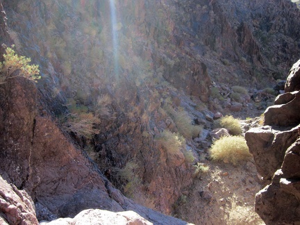 Well, my planned hike down this side canyon in the Sleeping Beauty mountains instantly ends when I reach a 10-foot drop-off
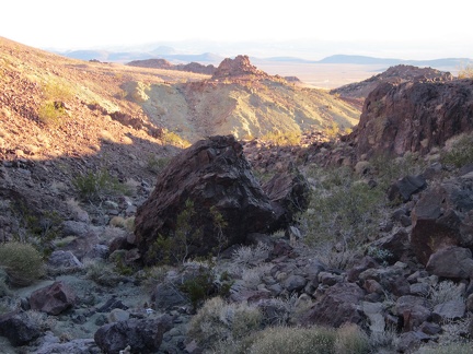 I'm up above the drop-off now in the Sleeping Beauty foothills
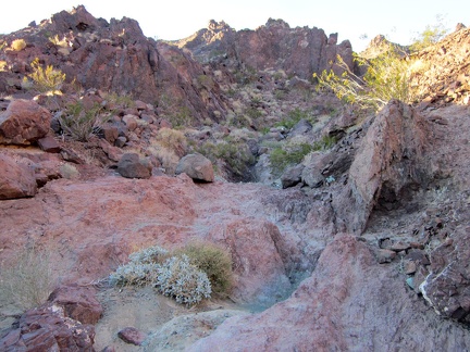 I look behind me at the lower part of the Sleeping Beauty canyon I've just descended
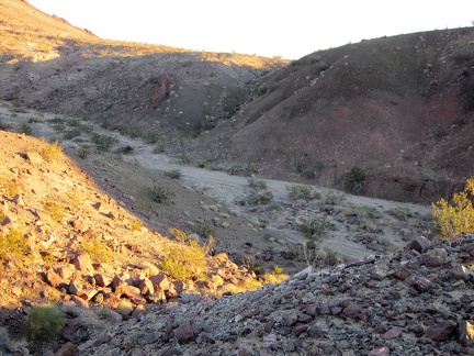 I cross a dry, sandy wash on the way back to my tent
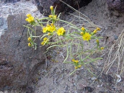 I've seen several of these little yellow flowers on today's hike
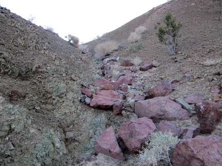 Climbing out of the sandy wash, a few big rocks, and a lot of small ones
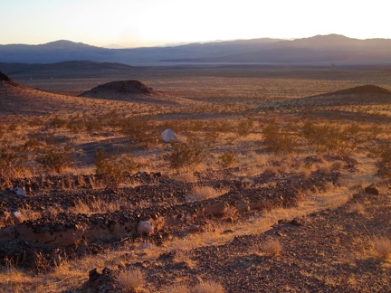 I'm almost back at the tent, with Sleeping Beauty behind me, right at sunset
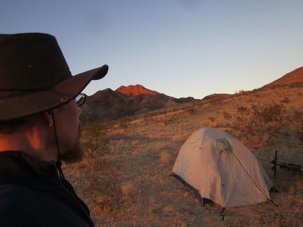 Back home for the night in the Sleeping Beauty foothills, what a great hike that was today!
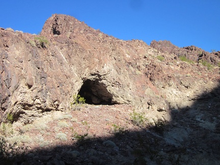 Hmmm, a little cave on the side of this canyon in the Sleeping Beauty mountains
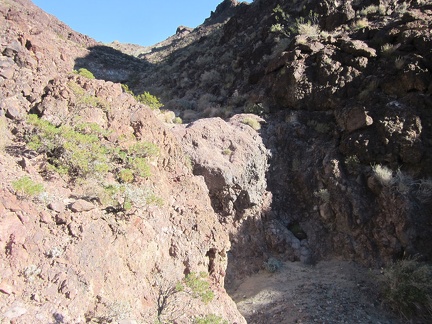 I take a look at a small dry waterfall in this unnamed Sleeping Beauty canyon that I just climbed around
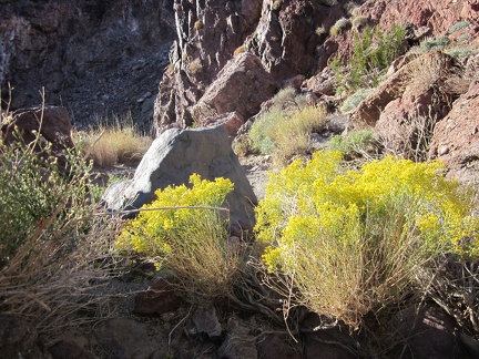 I pass a patch of brilliant rabbitbrush on the way down this Sleeping Beauty canyon
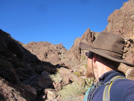 I study my maps a bit and backtrack a quarter-mile up the canyon before turning right and climbing over a rocky ridge
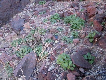 On the way up the steep, rocky hill, I notice many of those daisy-like plants of which I've seen many today
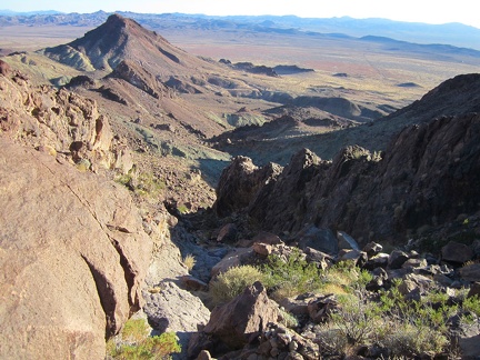 I've made it up to the ridge and have great views toward my campsite down below Sleeping Beauty (which I can't see yet)
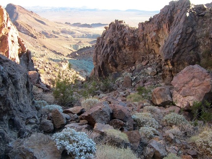 Such a beautiful canyon to descend during the hike back to my tent from Sleeping Beauty
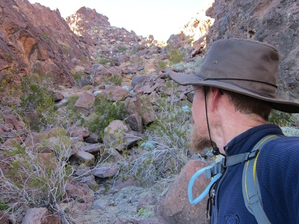 Now that I've almost reached the bottom of this Sleeping Beauty Canyon, I take a look back up behind me
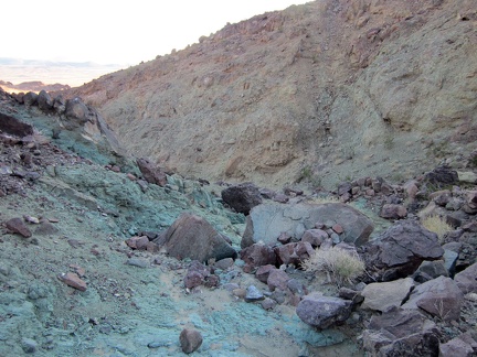 The Mojave Desert is full of interesting and colourful rocks and earth
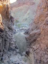 Oops, just when I'm not expecting any further obstacles, I encounter a 15-foot drop-off in the drainage that I'm hiking
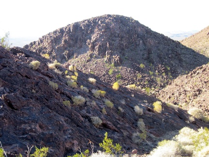 I take note of small tufts growing in the rocks as I walk down this Sleeping Beauty canyon that I didn't plan to explore
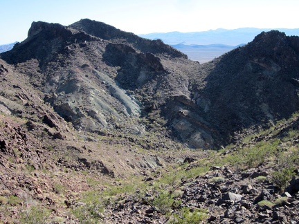 I head down into the shade in the Sleeping Beauty mountains
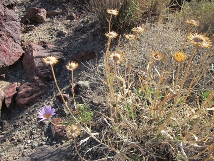 There are a few Mojave asters flowering here today, which I don't expect in November
 Ah ha! A special desert flower that's occasionally found even in the most remote Mojave Desert locales: an old balloon
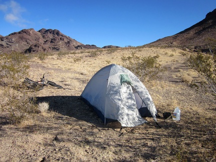 Bright, sunny morning, cool breeze, perfect for the hike that I've planned up the adjacent Sleeping Beauty hills
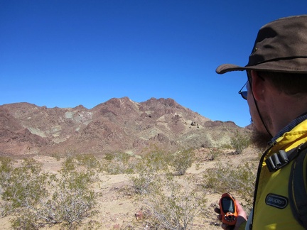 After a slow, relaxed morning in the sun, I'm finally setting out on today's Sleeping Beauty hike
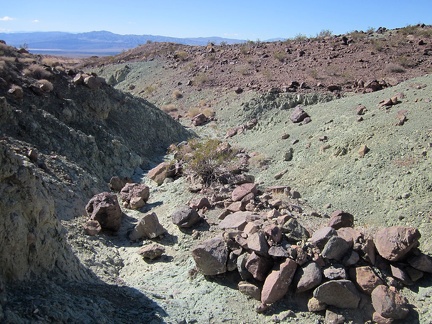 I cross a greenish-looking drainage on my way across the Sleeping Beauty foothills
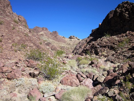 I start hiking up a slope that I identifed as a possible route up Sleeping Beauty while doing my homework before this trip
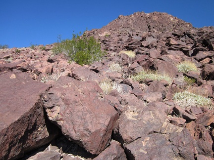 I'm careful and slow as I hike up the loose rock here on Sleeping Beauty
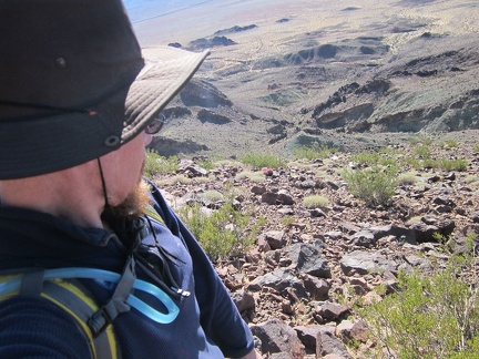 A look back down the hill behind me says I'm making progress on my Sleeping Beauty climb
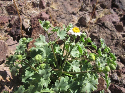 Here and there, I run into a few of these flowers on the slopes of Sleeping Beauty, mostly in relatively shaded areas
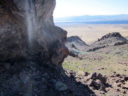 A little further up Sleeping Beauty, I pass around this large rock outcrop
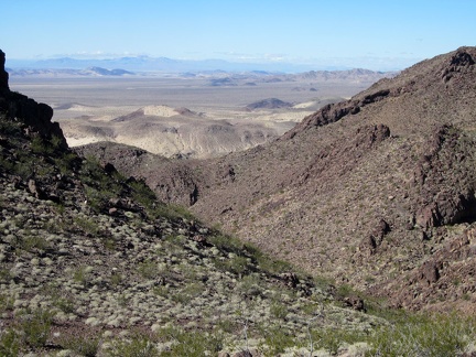 A bit past the rock outcrop, I continue up a ridge above a steep-sided drainage on the side of Sleeping Beauty
 I'm getting closer to the Sleeping Beauty peaks, but I still have a distance to go
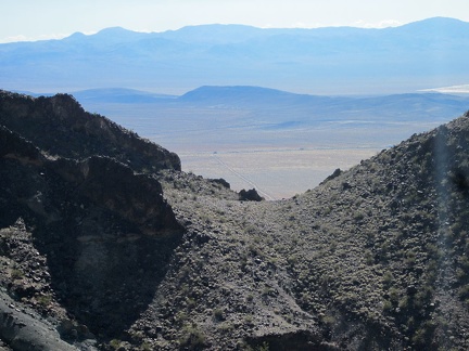 I zoom in on some nice views across the hills as I gain elevation in the Sleeping Beauty mountains
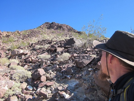 There's one of the Sleeping Beauty peaks up above me; how close can I get without getting vertigo?
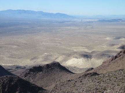 Delicious views as I arrive at a saddle high up in the Sleeping Beauty mountains
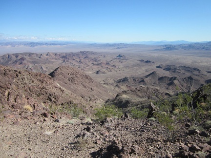 I take a half-hour break on this saddle in the Sleeping Beauty mountains, eat an energy bar, and suck back more water
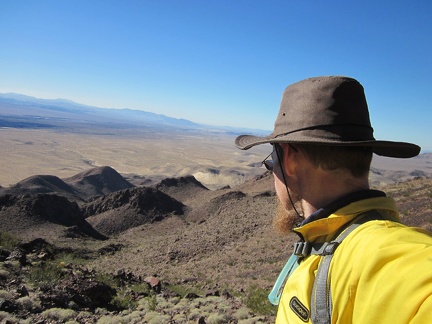 Well, I probably could climb down that way, in front of me, but I decide to check my maps first
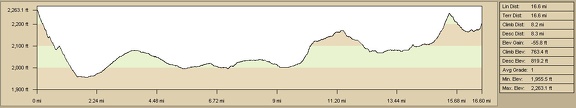 Day 8: Elevation profile of bicycle route from Newberry Mountains to Barstow by on Route 66
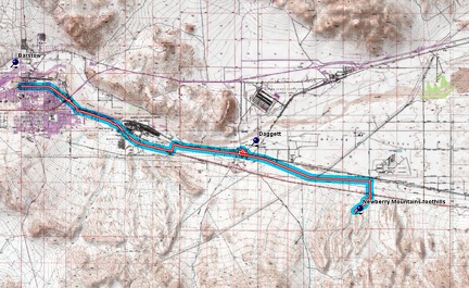 Day 8: Bicycle route from Newberry Mountains to Barstow by on Route 66
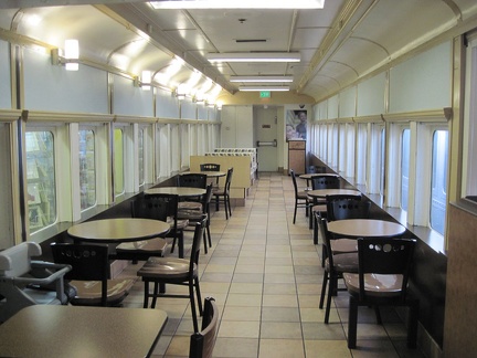 Barstow Station: I enjoy an early lunch in one of the refurbished train cars while waiting for the Amtrak bus
 The 10-ton bike waits patiently for the Amtrak bus outside Barstow Station
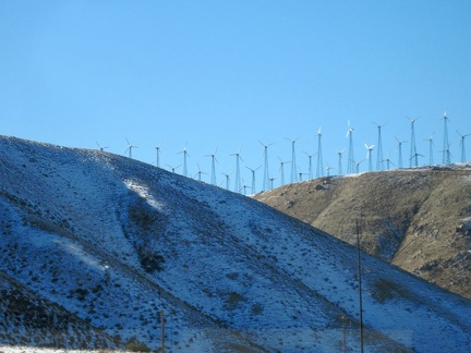 I see a dusting of snow as my Amtrak bus passes through the Tehachapi Mountains and its wind turbines; this was a good trip
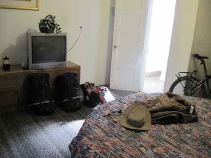 I spend the evening on the round bed in my cabin room at Barstow's Route 66 Motel, watching TV
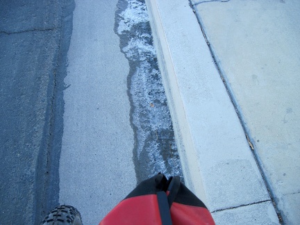 Tomorrow morning, the trip over, I see a bit of ice in the gutter as I ride Barstow's Main Street to the Amtrak Station
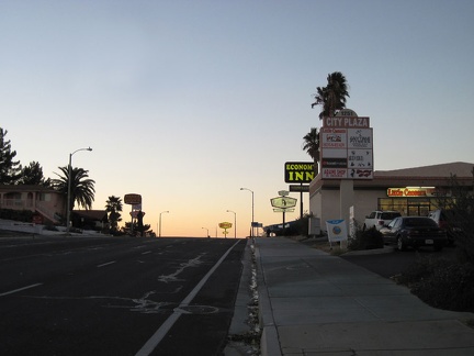 I ride through Barstow's motel district on my way to the old-school Route 66 Motel where I'll stay again tonight
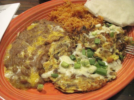 I have a delicious supper at Rosita's on Barstow's Main Street
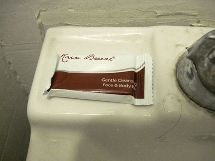 On my sink at the Route 66 Motel is a bar of "Rain Breeze" soap
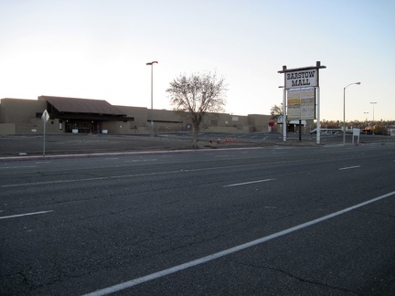 I remember passing the dead Barstow Mall at the beginning of this trip; I'm still intrigued by it
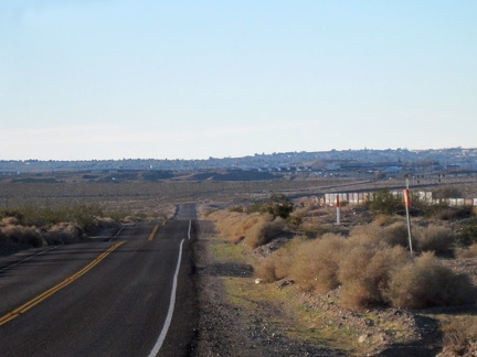 After my side trip into historic Daggett, I get back on Route 66 and head toward the I-40 freeway and tonight's motel in Barstow
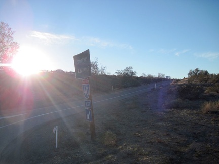 While riding the I-40 freeway past the military base on the way back to Barstow, my GPS mysteriously crashes
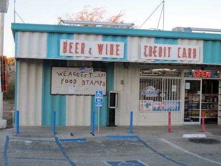 Off the freeway after a couple of miles, I know I've landed in central Barstow when I pass a liquor store
 Before leaving Daggett, I stop at a forlorn park bench to change the batteries in my GPS
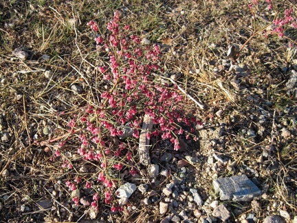 I've seen several of these low-growing pink-budded plants during this trip
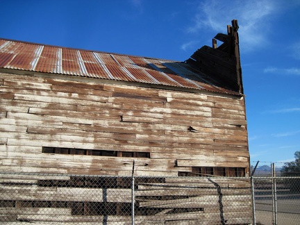 The siding of the old wooden building is peeling away as the structure sags
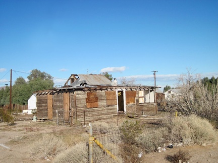 Daggett's old town is an interesting place with many modest older houses
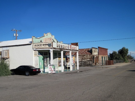 A small grocery store is the dominant living feature on Daggett's main street
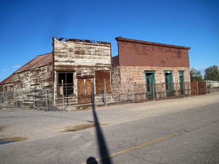 These two old commercial buildings in Daggett have been fenced off, perhaps with the hope of preserving them
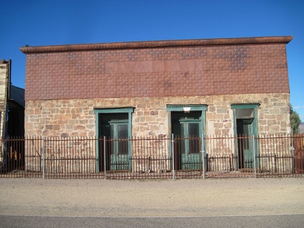 Nice antique tin paneling above the stone wall on the façade of the Daggett Stone Hotel
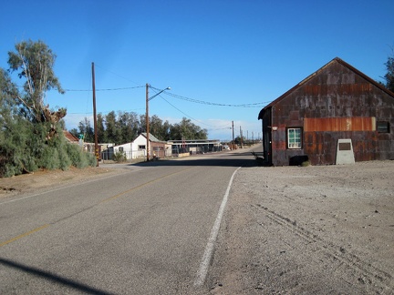 An old metal-clad garage-type building sits just down the street from the Daggett Stone Hotel
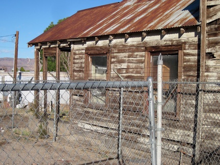 At the rear of the old wooden building is an addition that looks like residential quarters
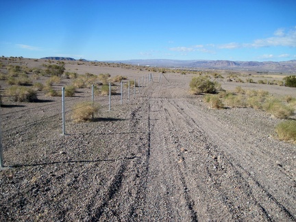 I return to the 10-ton bike and coast down the gravel road past a recently built fence
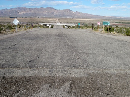 I make it back to the pavement of Hidden Springs Road and roll happily down the hill under the I-40 freeway toward old Route 66
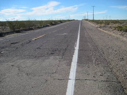 The headwind is so strong as I ride Route 66 that I can barely maintain 7 miles per hour
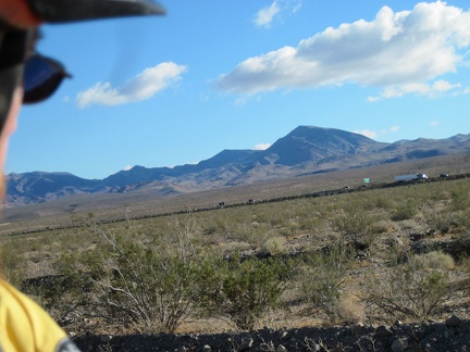 I stop several times along this stretch of Route 66 to take short breaks from the headwind and look to the Newberry Mountains
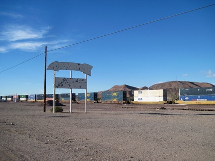 As I arrive in the area of the town of Daggett, I pass an old sign for a defunct service station
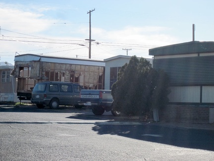 While passing a trailer park along Route 66 near Daggett, my eyes notice an unusual mobile home
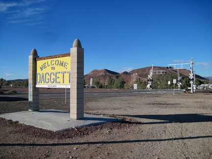 I reach the official "Welcome to Daggett" sign and decide to pull in for a quick tour of the small, historic town
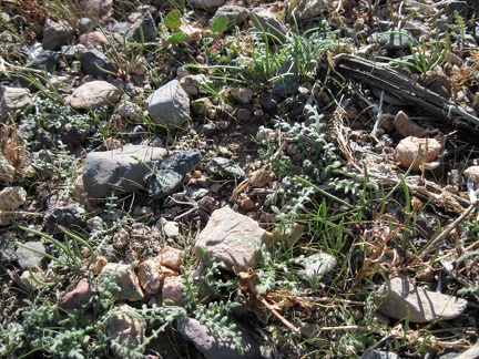 The Mojave Desert is a dry place, but I see a lot of green sprouts, happier than me about last night's rain storm
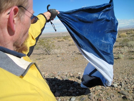 While packing up, the tent wants to be a kite; I discover that one of my tent poles has been bent by the wind
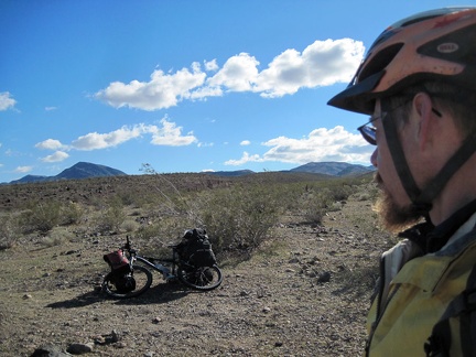 OK, I'm leaving my Newberry Mountains campsite, but maybe I shouldn't wimp out like this
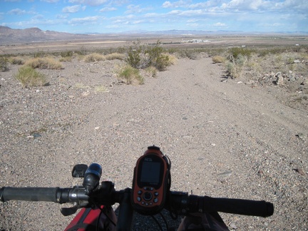 I start riding down the Newberry Mountains wash road that I came up last night
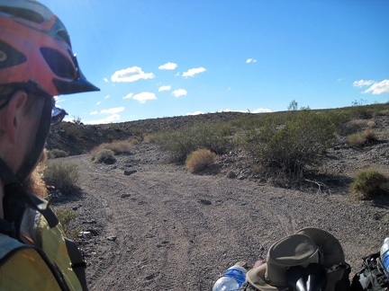 It's a winding, gravelly road; no wonder I had to walk the 10-ton bike up this hill last night in the dark
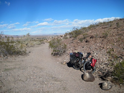 On my way down this Newberry Mountains wash, I stop at a joining side wash that I saw last night on the way here
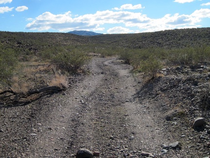 Hmm... If I had camped along this road in the Newberry Mountains foothills, I would have been more sheltered from the wind
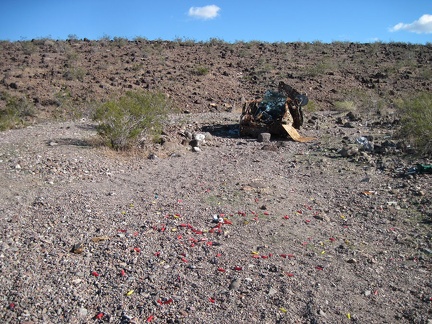 This little wash road in the Newberry Mountains foothills seems to end at the carcass of an old car used for target practice
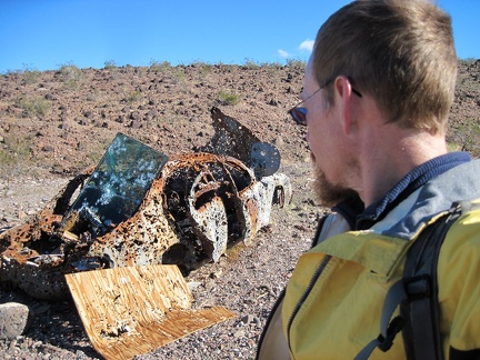 Wow, this must be the most shot-up thing I've ever come across!
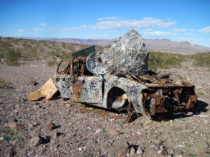 If there were ever a quintessential metaphor for the Amercian desert, this is it
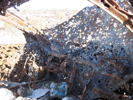 Apparently, this old car was once burned; the steering wheel looks quite melted and limp
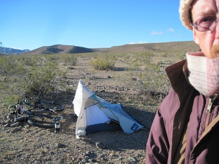 This desert wind storm seems to be getting a kick out of playing with my flexible tent, just to see what shapes it can make
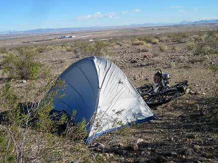 I've been up for an hour and a half now, and spent much of that pacing around outside, hoping that the wind will die down a bit
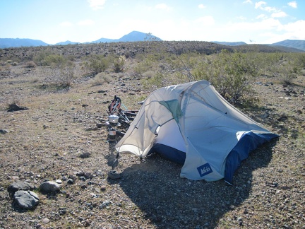 Coffee time, I hope: I try heating some water and shelter the burner a little by placing it behind the tent
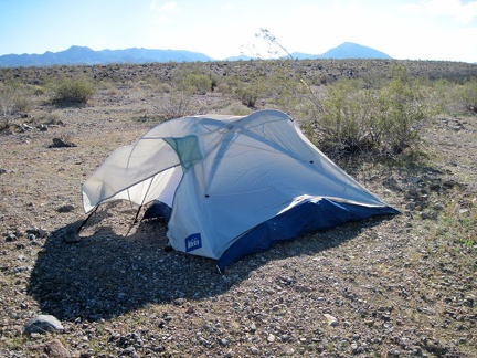 The problem now is that if the tent does fail and blow over, it will surely land on the flame of my propane burner
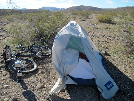 Every time I think the wind is lessening, and that the day will progress nicely after all, another big gust pummels my tent
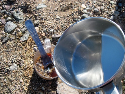 After more than 30 minutes, my lukewarm water makes a good cup of Starbuck's instant coffee, the only instant I find acceptable
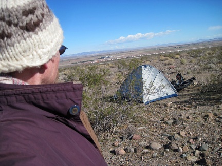 I stand in the wind on the Newberry Mountains foothills, thinking (wishing) that the wind is dropping to an acceptable level
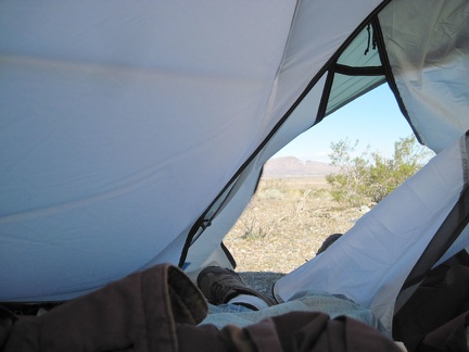 I retreat to the tent and consider packing up and skipping today's Newberry Mountains hike as the tent walls blow down at me
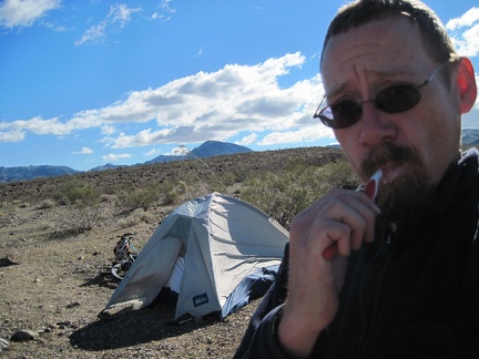 I hate my decision: I'm going to pack up and cancel my hike into the Newberry Mountains, even though I'm camped at my trailhead
 Last night's wind storm, which is still alive, blew a dusting of sand into my tent overnight, and kept me from sleeping well
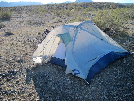 I step outside to take care of morning business and it's just as windy as I thought here in the Newberry Mountains foothills
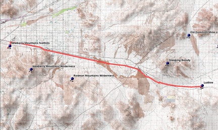 Route 66 Newberry Mountains bicycle route
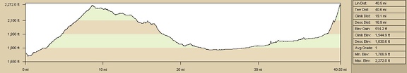 Elevation profile of Route 66 Newberry Mountains bicycle route
 In darkness, I head up the dirt road about a mile, set up camp, then an unexpected rain and wind storm descends upon me
 Westward on Route 66 I go, crossing under the I-40 freeway and leaving Newberry Springs
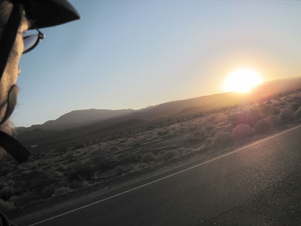 Another Route 66 sunset as I ride west from Newberry Spring
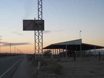 I ride by the California Agricultural Inspection Station, closed in 1967, which I passed on the first day of this trip
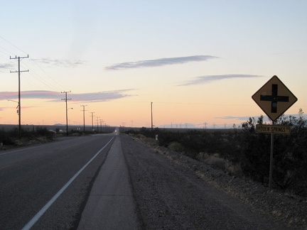 Finally, I arrive at my exit from Route 66, Hidden Springs Road, and turn left
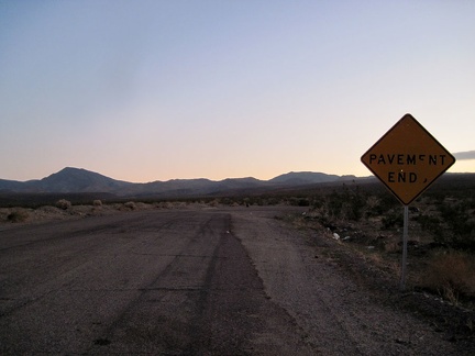 I look for the dirt road to follow after pavement ends at the foot of the Newberry Mountains, a short distance from the freeway
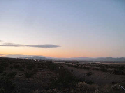 Hmmm.... The city lights of Barstow are not so far away as I start my way up the road into the Newberry Mountains foothills
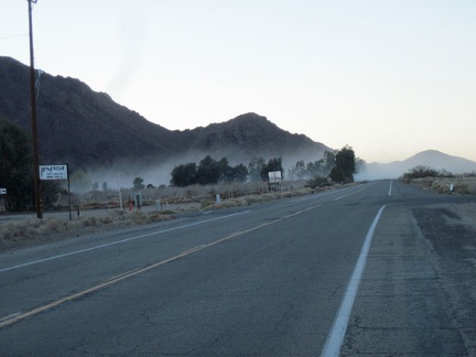 I ride through another dirt-bike dust cloud as I head west on the way out of Newberry Springs
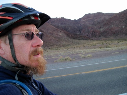 The Newberry Mountains briefly come right up to old Route 66 along here
 Bagdad Café: business cards, welcome signs (bienvenue) and personal messages everywhere, le tout en français
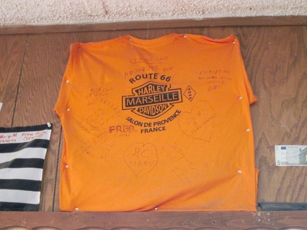 Bagdad Café: a French Harley shirt, mounted high on a wall
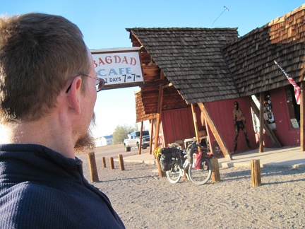 I figure I might as well stop in at the famous Bagdad Café since I'm passing by
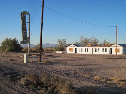 I take a quick glance at the old Henning Motel next door to the Bagdad Café as I get back on the road
 Bagdad Café: I'm hungry (again), so I order a plate of scrambled eggs and bacon
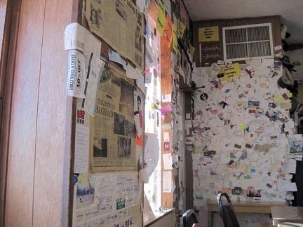 Bagdad Café: I begin to notice that most of the business cards and other paraphenalia on the walls are from France
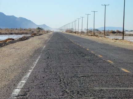 First, I think I'll ride the couple of remaining miles into Newberry Springs and refill my water supply
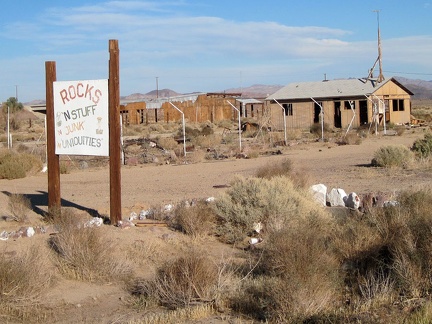 Here's another old business on Newberry Springs' Route 66 that didn't make it: "Rocks 'n' Stuff"
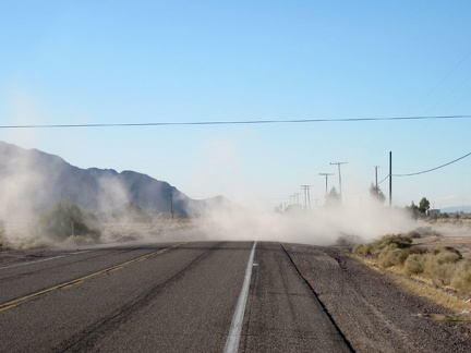 Newberry Springs: dirt-bikers paradise!
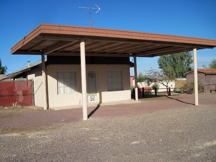 This old property on Route 66 in Newberry Springs is nicely maintained
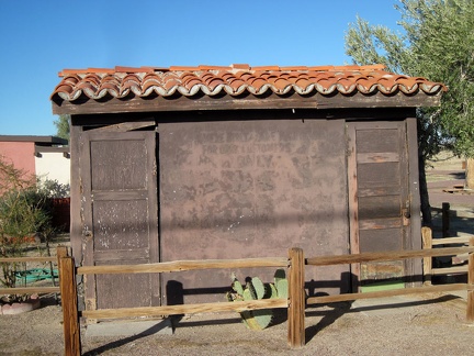 Old public toilets on Route 66, Newberry Springs
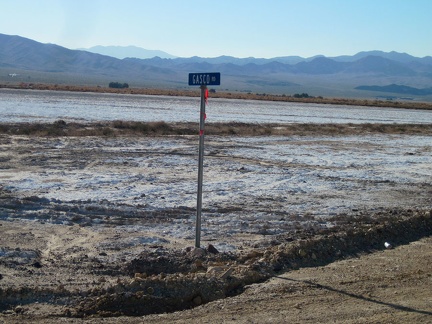 I stop to take a look at Gasco Road, which cuts across the salt pan on its way up to the Rodman Mountains Wilderness Area
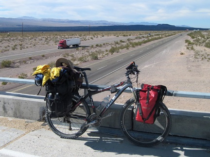 Old Route 66 makes a couple of 90-degree turns in order to cross the I-40 freeway
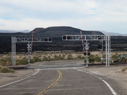 As old Route 66 crosses the tracks just after an I-40 overpass, I'm briefly facing Pisgah Crater
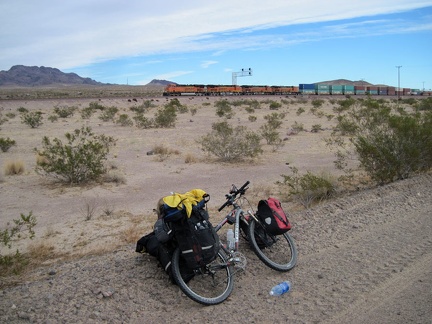 Not long after I cross the tracks, another one of those endless freight trains passes by
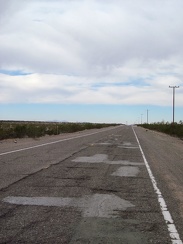 I'm on that rough part of old Route 66 again between Newberry Springs and Pisgah siding
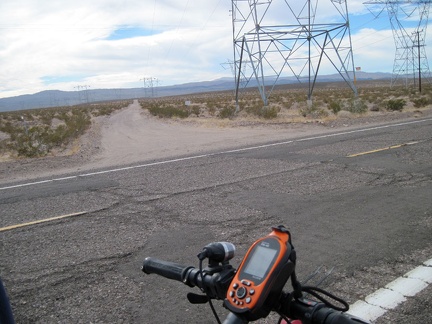 I cross the powerline road that cuts through the Cady Mountains just a few miles north of my campsite at Broadwell Dry Lake
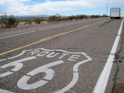 Now that I'm getting closer to the town of Newberry Springs, I'm starting to see a few more cars on this part of old Route 66
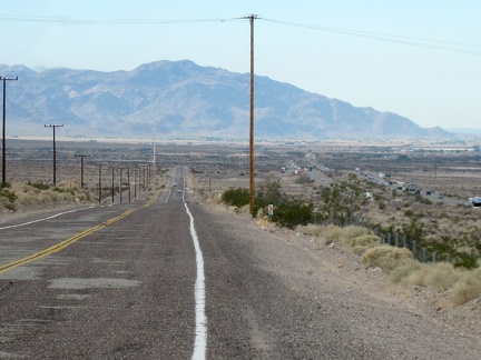 I begin the slight downhill on old Route 66 into the town of Newberry Springs, with the Newberry Mountains in the background
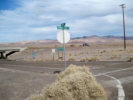 Hector Road here provides an opportunity for cars to get off old Route 66 here and get back on the freeway
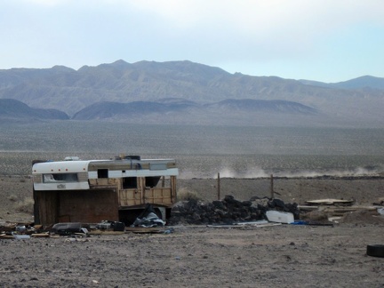 This abandoned property at the east end of Newberry Springs has a commanding view of the Rodman Mountains in the background
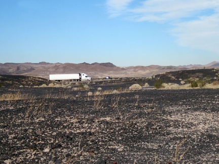 East of Newberry Springs, the freeway is really close to old Route 66
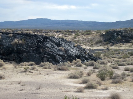 This lava outcrop along old Route 66 glistens in front of its Rodman Mountains Wilderness Area background
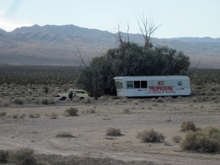 Perhaps the biggest no-trespassing sign I've seen on this trip, just east of Newberry Springs
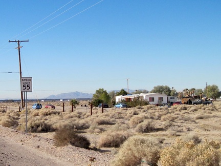 Now that I'm closer to town (Newberry Springs), I'm starting to pass more properties that are occupied
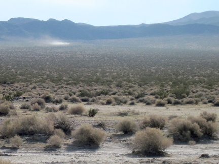 I see another motor-created dust cloud traversing the desert in front of the Rodman Mountains Wilderness Area
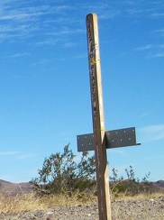 After almost six miles, I notice a little sign for "Sleeping Beauty Road"
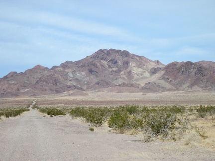 I stop at Sleeping Beauty Road for a very short break; it occurs to me that I could ride up this road and do a nice hike
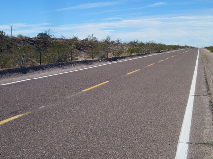 I'm out of my motel room by 10h30 and start my way up the first 8-mile segment of Route 66 toward Barstow from Ludlow
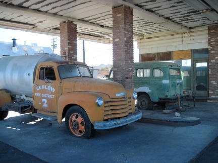 The two antique vehicles are protected from sun and rain under the old gas-station canopy
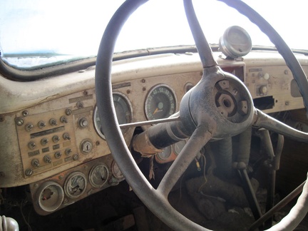 Interesting switches on the dashboard panel of the old van
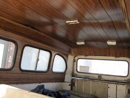 Faux wood paneling in the back of the old van, sagging a little
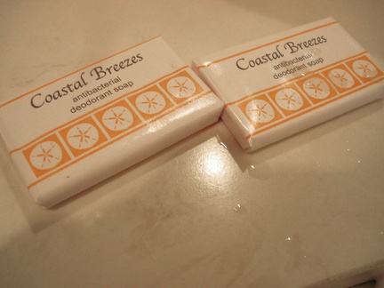 Ludlow Motel, in the heart of the Mojave Desert, has soap in the bathrooms called "Coastal Breezes"
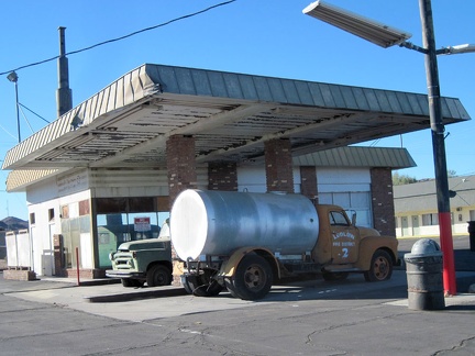 Between the Ludlow Café and the Ludlow Motel rests a former gas station, decorated with a couple of old vehicles
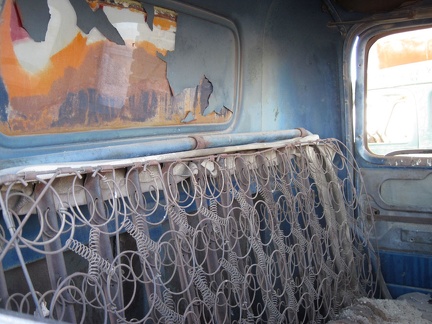 Please, have a seat
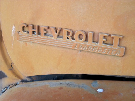 Loadmaster
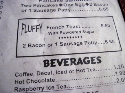 I slept so well last night here at the Ludlow Motel: the breakfast menu in my room invites me over to the café for FLUFFY
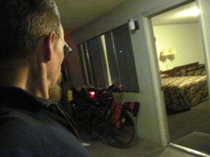 I decide to spend another night at the Ludlow Motel to catch up on some needed sleep and avoid the cold
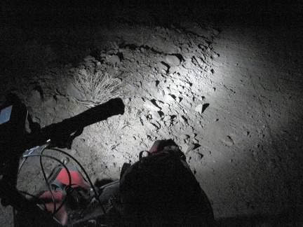 The sun has gone down for the last mile or so of the trudge up to Ludlow
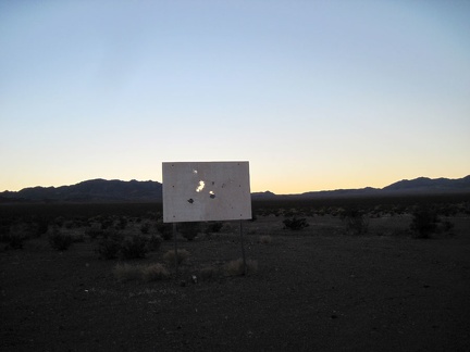 What could this old sign be out here in the middle of nowhere by Broadwell Dry Lake?
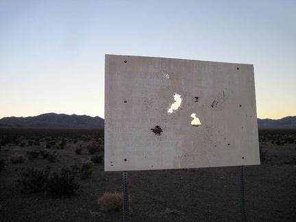 Ha! This old sign announces a former proposal (from the 1990s) to place a toxic-waste site here at Broadwell Dry Lake
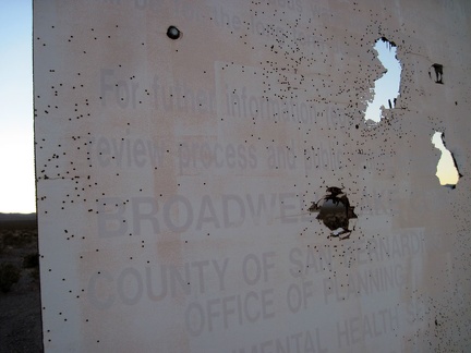 For further information on the review process for the proposed hazardous-waste site at Broadwell Dry Lake...
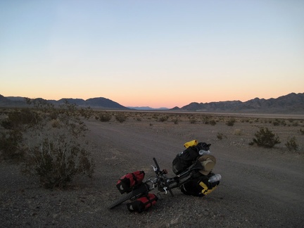 Relieved that I don't have to pass a toxic-waste dump here, I get back on the 10-ton bike and pedal onward toward Ludlow
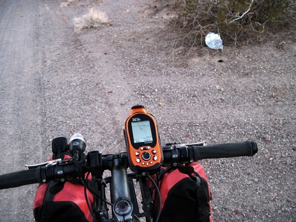 Oh, another stray balloon to collect for disposal!
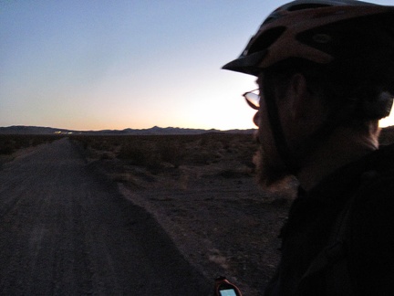 These last few miles up the gravelly slight incline toward Ludlow are slow, but I'm enjoying it
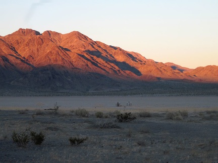 I see some pipes sticking out of the surface of nearby Broadwell Dry Lake, but I don't stop to investigate
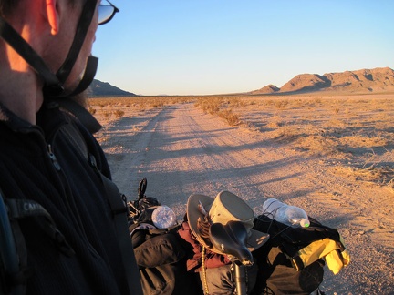 Back down on "the main road," I look north on Crucero Road near Broadwell Dry Lake
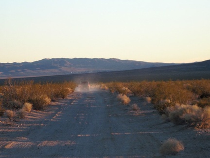 I pull over to allow a car to pass by, the first one I've encountered down here by Broadwell Dry Lake
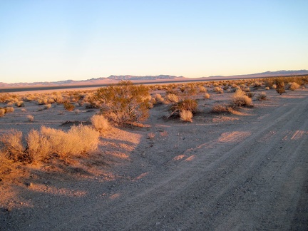 I watch the sun go down on the Bristol Mountains while I ride alongside Broadwell Dry Lake
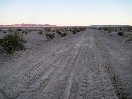 This stretch of Crucero Road looks like it gets mighty muddy during rainy times
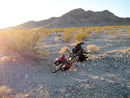 It's almost 16h and I'm just now starting today's bicycle ride out of Broadwell Dry Lake?
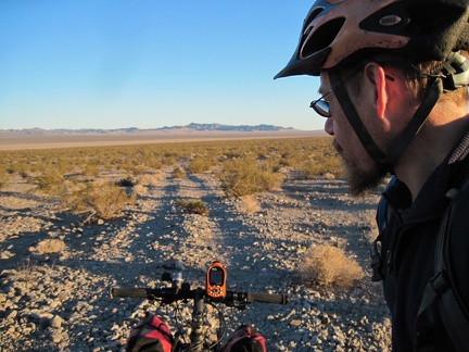 We're ready to ride the half mile down from the Old Dominion Mine area to Crucero Road
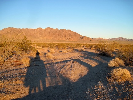 I ride down the faint road from the Old Dominion Mine site at sunset
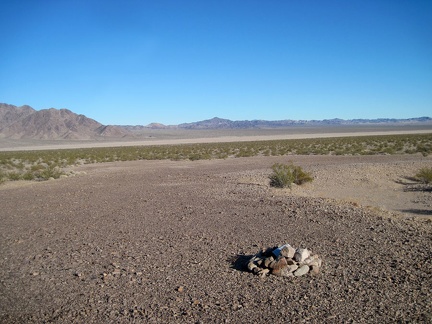 I decide that it might be best to turn back since there were no gunshot sounds until I reached this area