Home 7119

 I'm really enjoying walking through this area here behind Lobo Point on the Barber Mountain Loop Trail in a little hidden valley
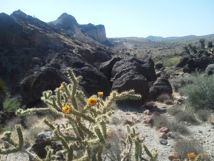 The Barber Mountain Loop Trail rises up a short, steep hill overlooking the hidden valley
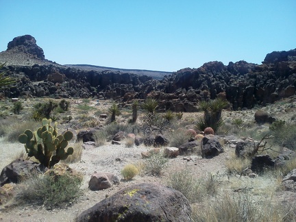 I decide to try hiking the adjacent Barber Mountain Loop Trail, or at least part of it, since I'm here
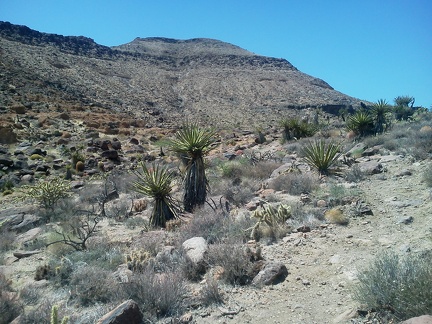 The Barber Mountain Loop Trail climbs slowly from the Rings Trail summit
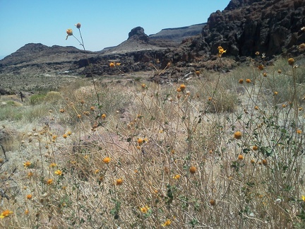 With so few flowers in bloom, I'm happy to find a few Encelias (brittlebrush) flowering on the Barber Mountain Loop Trail
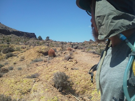 A short stretch of the Barber Peak Loop Trail crosses a noteworthy patch of yellow lichen on pinkish rock
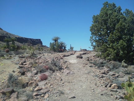 I pass a nice juniper tree as I approach the crest of this segment of the Barber Peak Loop Trail
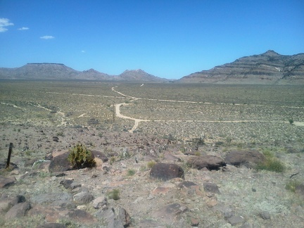 This spot on the Barber Peak Loop Trail is just high enough for me to see all the way across Gold Valley toward my camp
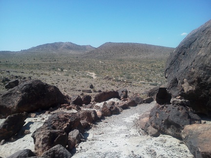 Barber Peak Loop Trail winds around some rocks, and I'm now looking at the Gold Valley hills that I rode across a few days ago
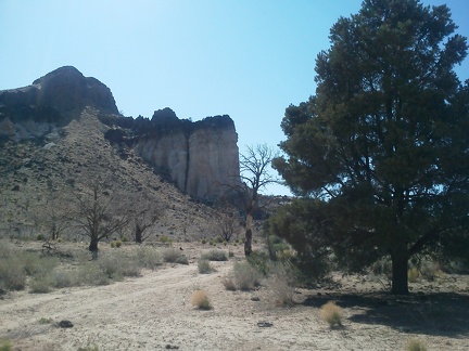
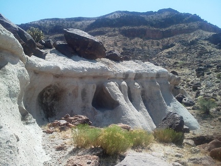 Perhaps the most interesting feature of the Barber Mountain Loop Trail is this eroded rock hotel
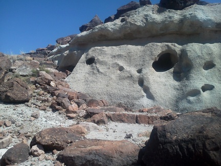 A nice rock staircase, part of the Barber Peak Loop Trail, hugs the left side of the rock hotel here
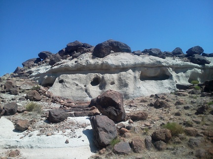 I take a peak through some of the windows, but find the hotel has no interior, as expected
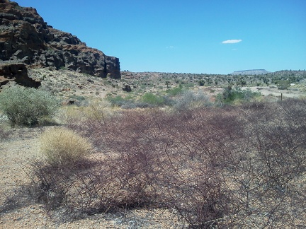 I notice a big patch of those pink dry buckwheats that I see here and there in the Mojave Desert, near the top of Rings Trail
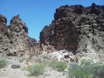 It looks like the Rings Trail is going to lead me into that slot in the rocks
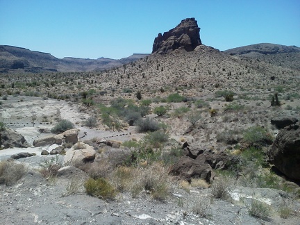 As the Rings Trail approaches a slot in Banshee Canyon, it's nice to look back
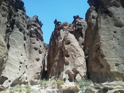 Is that the slot where the Rings Trail is leading?
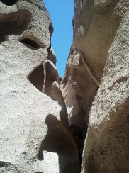 Ah... there are those famed rings I've heard of: the Rings Trail is now headed upward!
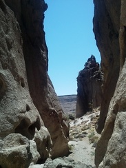 As I start climbing the rings, I take a look back at a rock turret behind me
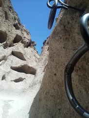 Climbing up the rings on the Rings Trail
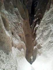 At the top of the short climb up the rings on the Rings Trail, I take a look back down
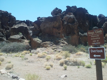 At the top of the Rings Trail, I encounter the sign warning that it's a potentially strenous climb for some folks
 I walk over to "The Overlook" at the top of the Rings Trail to see what it is that the sign points toward
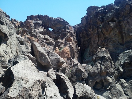 Oh, there's an eye, a tiny natural arch in the bubbly rock here near the top of the Rings Trail, Mojave National Preserve
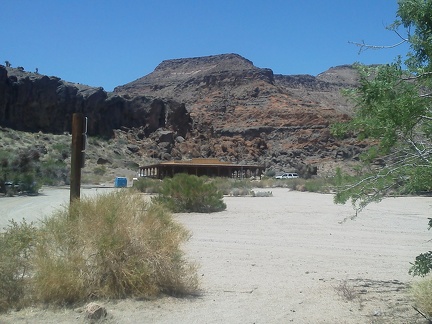 As I start down the Rings Trail, I take a look back at the Hole-in-the-Wall Visitor Centre, where I've locked my bicycle
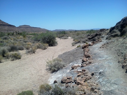 The Rings Trail starts out following a wash, and I can see down beyond the Woods Mountains where I rode my bike yesterday
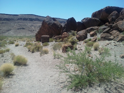 Rings Trail curves and I'm now staring straight ahead at Wild Horse Mesa
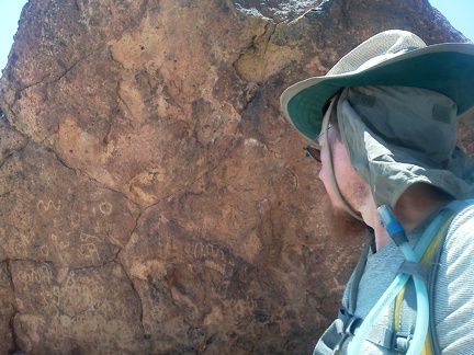 If you don't pay attention, you might miss these little beauties as you walk past!
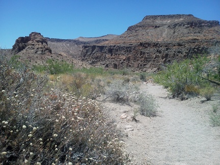 Rings Trail, Mojave National Preserve: buckwheats blooming
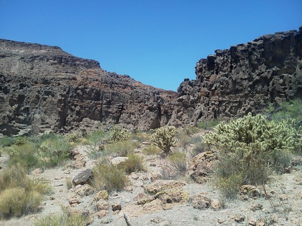 Rings Trail moves straight ahead toward those hot bubbly rocks
 After breakfast, I ride the 5.5 miles over to Hole-in-the-Wall Visitor Centre to do the Rings Trail hike
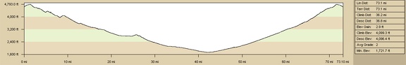 Elevation profile of round-trip mountain-bike ride from Woods Wash, Mojave National Preserve, to Fenner and Essex, CA
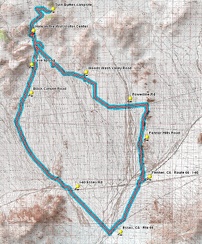 Route of round-trip mountain-bike ride from Woods Wash, Mojave National Preserve, to Fenner and Essex, CA: Day 10
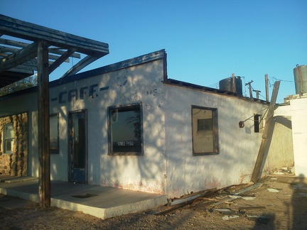 According to the windows at the old Essex Café on Route 66, 'good food' was served here
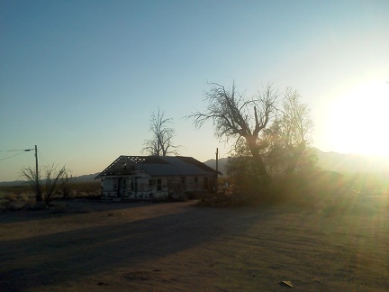 Across the road from the old Essex Café, an abandoned house awaits something
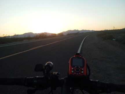 After my brief visit to Route 66 Essex, CA, it's time to begin the long ride back to camp, beginning with Essex Road
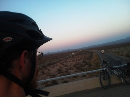 It's fun to stop and watch I-40 freeway traffic for a few minutes while crossing over it on Essex Road on the way back to camp
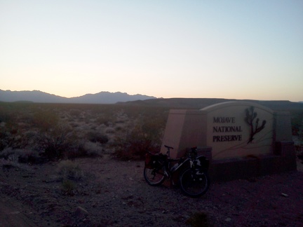 I reenter Mojave National Preseve at dusk, and ride most of the final 20-some miles back to camp in the dark: a pleasant evening
 A few Desert milkweeds pick up the sun along old Route 66 as I get close to Essex, CA
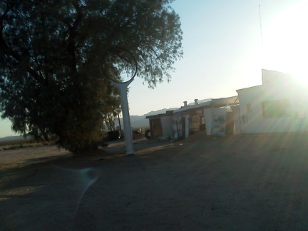 On the outskirts of Essex, CA, I stop to check out an old abandoned gas station and its empty sign
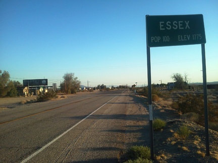 Arriving Essex, California, Route 66, by bicycle
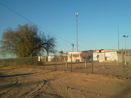 Essex, California has a school
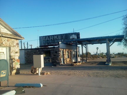 The 'core' of Essex, CA is the old post office house at left and the abandoned café straight ahead
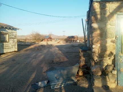 Behind the Essex post office and the abandoned café is a short street leading to a couple of houses
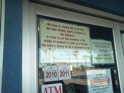 Gotta love this weird sign in the door at the Fenner store just off I-40 and on old Route 66
 I take a good half-hour break in the shade of the Fenner store, drinking a couple of bottles of Sobe orange-carrot drink
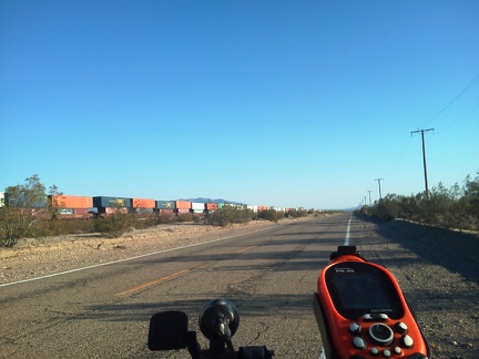 After my refreshment break at the Fenner store, I'm ready to ride on; I ride under the I-40 freeway and down old Route 66
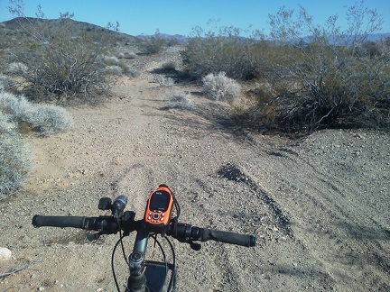 It seems that riding down Fenner Hills Road is getting slower and slower, even though I'm riding mostly slightly downhill
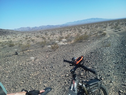 Aha, I can now see trains down there rolling past Fenner by old Route 66, with the Piute Mountains Wilderness in the background
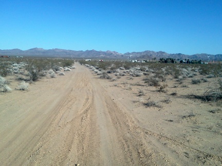 I'll be at Fenner shortly; I definitely need a break and I want some COLD water
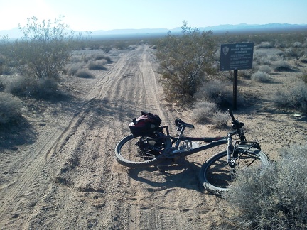 34 miles into today's ride, just before arriving at Fenner, I exit Mojave National Preserve for a while
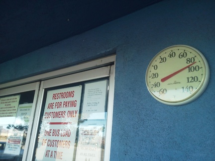 I arrive at the store at Fenner, CA and the outdoor thermometer reads 89F in the shade; no wonder I'm hot and thirsty!
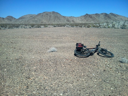 Fenner Hills Road crosses a wide gravelly area thst was apparently once cleared of vegetation
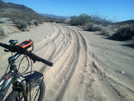 Ugh, Fenner Hills Road passes through a couple of sandy stretches where I can barely ride my bike.
 Out of the last sand-trap on Fenner Hills Road, the road briefly crosses a gravelly area, then returns to a soft earth surface
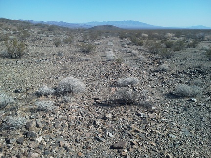 Occasionally, Fenner Hills Road almost fades away, in the gravelly stretches
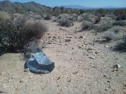 Just before I leave the powerline road for Fenner Hills Road, I spot yet another balloon, near the one I just saw
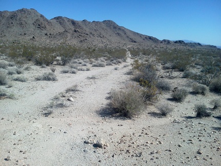 After about 25 miles so far today, I get excited as I start riding the almost 9 miles down Fenner Hills Road toward Fenner
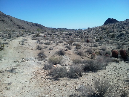 After a few miles, the rough Fenner Hills Road passes by a small hill on the right
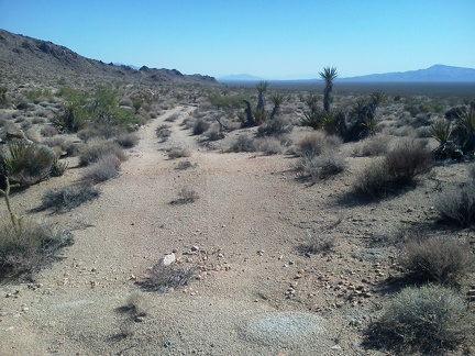 On some parts of Fenner Hills Road, rocks provide the surface for short stretches
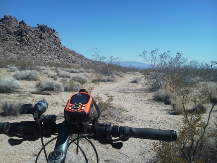 Some stretches of Fenner Hills Road are just a weak track through creosote-bush scrub
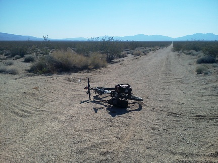 My Fenner Hills Road route crosses the (gas) pipeline road, both roads lightly traveled
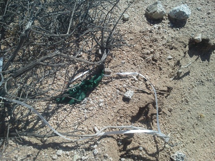 Just before I leave the powerline road for Fenner Hills Road, I spot the remains of a balloon
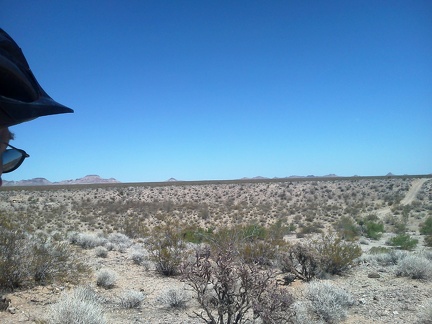 As the road crosses Watson Wash ahead, I run across a rancher in a pick-up truck on the way up that hill over there
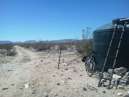 I pause to shoot photos at another water stop along the route, more cow shit everywhere of course!
 The road quickly gets better and I pass another functional corral just before I arrive at the powerline road
 I go for a short ride up a side road, wondering where it leads, and it ends near a guzzler, which is dry today
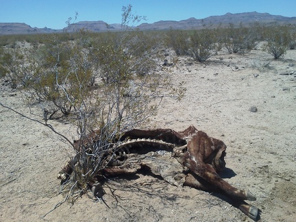 I'm intrigued by a cow carcass that I discover along the road
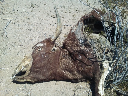 Smile for the camera!
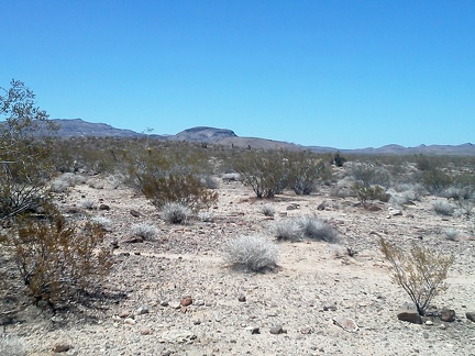 Ah, a view of Tortoise Shell Mountain in the Woods Mountains, where I hiked yesterday
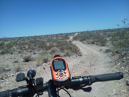 Woods Wash Valley Road continues through remote territory
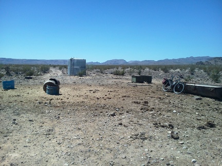 Cow shit everywhere, I'm getting used to the smell in the hot sun!
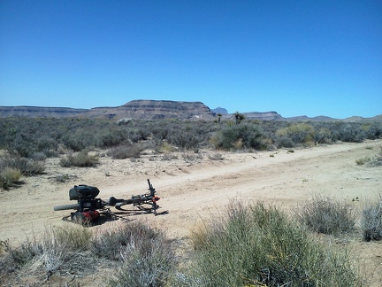 I leave camp before 10h and ride past the Woods Mountains, at first on the way to Hole-in-the-Wall Visitor Centre to get water
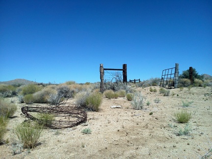 I pause briefly at the high point of Woods Wash Road to check out remnants of barbed-wire removal
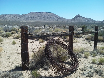 More remnants of barbed-wire removal along Woods Wash Road, with Table Mountain and one of the Twin Buttes in the background
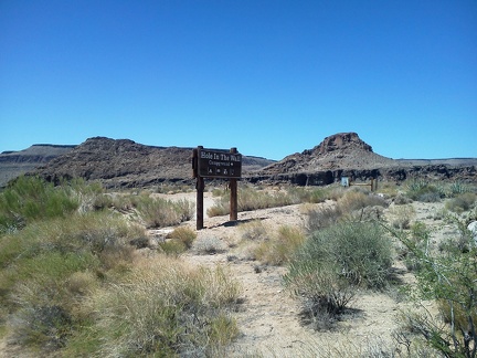 After 5 miles, I arrive at Hole-in-the-Wall Campground and go for a short ride, noting that it's nearly deserted today
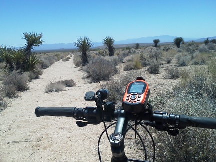 I try riding a half-mile down a really sandy road near Rustler Canyon, but it doesn't work out and I decide to backtrack
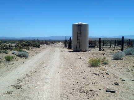 This better, unnamed road in the Woods Wash Valley is also rather sandy, but it is rideable
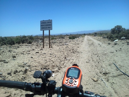 Cow shit everywhere here in the upper Woods Wash Valley; 4WD required, I only have two (but I do have two feet in addition)
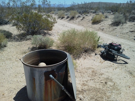 I notice a small water tank on the roadside and it's full of fresh, clean water
 Tortoise Shell Mountain hike elevation profile
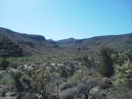 An hour later, I'm back down in the Woods Wash area
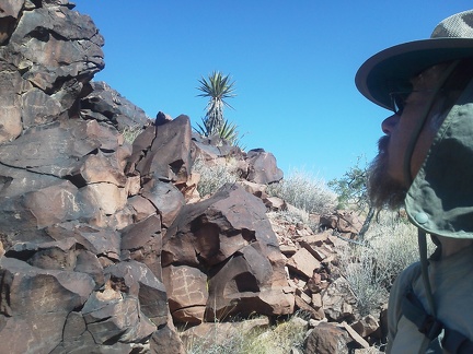 Scribbles
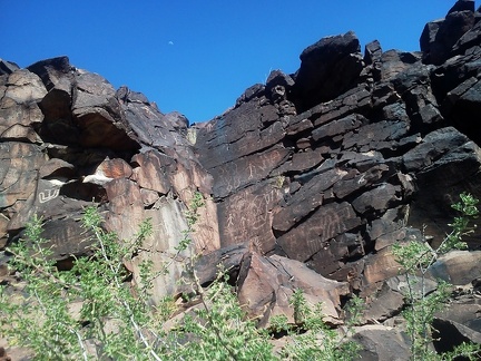 Crescent moon and etchings
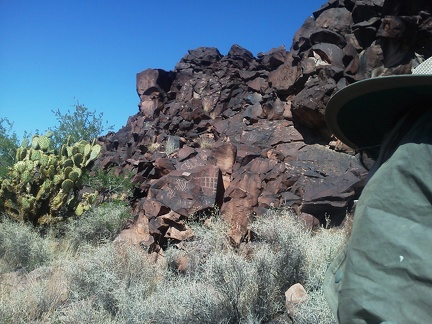 Chalkboard?
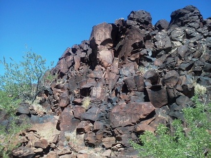 Most of this has been here for a long time...
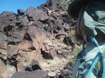 I could spend hours here looking at this stuff
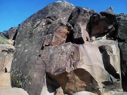 It looks like there has been some weather erosion on some of the designs here
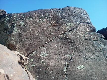 Some of these look carved deeply into the rock
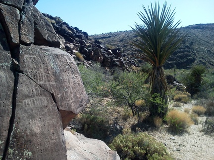 Yucca in Woods Wash, plus some bonus carvings
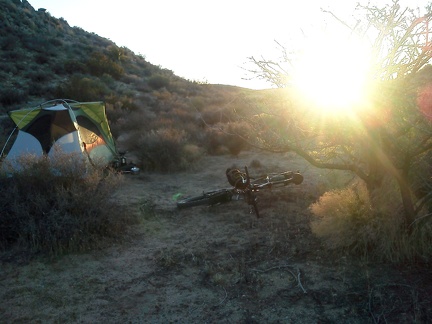 Sunset back home at the tent near Twin Buttes, I fix the broken rack piece on my bike (glad I brought extra parts!)
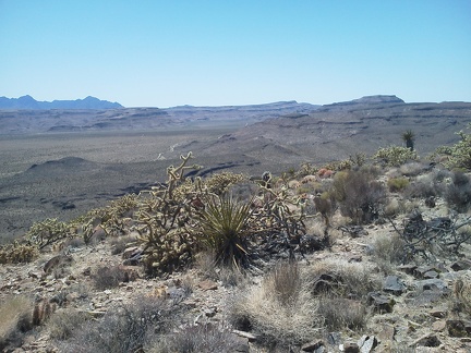 Sitting up on Tortoise Shell Mountain for half an hour, I enjoy views toward Wild Horse Mesa and the Providence Mountains
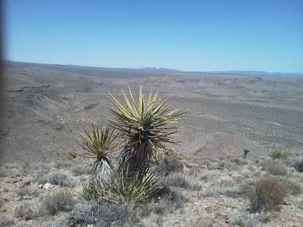 I also enjoy views across the Lanfair Valley while sitting up on Tortoise Shell Mountain
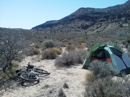 It got rather cold overnight, so I didn't sleep well, but as soon as the sun hit my tent this morning, it was intensely hot!
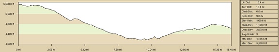 Elevation profile of bicycle route from Mid Hills Campground to Twin Buttes area
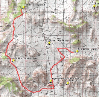 Bicycle route from Mid Hills Campground to Twin Buttes area
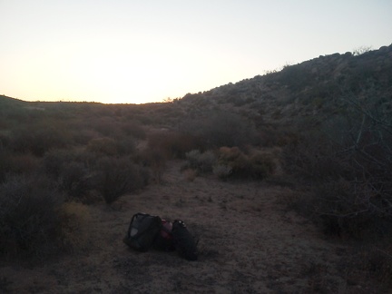 I walk around the area where my bike rack broke, looking for an open area for a good campsite, not too close to the road
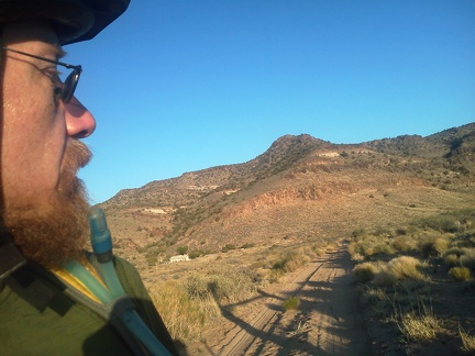 I'm excited to be heading up Woods Wash Rd toward my new campsite, though I don't know exactly where that is yet
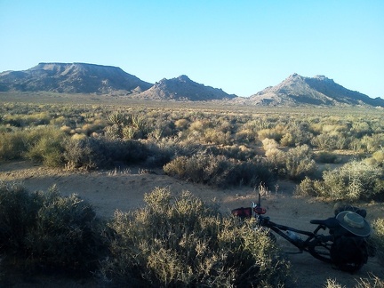 Table Mountain on the left, and Twin Buttes: a classic Mojave National Preserve view that I usually see from Black Canyon Road
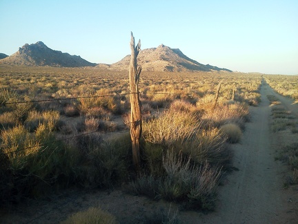 This stretch of Woods Wash Road follows an old range fence toward Twin Buttes, with old rough-hewn wood posts
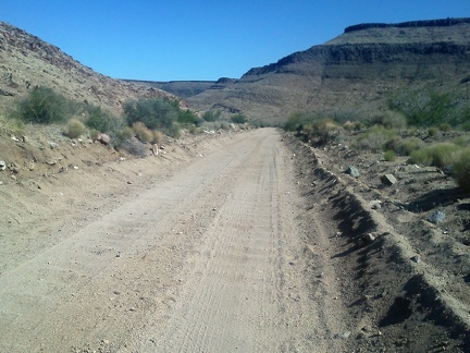 I ride the 10-ton bike slowly on the heavy washboard of this part of Wild Horse Canyon Road
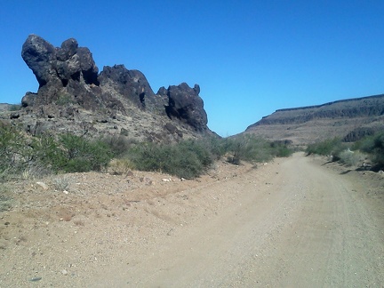 Cool rock formations abound on lower Wild Horse Canyon Road, Mojave National Preserve
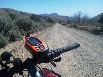 Wild Horse Canyon Road is all scenic, but I especially enjoy riding down this part with the Providence Mountains in the distance
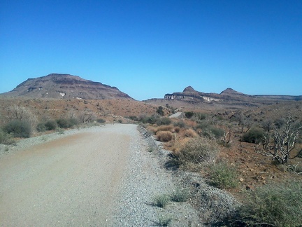 Wild Horse Canyon Road rolls along as it approaches the Barber Peaks area
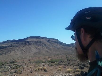 I reach a point where I have a view over to Bluejay Mine Road and Wild Horse Mesa above
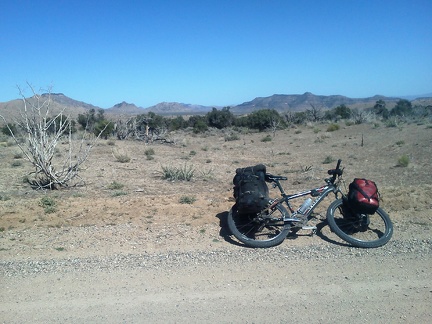 I finally leave: on my way out of Mid Hills Campground, I run into Ranger Greg, and we have a great chat
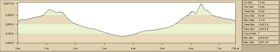 Black Diamond Spring hike from Barnett Mine, Mojave National Preserve
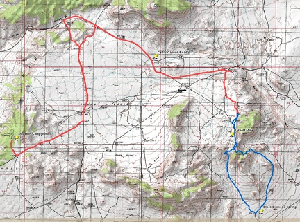 Route of Black Diamond Spring-Barnett Mine bike-hike from Mid HIlls campground
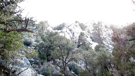 Hmmm, I'm not making as much progress climbing all these rocks as I would like
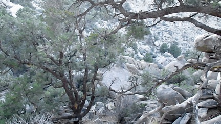 Up on the rock-pile hill, it seems that everything is steep going up and steep going down, with neither direction being best
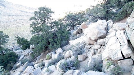 I consider climbing back down to the wash and trying a less rocky route up over the hill, but I might as well continue upward
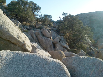 I need to climb up over that ridge to my right to get back to the Barnett Mine area
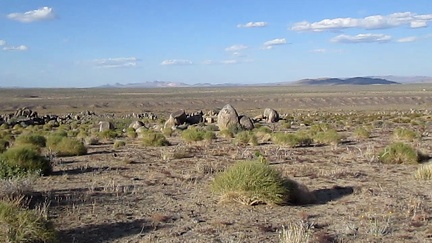 Nice views eastward across the Lanfair Valley as I reach the top of the fan above Watson Wash
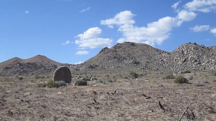 A couple of stray boulders sit on this part of Upper Black Diamond Spring Valley
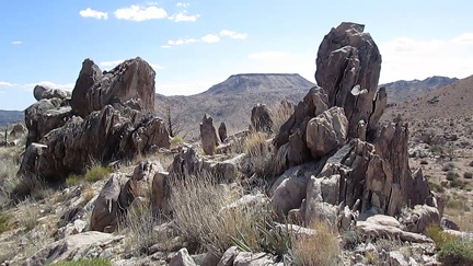 A row of vertical rocks outcrops above Barnett Mine frame a view of Table Mountain
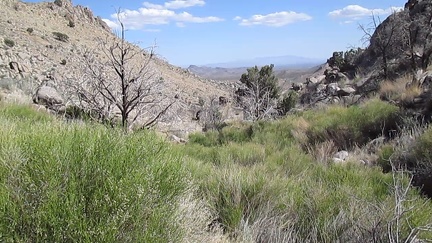 I walk down a rocky slope and join a brushy drainage that should lead to Black Diamond Spring
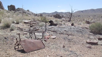 Have a seat and relax at the end of the Barnett Mine Road
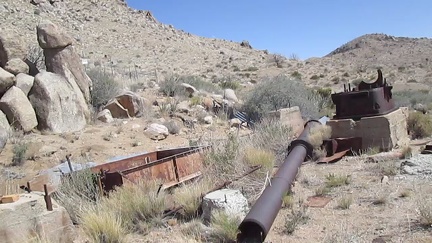 More mining remains at the Barnett Mine
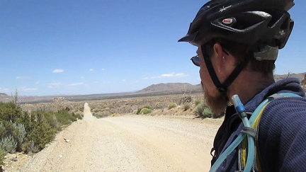 All rides out of Mid Hills Campground start with Wild Horse Canyon Road, and I always enjoy the descent into Round Valley
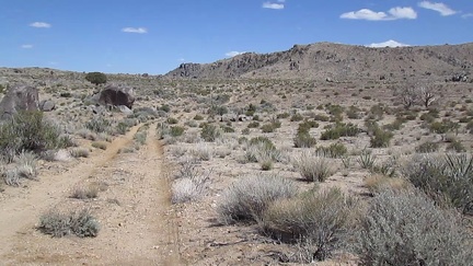 The road to the Barnett Mine area, about 1.5 miles long, is rough and slightly uphill
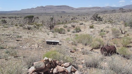 A bit of assorted debris is scattered around at the end of the Barnett Mine Road
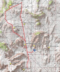 Gold Valley bicycle route
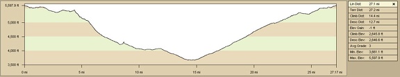 Elevation profile of Gold Valley bicycle ride
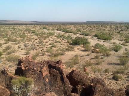 The views from here are excellent, and I can almost see down to the old Route 66 area from here
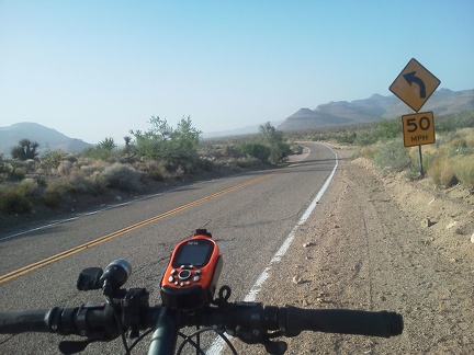 The 13-mile ride back to Mid Hills Campground up Black Canyon Road starts on pavement
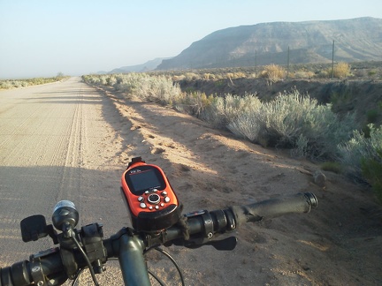 After about 3.5 miles, the pavement goes away; Black Canyon Road turns to dirt on the way back to Mid Hills Campground
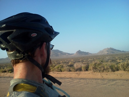 Twin Buttes and Table Mountain: I've ridden past them many times around sunset while camping at Mid Hills Campground
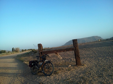 A motor vehicle pulls over while I'm taking photos by a big, old corral in the Gold Valley Ranch area: I meet Russ
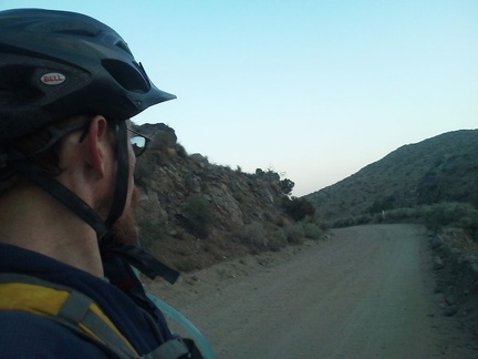 The sun starts to go down as Black Canyon Road winds its way through the pass
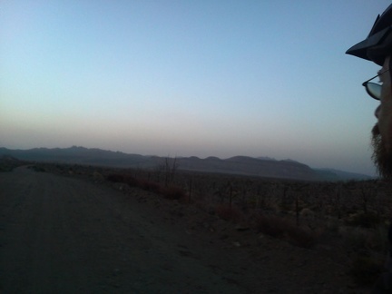 It gets dark just as I approach Wild Horse Canyon Road for the final couple of miles back up to Mid Hills Campground
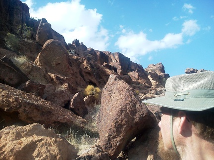 I climb up a couple of hills near Grass Canyon at a leisurely pace, with no specific goal in mind
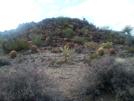 Lots of barrel cacti grow here in the hills near Rustler Canyon and Grass Canyon
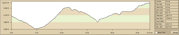 Bicycle route: Mail Spring to Mid Hills Campground via New York Mountains Road
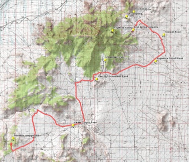 Bicycle route: Mail Spring to Mid Hills Campground via New York Mountains Road
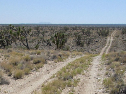 Way off in the distance, I can see flat-topped Table Mountain, which I'll pass later on the way to Mid Hills campground
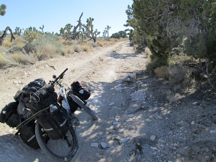 An hour goes by, and I'm still riding, and pushing, the bike up the Sagamore Cut-off Road
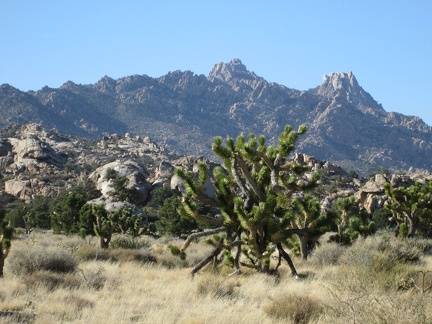 Postcard view of the New York Mountains while mountain-biking through the Carruthers Canyon area
 I make a quick stop along Ivanpah Road to climb up onto an old railway grade that is marked as a road on some maps
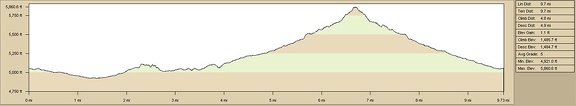 Elevation profile of hiking route: Mail Spring, Lecyr Spring and Keystone Spring, Mojave National Preserve
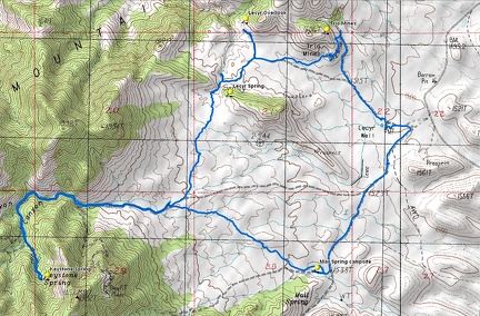 Hiking route: Mail Spring, Lecyr Spring and Keystone Spring, Mojave National Preserve
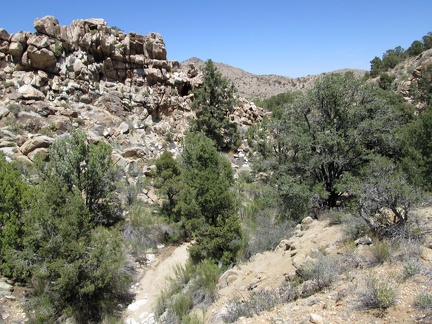 Despite today's hot weather in the 90s (F), the Lecyr Spring canyon looks rather green
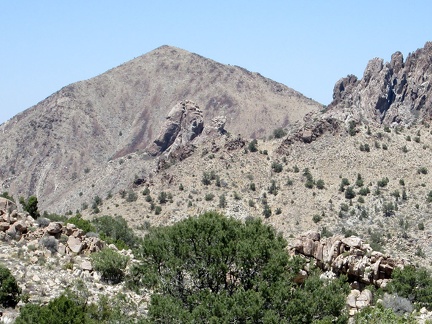 Lots of hiking possibilities on steep, scenic hillsides around Lecyr Spring
 While walking across the plain between Lecyr Spring and Keystone Canyon, I take a break under one of the big juniper trees
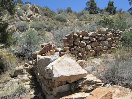 An old rock wall sits above Lecyr Spring
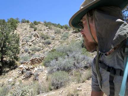 If you don't look closely while walking by, you might not even notice the old rock wall above Lecyr Spring
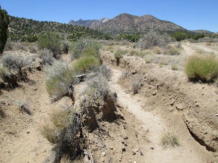 A former alignment of the old road has turned into a drainage gulley over the years, so a new road was built to the right of it
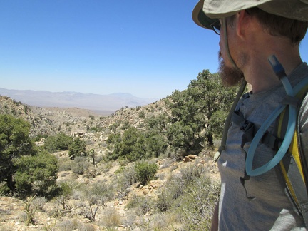 I arrive at a spot I'll call the Lecyr Overlook; my original plan was to hike down the canyon ahead
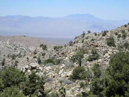 The views down Lecyr Canyon toward Ivanpah Valley are quite nice, with the Ivanpah and Clark Mountains in the background
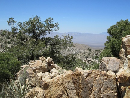 Pinon pines, low banana yuccas and junipers grow in this area overlooking the Ivanpah Valley
 I turn around to start my hike over to check out Lecyr Spring, and zoom in on the New York Mountains
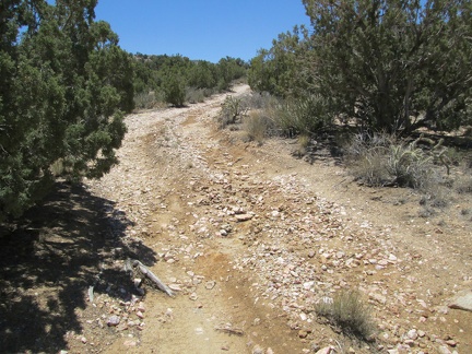 An old road rises slowly toward Lecyr Spring
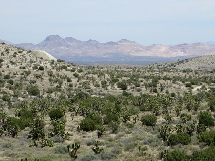 I'm just high enough now to have an expansive view across upper Lanfair Valley to the Castle Mountains
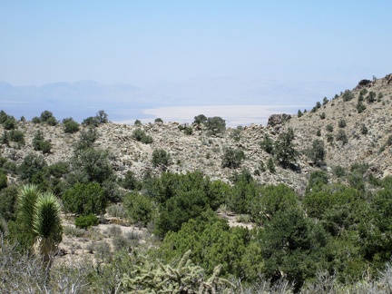 From here, I can also see beyond the hills to Ivanpah Dry Lake
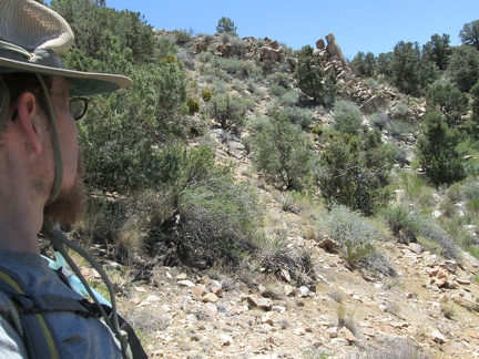 Lecyr Spring should be just down there in that little canyon
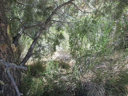 I push through a few baccharis bushes, enjoying the shade of a pinyon pine, on my way to Lecyr Spring
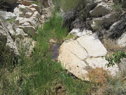 Lecyr Spring, Mojave National Preserve
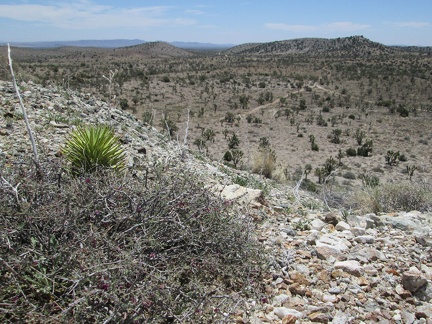 A few grey Range ratany bushes on the Trio Mine tailings pile still sport a few magenta flowers
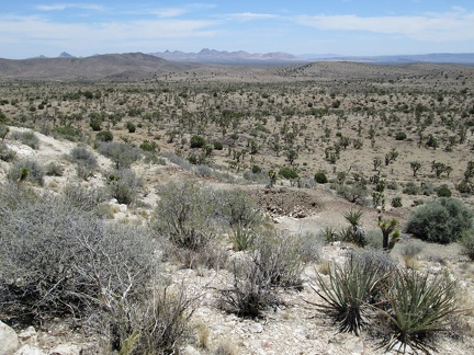 I climb up the hill a little further to get a better view of the main Trio Mine tailings pile
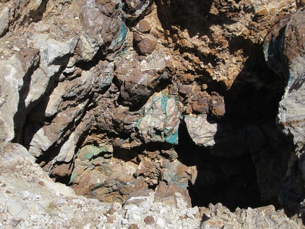 Turquoise veins in rock at Trio Mine, Mojave National Preserve: copper, presumably
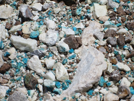 Turquoise-coloured bits in tailings at Trio Mine, Mojave National Preserve
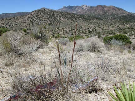 I start hiking down the hill from Trio Mine toward my next stop and come across an old balloon
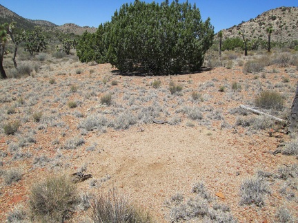 A barren patch of earth catches my interest as I walk past
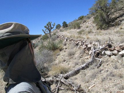 Here's the old road leading up to the main Trio Mine tailings pile
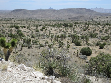 From the Trio Mine site, a look across the valley sees a few houses over on the other side of the valley
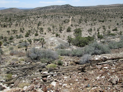 Some debris from a former building at Trio Mine tumbles down the hill
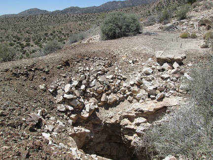 I take a look at one of the major shafts at the Trio Mine site
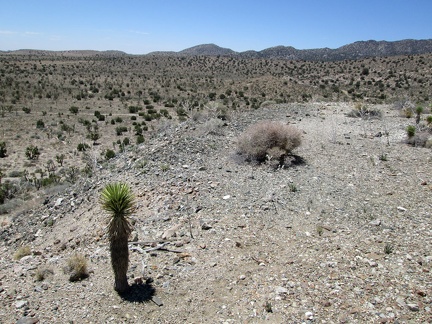 A few Joshua trees are starting to grow atop the tailings pile at Trio Mine
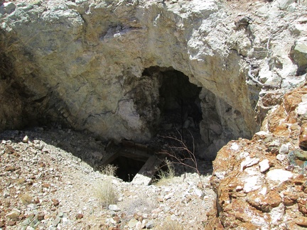 I take a peek at some excavations before walking over to the main Trio Mine area
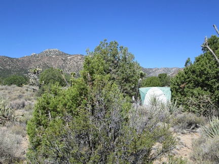 I leave the tent on today's Lecyr Spring and Keystone Spring hike before 10h30
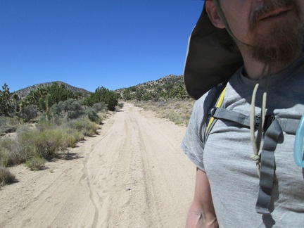 I start the hike by walking down Mail Spring Road, seeing the road that I rode two nights ago by headlight
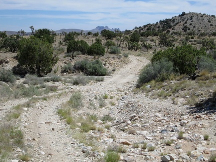 I think I remember pushing my bike up this little rocky hill a couple of nights ago, dazed in the dark
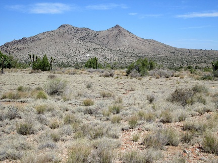 Straight ahead across the plain, halfway up the distant hill, is the old Trio Mine, today's first destination
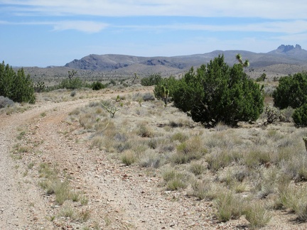 While walking down Mail Spring Road, I recall good memories of last year's hikes in the distant hills
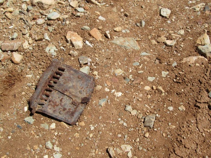 I walk past a rusty metal object on Mail Spring Road
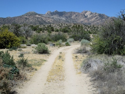 When I reach the road to Lecyr Spring, I turn and hike up that way, with the New York Mountains peaks in the background
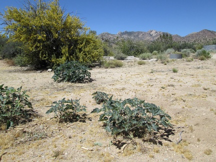 I arrive at the dry Lecyr Well site, with low-growing daturas in the foreground, Mojave National Preserve
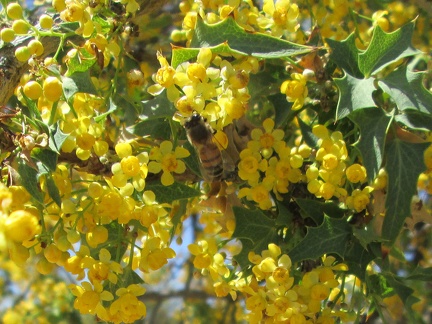 These flowering mahonia (berberis) bushes are noisy at this time of year, attracting lots of buzzing bees
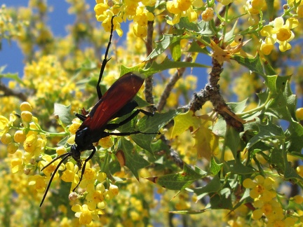 It's not just bees making noise: these mahonia (berberis) flowers also attract many large orange wasp-like insects
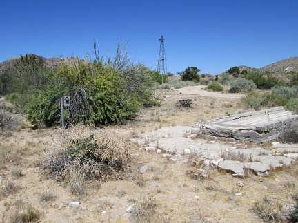 A windmill, a defunct wilderness camera and a dry cistern all sit at the old Lecyr Well site, Mojave National Preserve
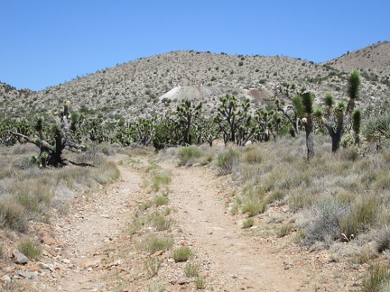 Next stop on today's hike is the old Trio Mine site
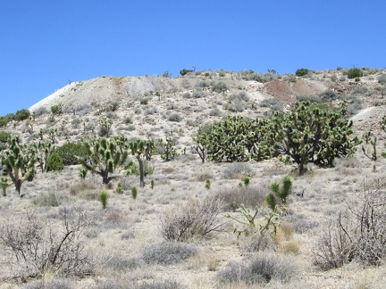 I get closer to the tailings pile at the old Trio Mine site
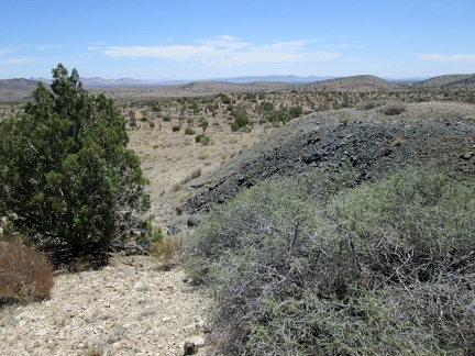 I follow an old road briefly beyond the Trio Mine site to another old tailings pile
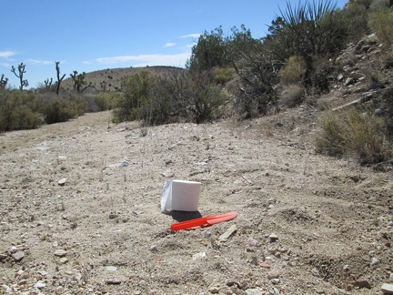 A good day of backcountry camping usually begins with a roll of toilet paper and a 'sanitation trowel'
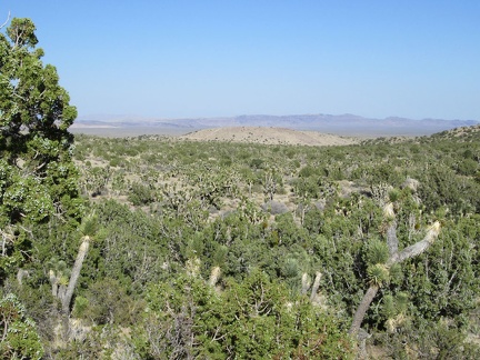 My tent is somewhere in the area in front of that low brown hill in the middleground
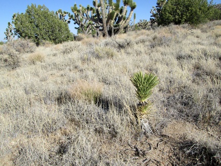 I pass this juvenile Joshua tree while hiking back to my tent near Mail Spring, Mojave National Preserve
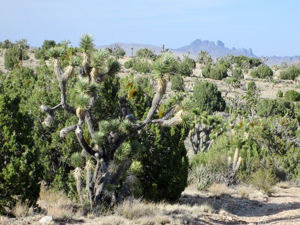 Beyond the Joshua trees and junipers, I have good views over to the Castle Peaks while hiking back to my tent near Mail Spring
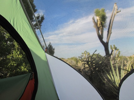 I arrive back at my tent before sundown and rest inside until the sun goes down and things cool off a bit
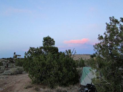 With sunset at Mail Spring comes a bit of relief from the day's heat, followed by thousands of stars in a moonless sky
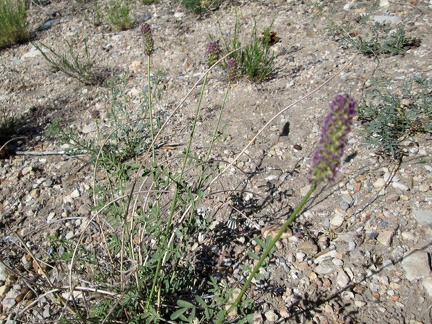 On my way back down Keystone Canyon, I pass a few expiring purple flowers that I've seen before, but can't identify
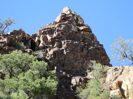 On the way back down Keystone Canyon, I pause to take a look at interesting staining on a rock-outcrop turret near the trail
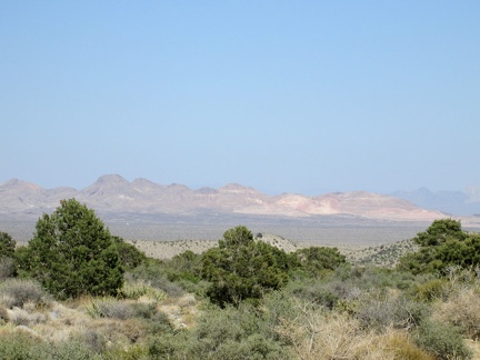 I'm hiking into spectacular views across Lanfair Valley to the Castle Mountains as I exit Keystone Canyon
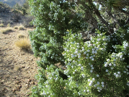 Juniper berries on the hike back to my tent near Mail Spring from Keystone Canyon
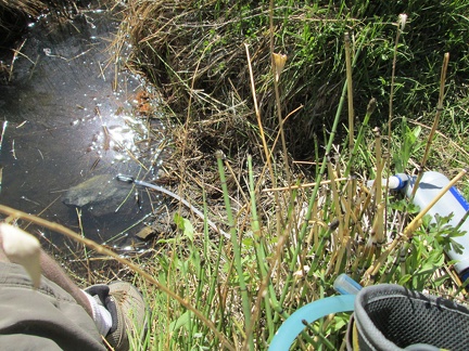 I get out my water filter and pump a few litres of water from Keystone Spring
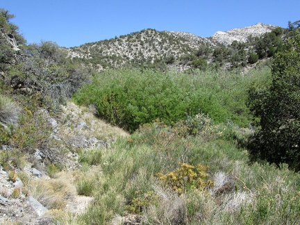 I encounter a dense thicket of willows, or Desert willows (chilopsis), so I climb up the hill a bit to detour around it
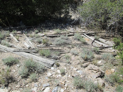 Another interesting find is what appears to be the remains of a small building
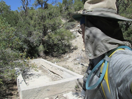 In Keystone Canyon, I come across an old cistern that I remember from when I was here in 2008
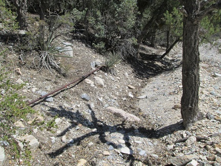 An old pipe leads up to Keystone Spring from the dead cistern that I just passed
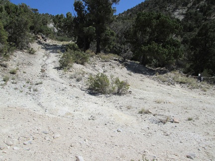 OK, now I'm on the correct trail to Keystone Spring!
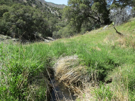 And here it is: Keystone Spring!
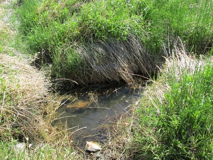 I presume the Keystone Spring water hole here has more (and fresher) water during the wetter season
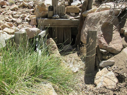 This appears to be the source of the spring