Home 7119

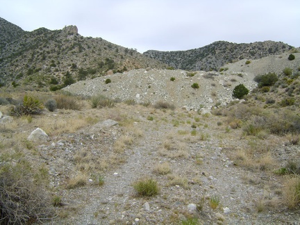 The road fizzles out and comes to an end at two big tailings piles at about 5400 feet elevation
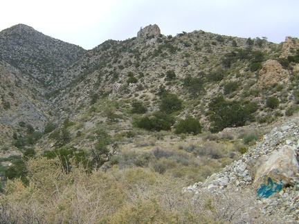 A bright blue streak in the rock at bottom right, presumably copper
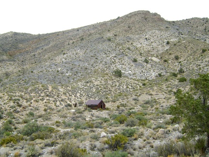 On the half-mile walk up the old road to Copper World Mine, I notice a lonely old cabin nearby
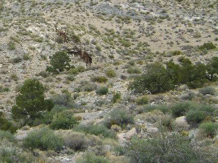 A bit further up the Copper World Mine road, down in a gulley, is an old headframe
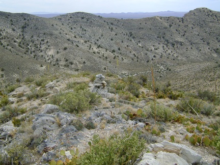 On the saddle halfway down to Copper World Mine Road, someone has built a rock cairn
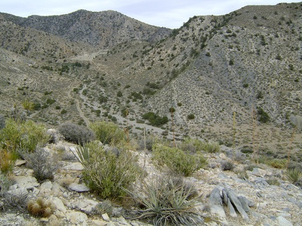 As I approach the bottom of the hill, I look up the road that leads to the old Copper World Mine site
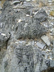 There's a lot of interesting rock to look at on the way down the hill
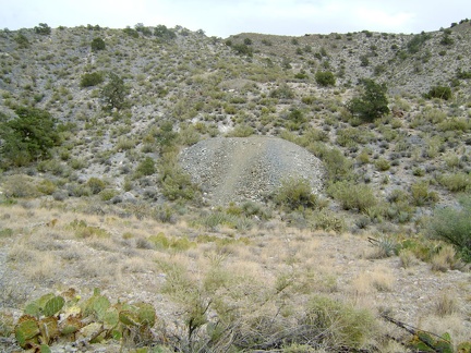 I reach the bottom of the hill and start walking up the road toward the Copper World Mine site
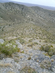 This downhill to Copper World Mine Road is also pretty steep, but it has a bit of a saddle on the way to ease the descent
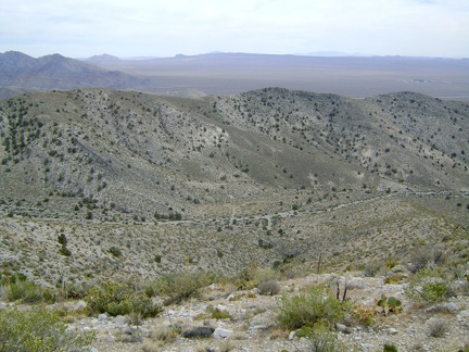 Looking south from the unnamed ridge above Copper World Mine toward Cima Dome on the horizon
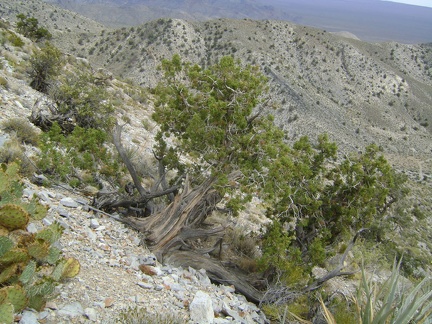 I reach a steep slippery area on the ridge with a gnarled juniper while attempting to begin a descent toward Copper World Mine
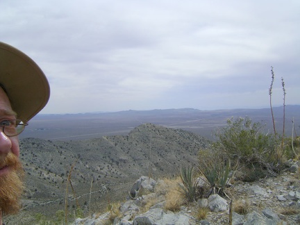 From the ridge, I'm now looking down the other side into the canyon and see the road that leads up to Copper World Mine
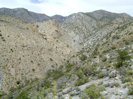 From the ridge, I look down into the steep canyon that descends from Clark Mountain
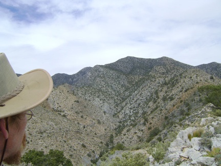 Up on the ridge, I find myself staring straight at Clark Mountain
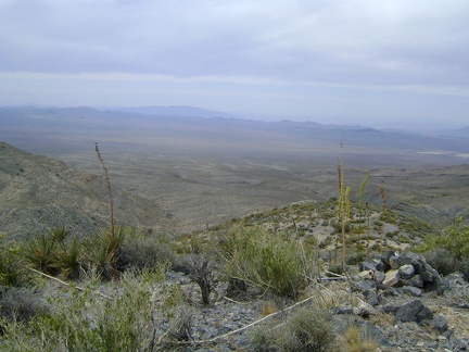 I've reached the top of the hill and Pachalka Spring's green spot is still in view at the centre-right
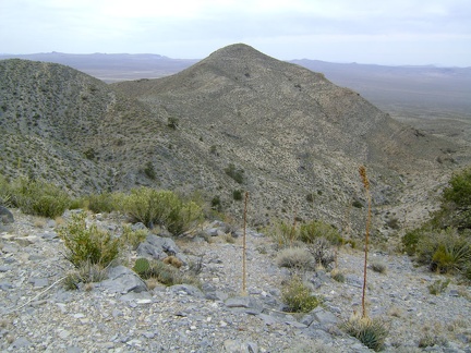 My route up the hill is as steep as anticipated and has great views back down toward the wash
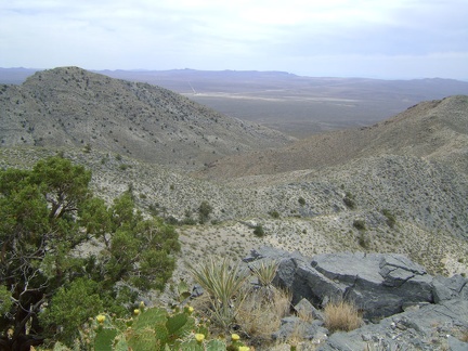 A little higher up the hill, looking west toward Valley Wells, where I stopped at the store yesterday
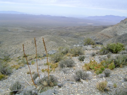 A northwest view beyond three agave stems toward Pachalka Spring, with Kingston Range in the distance at the right
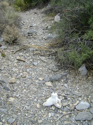 Just as my route leaves the wash, I notice a bone fragment on the ground
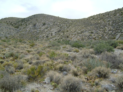 I start the one-mile climb up the hills ahead on the way to Copper World Mine
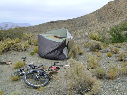 Strong winds roll my tent over at Pachalka Spring just as I'm thinking perhaps I should put some rocks inside to weight it down
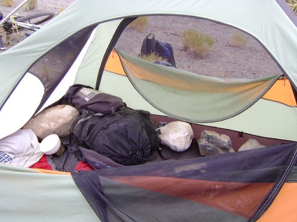 I've learned my lesson and walk around looking for large rocks to put inside my tent
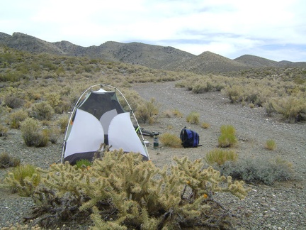 My backpack is prepared for the day and waits for me to take it on a hike over the hills to the old Copper World Mine area
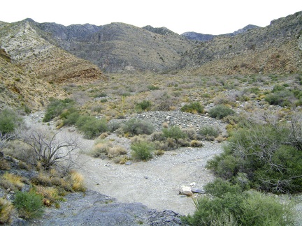 Pachalka Spring Road drops down into a gravelly wash that drains from the Clark Mountain area in the background
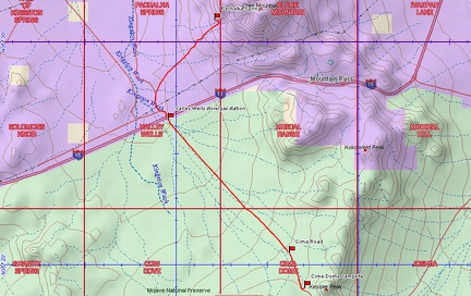 Bicycle route from Cima Dome (Sunrise Rock) to Pachalka Spring, Mojave National Preserve (Day 12)
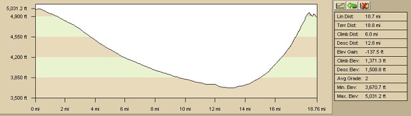 Elevation profile of bicycle route from Cima Dome (Sunrise Rock) to Pachalka Spring, Mojave National Preserve (Day 12)
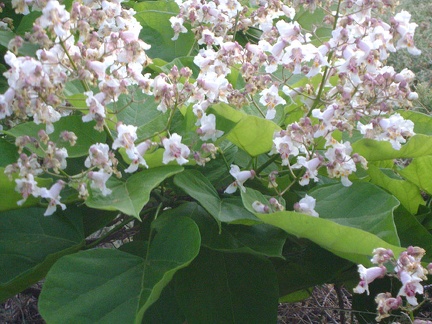 The blossoms on this tree look almost like the flowers of a Palmer's penstemon; hummingbirds probably love these
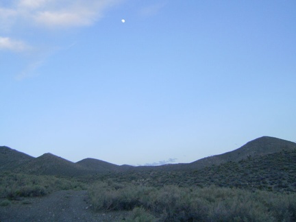 Most of the day's clouds have lifted in the south and I can see that it's getting close to full moon
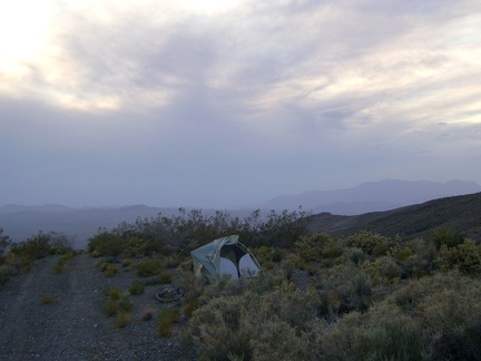 The view northwest from my Pachalka Spring campsite provides no colourful sunset this evening due to cloud cover
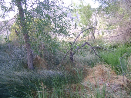 Before sundown, I go for another short walk over to Pachalka Spring
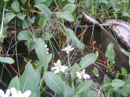 There it is, Pachalka Spring, bubbling up from a pipe in the middle of the yerba mansa patch
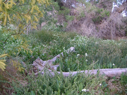 I hear a trickle of water somewhere nearby, so I walk past the yellow mesquite blooms into the patch of yerba mansa flowers
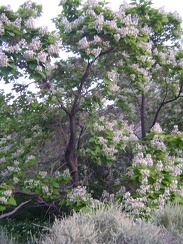 A tree that I've never seen before is blooming profusely in the moist area just below Pachalka Spring
 With Pachalka Spring's greenery behind me, I walk back to my bike and look for a spot to set up my tent
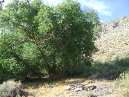 A campfire ring by the trees adjacent to Pachalka Spring makes for an enticing place to set up camp
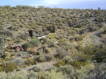 Down in the wash below Pachalka Spring are more ruins
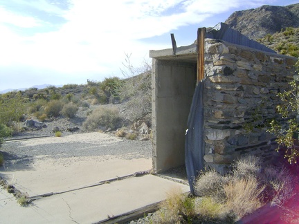 Only a small piece of the stone walls remains of the house that once stood near Pachalka Spring, Mojave National Preserve
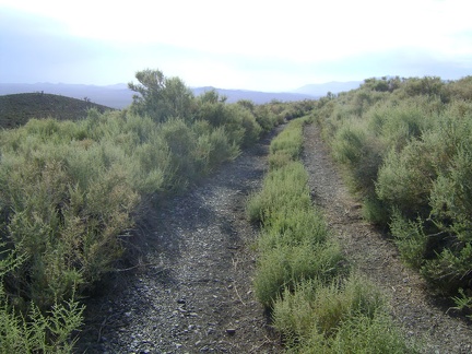 Pachalka Spring Road just west of the ruins doesn't look like it gets much traffic
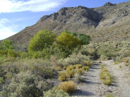 Im not sure yet where I'll set up my tent; I park my bike and walk down the short road toward the green trees at Pachalka Spring
 After passing through an extensive gravelly area in the wash south of Pachalka Spring, the road abruptly rises a short distance
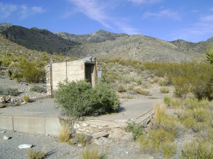 In the area above Pachalka Spring, I find the ruins of an old house
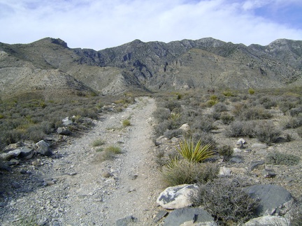 Pachalka Spring Road has slowly made its way up onto a low ridge
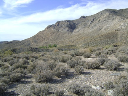 Looking to my left (north), I see a patch of green trees, which must be Pachalka Spring
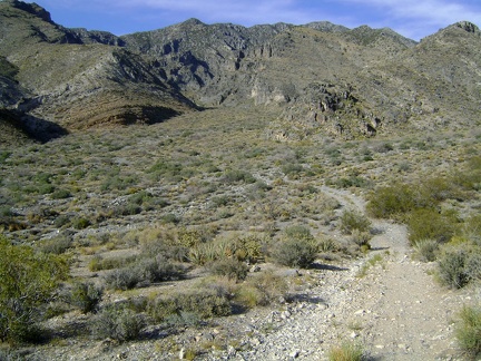 After a couple hours of hike-a-biking, it's a pleasure to remount the bike and ride down into the wash south of Pachalka Spring
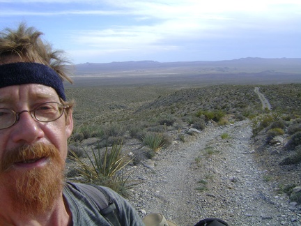 As always, I look behind me frequently to see how much I've risen, to reassure myself that my work is creating progress
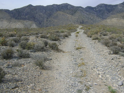 Pachalka Spring Road was climbing slowly at 3-5 percent grade for a while, but now the grade is 5-10 percent
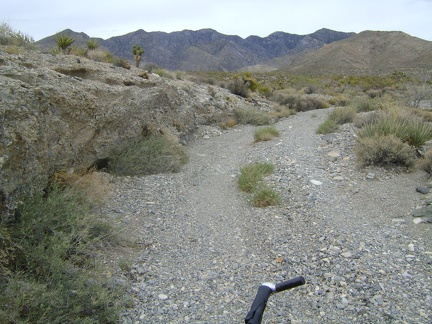 An hour later, Pachalka Spring Road climbs up through a wash
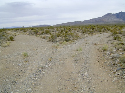 My road splits, and I follow the right fork leading toward the Clark Mountain Range and Pachalka Spring
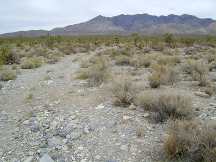 I start riding up the fan on the road to Pachalka Spring, Mojave National Preserve, straight toward the Clark Mountain Range
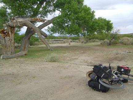 A big tree, partly broken, near the old Valley Wells town site
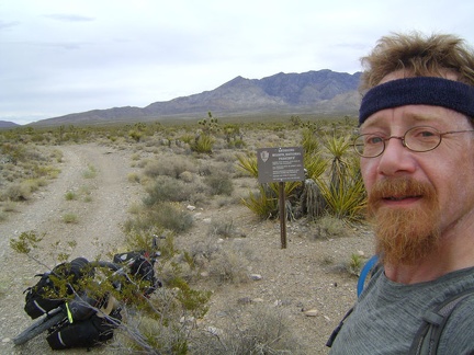 Re-entering Mojave National Preserve, this time in the smaller part of the Preserve that's north of Interstate 15
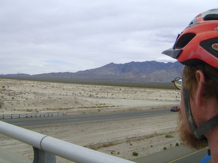 Looking over to the Clark Mountain Range from the Cima Road bridge over I-15, I try to discern the location of Pachalka Spring
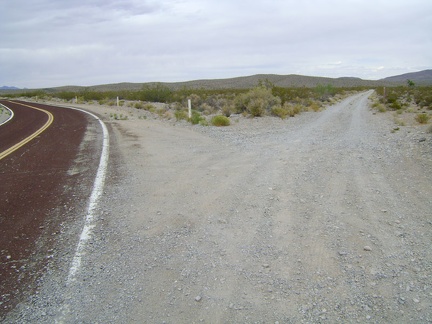 1.5 miles beyond Interstate 15, I reach the dirt road that will take me to Pachalka Spring and bear right
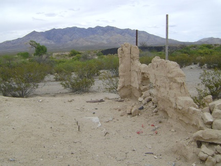 I stop at the old Valley Wells town site to check out the final remnants of the wall of a mud-brick building
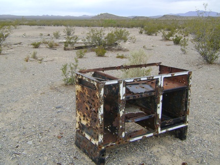 Nearby is the metal skeleton of an old counter or stove
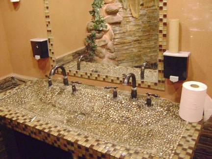 The washroom sink at the Valley Wells gas station matches the urinal in its unique epoxy tackiness
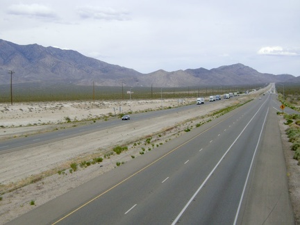 Replenished with lots of water in case there is none at Pachalka Spring, I ride over the bridge above Interstate 15
 The urinal in the washroom at the Valley Wells gas station is truly unique
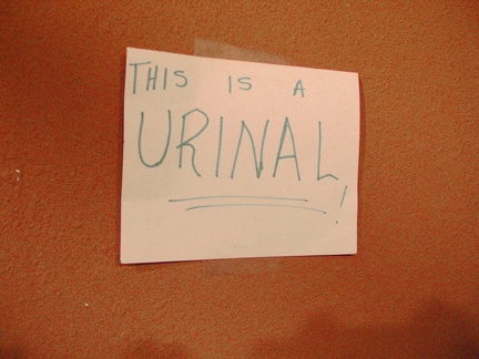 The Valley Wells urinal is so unique that an adjacent handwritten sign tells you that, "yes, this IS a urinal!"
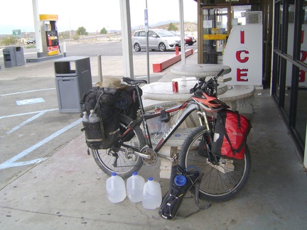 I buy three gallons of water at the Valley Wells gas station store at I-15 and take a nice long break
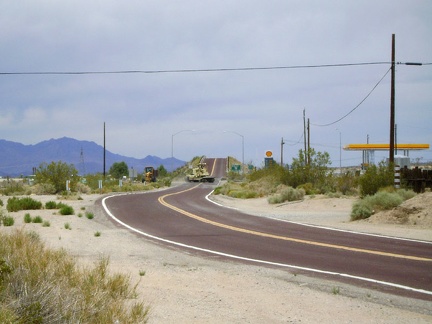 Cima Road rises up to a bridge that crosses over Interstate 15 and I stop at the gas station store here to fuel up on supplies
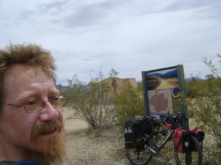 The bottom of Cima Road exits Mojave National Preserve; I take a break by the monument that folks see upon entering the Preserve
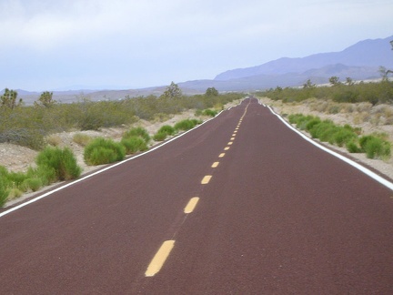 I continue whooshing down Cima Road and can now see trucks on Interstate 15 in the distance
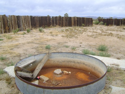 Well, the cistern in this old corral along Cima Road is dry, so I presume the big water tank nearby is empty too
 I zoom down the 12 miles of gentle Cima Road grade to Valley Wells at Interstate 15
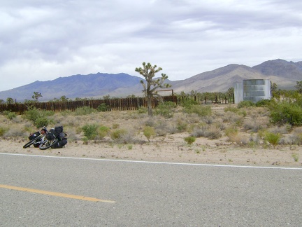 On the way down the Cima Road hill, I stop at an old corral and water tank
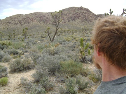 Nearby is Kessler Peak and an old mining to the north, which might make a nice hike
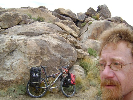 I decide to head to Pachalka Spring as originally planned; my campsite slowly morphs into a well-packed 10-ton bike
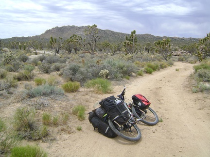 I ride the half-mile up the dirt road from my Cima Dome campsite and reach the pavement of Cima Road at noon sharp
 Along Cima Road is a large patch of exposed rock
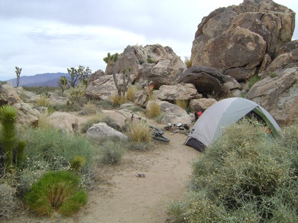 It's a pleasant, breezy morning up here on Cima Dome, about 70 degrees, and a bit overcast
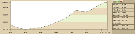 Nipton to Sunrise Rock (Cima Dome) elevation profile (Day 11)
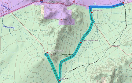 Nipton to Sunrise Rock (Cima Dome) bicycle route (Day 11)
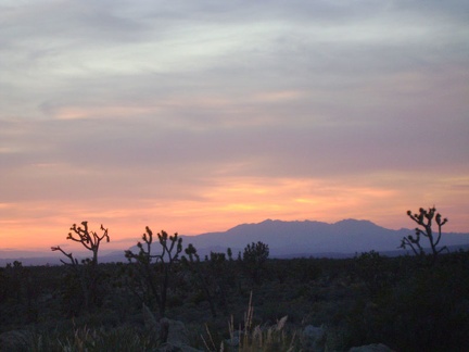 Sunset glows around the distant Clark Mountain range tonight
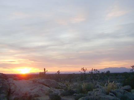 When I think of the Cima Dome area, I think of gorgeous sunsets, and tonight is no exception
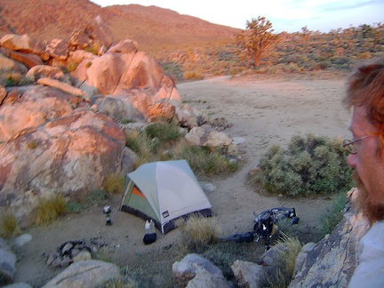 I hop around the rocks that surround my Cima Dome campsite and catch the pre-dusk orange desert glow
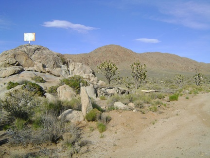 At the summit of Cima Road, I pull in at Sunrise Rock and go about selecting a campsite
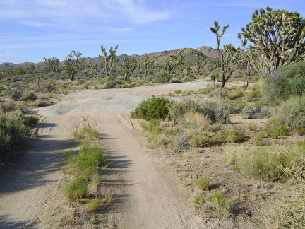 I ride down the sandy road by Sunrise Rock to choose a campsite
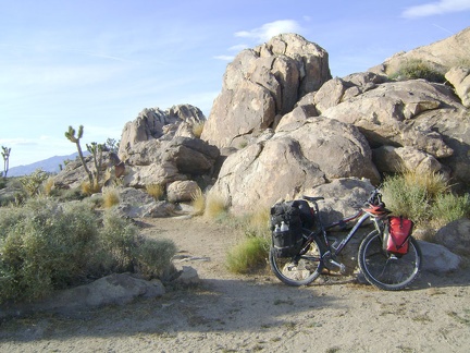 A half a mile beyond Sunrise Rock, I choose a campsite next to a rock pile where I camped last year and set up my tent
 Cool winds up here on Cima Dome at 5000 feet have dried my sweat; crunchy salt stains remain
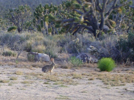 From my tent on Cima Dome, I watch a jackrabbit hop around a lot, digging small holes along the way
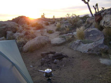 I'm really hungry, so I get out my pot and propane burner, but decide to take sunset photos instead of cooking supper right away
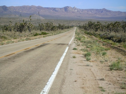 I turn around for a view back down to Cima while climbing up Cima Road
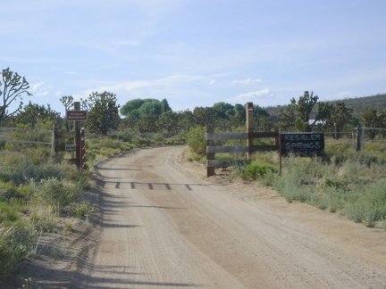 A little further up Cima Road is the Kessler Springs Ranch property, which is inhabited and off-limits to Preserve visitors
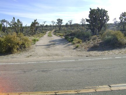 Across Cima Road from Kessler Springs Ranch is a dirt road that leads to Cut Spring
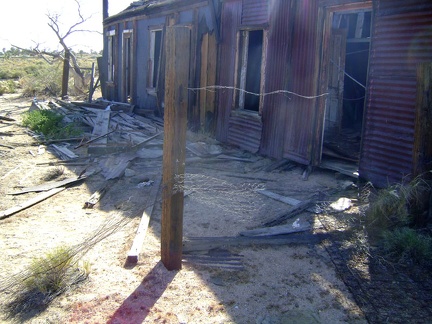 The front exterior of the collapsing house at Cima
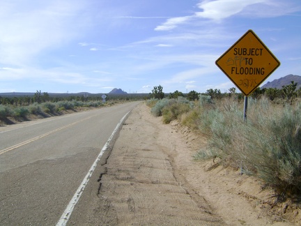 I get back on the 10-ton bike and start riding up to the top of the Cima Dome hill
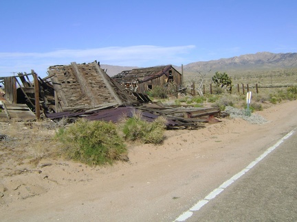 On my way out of "town," I'll check out these collapsing old houses just up the road from the Cima store
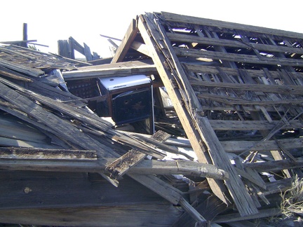 An old stove is crushed beneath the collapsed roof of this house at Cima, Mojave National Preserve
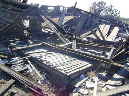 Old hardwood-flooring slats peer out from beneath the debris of this abandoned house at Cima, Mojave National Preserve
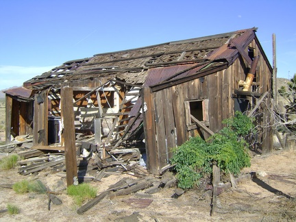 It always amazes me that houses like this one at Cima can be left to decay literally to the point of collapsing
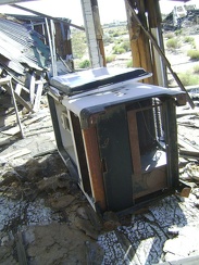 Old refigerator in the back porch of an abandoned house at Cima, Mojave National Preserve
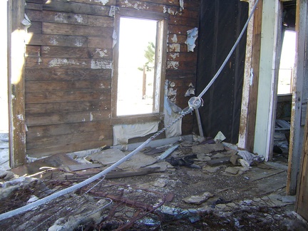 Inside one of the rooms of the collapsing house at Cima
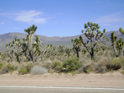 I divert my attention away from the climb by staring off into the distance at the Butcher Knife Canyon area of the Mid Hills
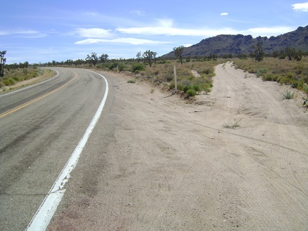 Finally I've made it to the top of Morning Star Mine Road
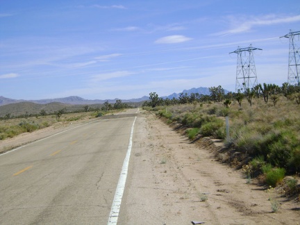 Two miles before the Cima store, Morning Star Road passes under one of the big power lines that cross the Mojave Desert
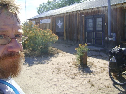 Oh well, Cima store is closed, but I wasn't really expecting it to be open
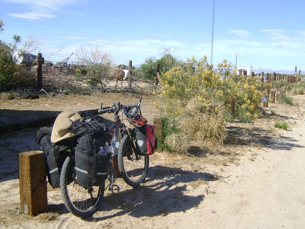 The 10-ton bike takes a short rest by the Cima store before the final six-mile ride up Cima Road to Cima Dome
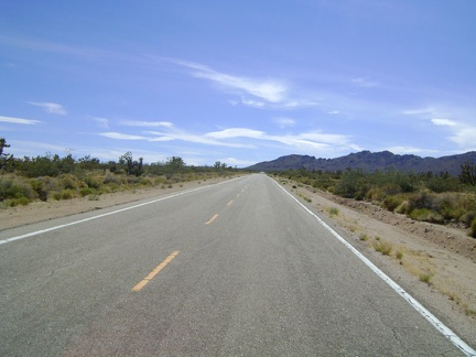 Onward and upward on the final three miles of climbing of Morning Star Mine Road
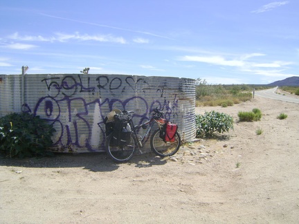 After almost two hours of climbing, I reach the corral, my favourite landmark (one of the only ones) on Morning Star Mine Road
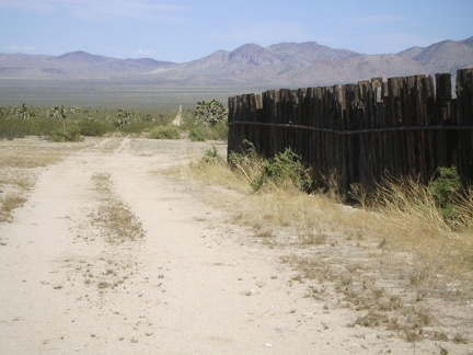 Behind the Morning Star Mine Road corral is a dirt road that crosses the fan to the base of the New York Mountains
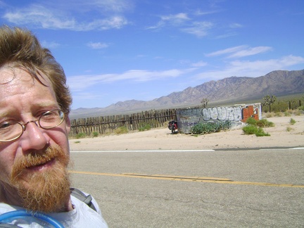 I go for a walk around the Morning Star Mine Road corral to cool down a little
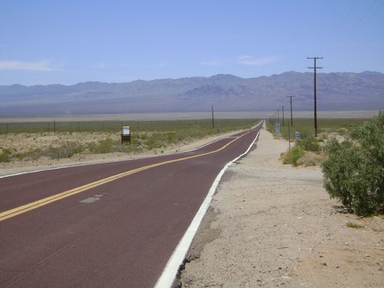 After filling up my water supply and stopping at the store for a cold iced tea, I'm on my way down Nipton Road just after noon
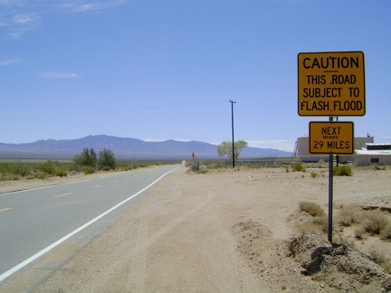 I turn south on Ivanpah Road and am welcomed by this flash-flood warning sign
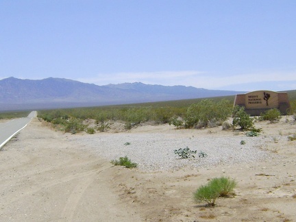 Also near the beginning of Ivanpah Road is one of those "entering Mojave National Preserve" monuments
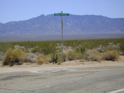 I reach the junction of Morning Star Mine Road and turn right
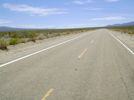 OK, the long, slow, dreaded climb up Morning Star Mine Road is officially on
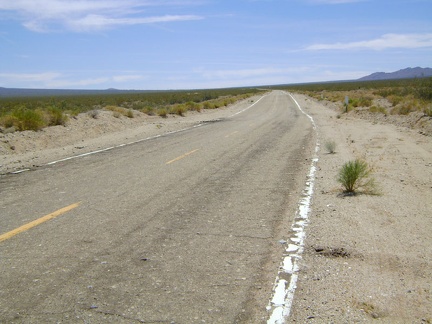 Morning Star Mine Road rises over 11.5 miles from 2750 feet elevation to about 4285 feet
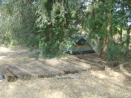 I'm up early this morning to have breakfast at the Nipton café and pack up the tent
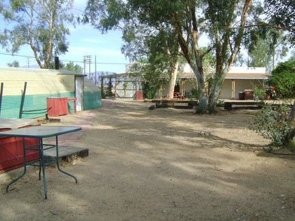 I walk over to the Nipton café and Bill cooks me another tasty omelet with Asian vegetables and shrimp
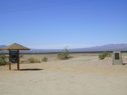 In front of the Nipton store is a Mojave National Preserve information kiosk; the Preserve begins just beyond the train tracks
 I take a another shower before leaving Nipton (probably my last one for a week) and brush my teeth
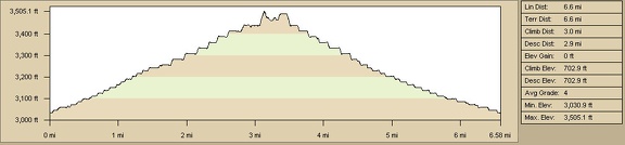 Nipton to Black Palisades hike elevation profile (Day 10)
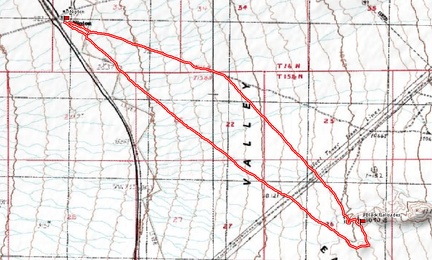 Nipton to Black Palisades hike route (Day 10)
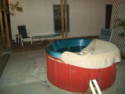 The Nipton hot tub was repaired today, so I try it out later in the evening
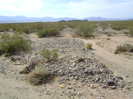 This area on the fan just south of Nipton is clearly subject to occasional flooding during heavy rains
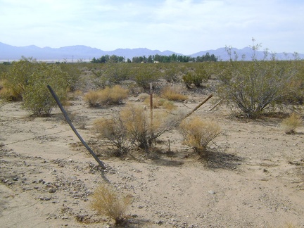 I'm almost back at Nipton when my direct route is foiled by this weak barbed-wire fence, but it's easy to get past
 Back in the shade of the tent, I settle in for beer from the Nipton store and a makeshift cooler of ice plus plastic bag
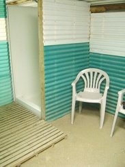 Later in the evening, I rinse off in Nipton's dirt-floor semi-outdoor showers and wash some clothes in the two-washer laundromat
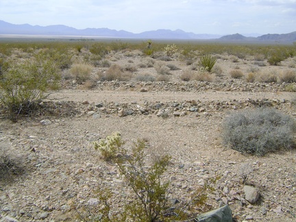 Crossing the power-line road on the way back to Nipton
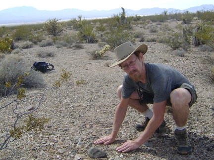 I stop to touch the rocky ground beneath me on the way back to Nipton
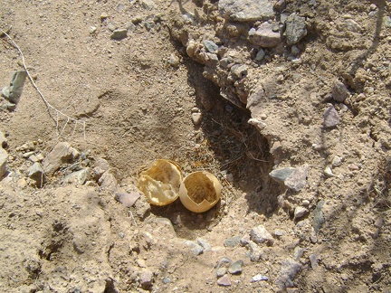 The outer shell of a coyote gourd near Nipton
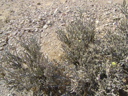 I think this is a pencil cholla cactus, near Nipton, Mojave National Preserve
 I walk up the low mound just south of Black Palisades
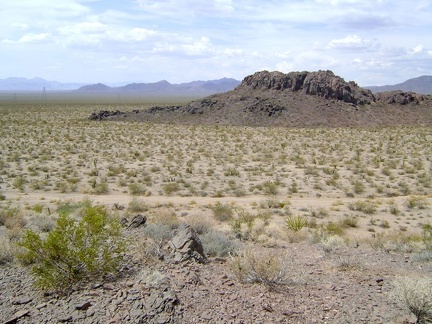 The mound is just high enough to provide nice views of Black Palisades and the surroundings
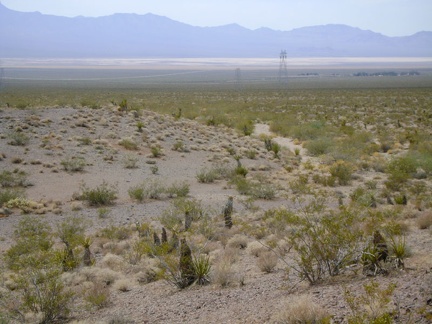 I walk down the mound to an adjacent wash and start heading back toward the power lines on the Nipton return hike
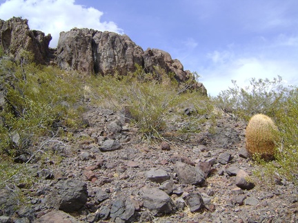 There's a lot more to explore here, but I'm lazy today and walk back down the slope of Black Palisades
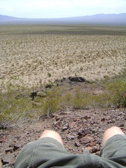 Nice view from here at Black Palisades toward Cima
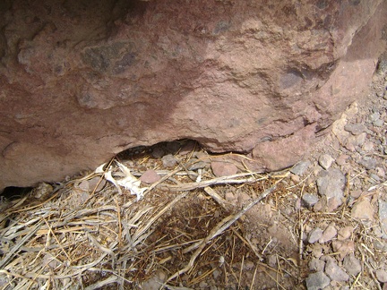 Nearby, I discover some bones in a nest huddled in the rocks
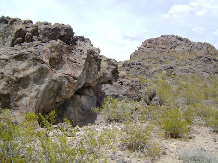 OK, I'll climb a little higher up Black Palisades, just a little further
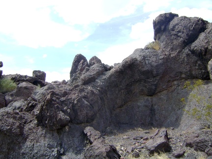 More volcanic-looking rock on Black Palisades, Mojave National Preserve
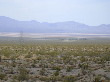 Looking down toward Nipton, I see a dust devil making its way across the fan
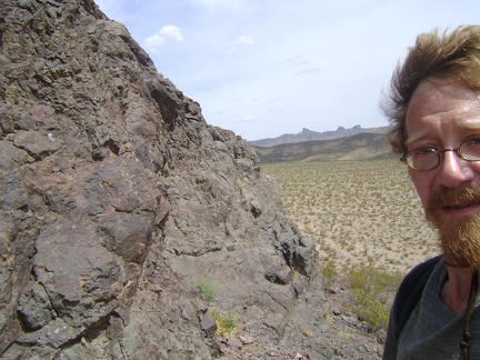 I rest here on the west side of Black Palisades for a few minutes
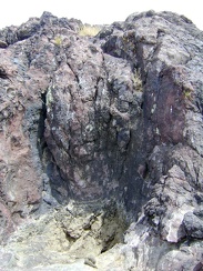 I discover a dry tinaja (Spanish for "water jar") at Black Palisades with fairly fresh scat adjacent
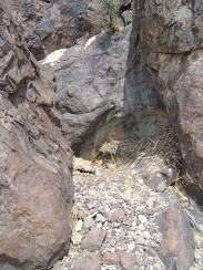 A nearby alcove in the rocks at Black Palisades harbours nesting materials rather than a tinaja
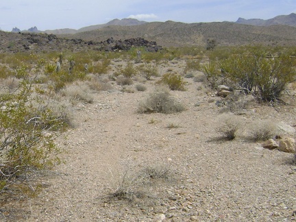 I stumble across a faint trace of an old road that passes by the west edge of Black Palisades
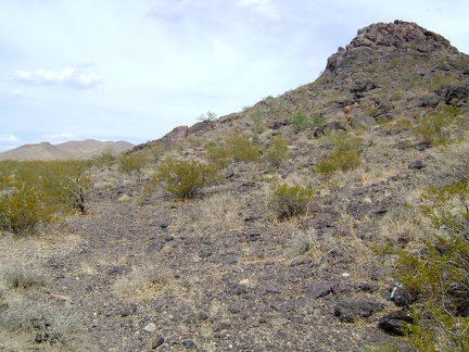 I walk up toward the closest turret of Black Palisades
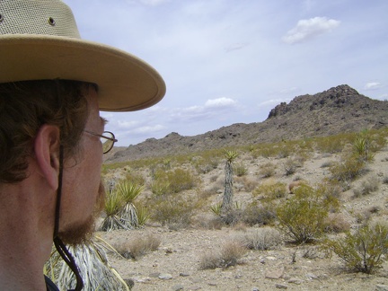 Here it is, Black Palisades, about a quarter mile in front of me
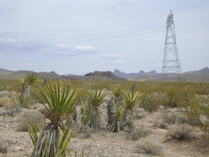 I reach the power lines about a half mile before Black Palisades
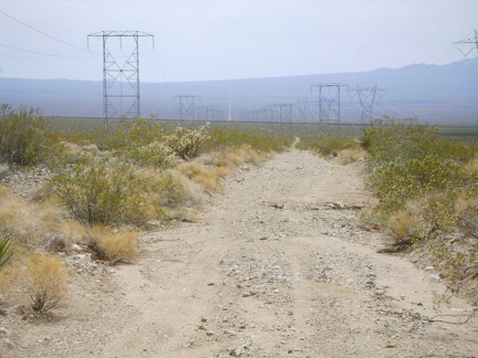 I cross the power-line road and stare at its thread leading up the hill into the distance, toward Cima
 I leave the primitive road and start walking cross-country toward Black Palisades
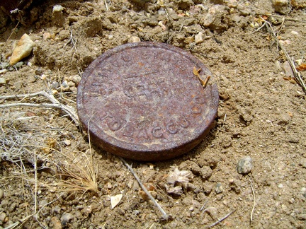 Here's an old rusty lid from a tobacco tin, perhaps Copenhagen snuff
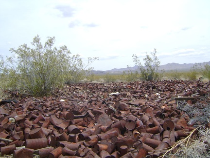 A substantial can dump on the outskirts of Nipton
 At the junction of two old roads, I take the one that heads off to my left, toward the Mid Hills
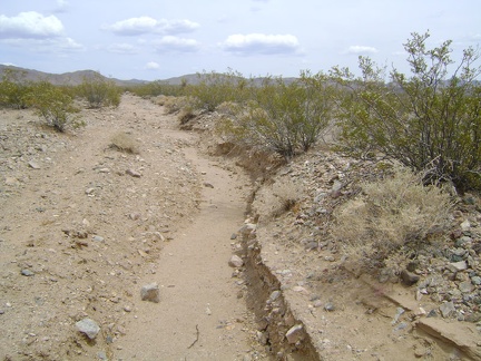 The old road out of Nipton is marginal at best and is a bit washed out in places, but it makes a great trail
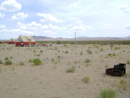 I stop in at the Nipton store to pay for another night of camping before walking past the tent cabins to start today's hike
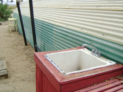 One last thing: I stop at the outdoor sink at Nipton to refill my water bottles before heading out
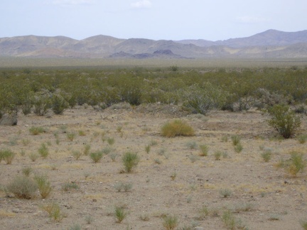 Today I'm hiking over to "Black Palisades" (it has no official name): that dark rocky mound in the distance
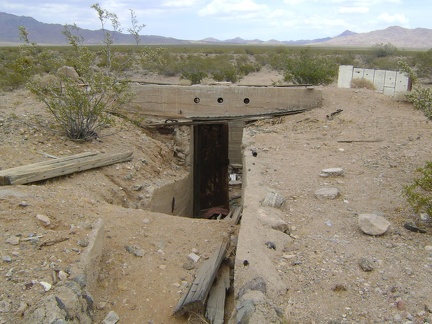 A concrete stairwell and heavy steel door lead into the basement
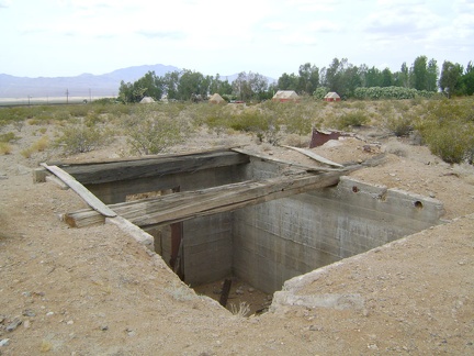 Just southeast of Nipton lies this bunker-like concrete foundation
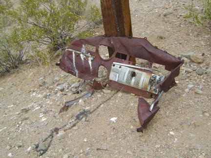 Further beyond, I stumble across what appears to be part of an old automobile dashboard
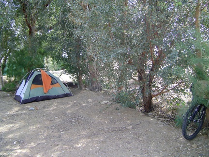 Last night's light rain never became heavy; now I enjoy the shade of the eucalyptus trees during the warm morning at Nipton
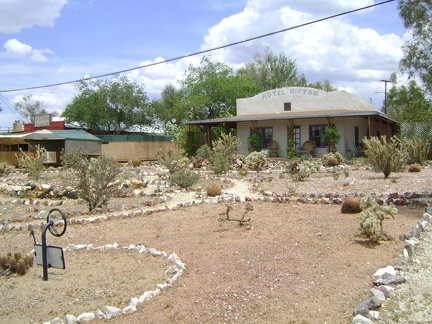 After breakfast, I take a shower and explore the rustic garden in front of the bed-and-breakfast
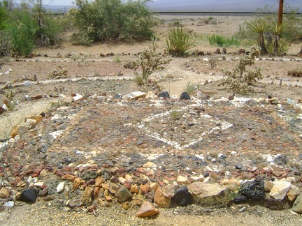 In the middle of the Nipton garden is an area built of coloured rocks
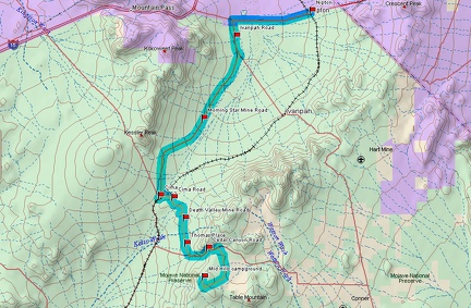 Bicycle route from Mid Hills campground to Nipton via Cima and Morning Star Mine Road (Day 9)
 Elevation profile of bicycle ride from Mid Hills campground to Nipton via Cima and Morning Star Mine Road (Day 9)
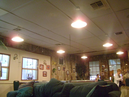 At Nipton's Whistle Stop Café, Bill cooks me a delicious New York steak, salad and fries
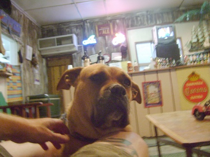 Bill's dog keeps me company while he prepares our meals
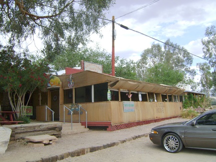 Next door to the Nipton store is the Whistle Stop Café, which is what I'm really looking forward to
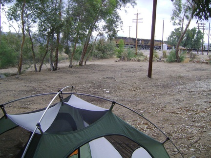 While setting up my tent under the eucalyptus trees just south of the Nipton store, a train rushes past
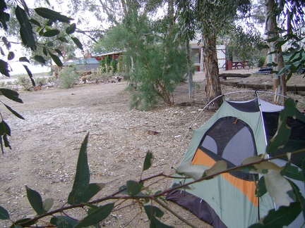 In the heat of the late afternoon, I drink lots of cold beer, which goes down like water after a hot bicycle ride
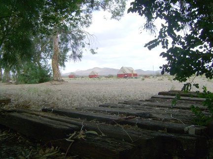 Behind my tent at Nipton lays a series of old railroad ties concealing a stinky septic leach field, and a few tent cabins beyond
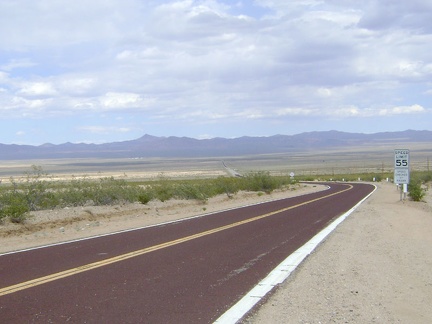 After three miles on Ivanpah Road, I head east on Nipton Road for the final seven miles across Ivanpah Valley
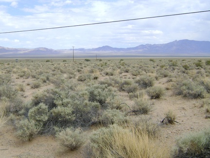 Crossing the floor of the Ivanpah Valley on Nipton Road, I stop for a very short break to take in the scenery
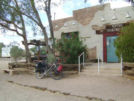 After the slow rise out of Ivanpah Valley, I pull up at the Nipton store at 3000 feet elevation, the end of today's bicycling
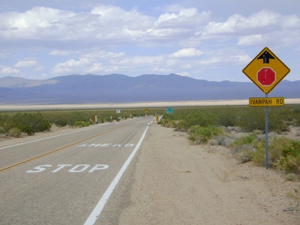 The amazing 11.5-mile downhill on Morning Star Mine Road abruptly ends at a T-intersection and stop sign at Ivanpah Road
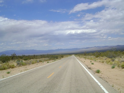 Downhill on Morning Star Mine Road is not steep, but it is long: about 11.5 miles on a 2 percent grade
 It's down, down, down on Morning Star Mine Road, Mojave National Preserve
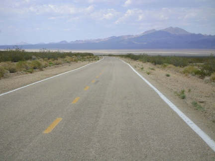 Still rolling quickly downward on Morning Star Mine Road, Ivanpah Valley comes clearer into view
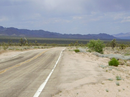 I reach the point on Morning Star Mine Road that I call "the big curve," after which the serious downhill begins
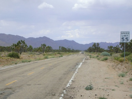 I depart Cima and ride down Morning Star Mine Road, one of Mojave National Preserve's main, high-speed, paved roads
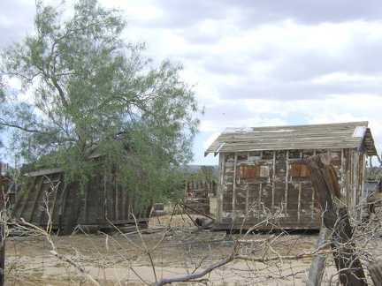 Two very crooked old sheds rest on the property behind the Cima store
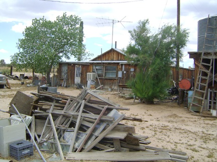 Behind the Cima store is an old house, presumably the residence of the store owner and postmistress
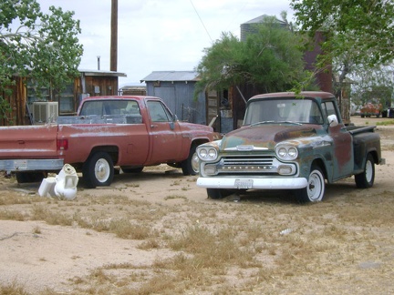 The Cima Store property also serves as a graveyard for many expired motor vehicles
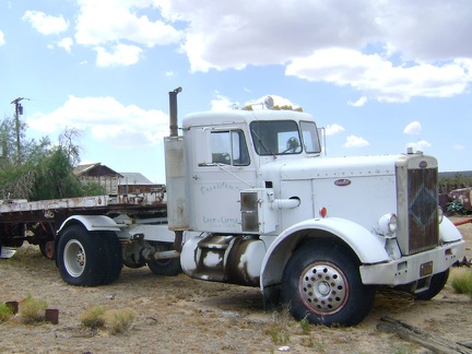 Faded paint on this old truck behind the Cima Store labels it as a possession of Providence Land and Cattle
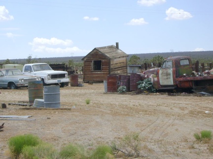 More old motor vehicles, and another crooked shed, behind the Cima Store, Mojave National Preserve
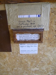 The interior mail slot taped shut, I follow the instructions and drop my mortgage payment in the mailbox outside
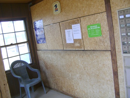 Inside the lobby of the Cima post office
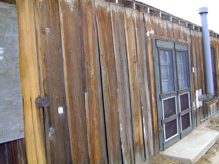 The heavily weathered board-and-batten exterior of the Cima store is in need of restoration work
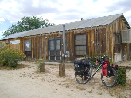 Predictably unpredictable, the Cima store is closed, even though it should be open according to the posted hours
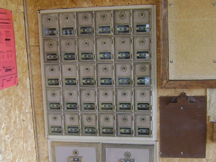 The real gem of the Cima post office is its set of antique postal boxes, apparently still in service
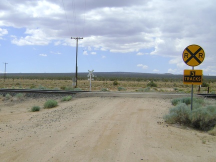 At the bottom of Cima Road, I cross the train tracks, arrive on pavement, and ride over to the Cima Store
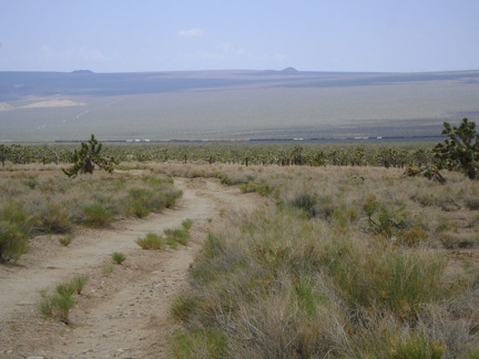 A mile up Death Valley Mine Road, I stop at Thomas Place for a Clif-bar-and-water break like I did yesterday
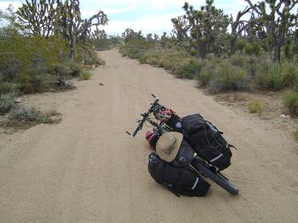 After my break at Thomas Place, I get back on Death Valley Mine Road and ride north through the joshua tree forest
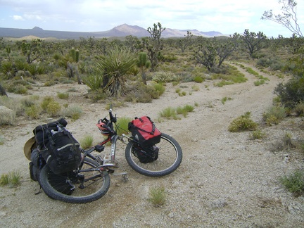 I've ridden Death Valley Mine Road a couple of times on previous Mojave National Preserve trips, and I always enjoy this one
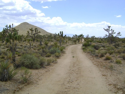 I make a mistake and turn down a well-travelled road that I think at first is Cima Road
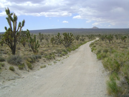 After a pleasant five miles on Death Valley Road, it ends, and I turn west on Cima Road, with Cima Dome and Kessler Peak ahead
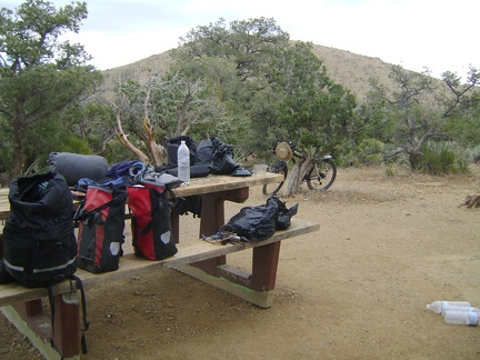 Almost everything I brought with me ends up on the picnic table, and then squeezed into my saddlebags
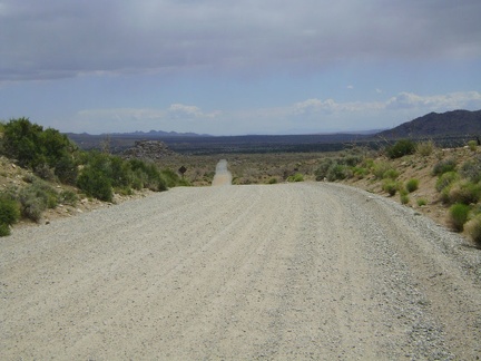 It will be almost all downhill riding today in Mojave National Preserve
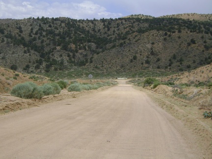 Next, I ride two miles down the washboarded Black Canyon Road, which ends at a T-intersection in Cedar Canyon
 I follow Cedar Canyon Road westward for a few miles, which is also mostly downhill
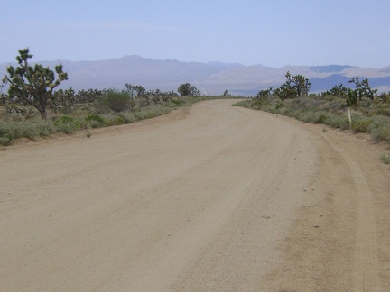 The road rises out of Cedar Canyon to look out over Kelso Valley and I turn right here on Death Valley Mine Road
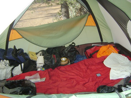 OK, I really am leaving Mid Hills campground this morning; to go to Nipton
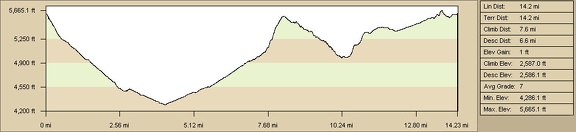 Elevation of round-trip hike from Mid Hills campground to Thomas Place, Live Oak Spring and "Seep Canyon" (Day 8)
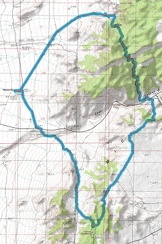 Round-trip hiking route from Mid Hills campground to Thomas Place, Live Oak Spring and "Seep Canyon" (Day 8)
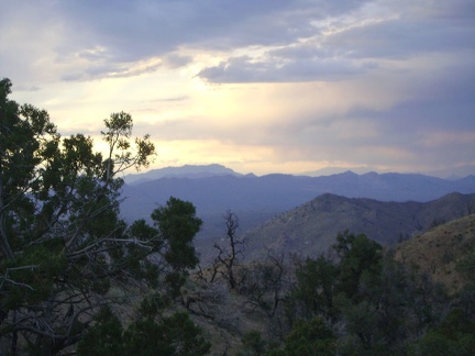 I take in my final sunset from Mid Hills campground toward the Clark Mountains the distance, where I hope to be in a few days
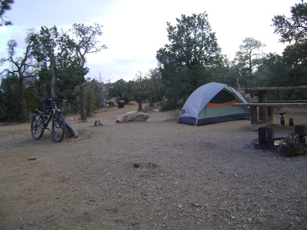 Back at Mid Hills campground, 7.5 hours after starting today's hike, I settle in for my sixth and last night here
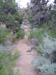 I walk up the drainage to the campground and almost resurface at the back of the wrong campsite at Mid Hills
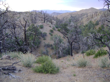 Despite my plan, I end up dipping back down into a drainage wash a bit north of my Mid Hills campsite
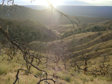 The challenge right now is to hike to my left and get over to that middle ridge without descending down into Eagle Rocks wash