21/58
Home / Mojave Preserve and Desert bikepacking trips / 2008: Mojave National Preserve Mountain-Bike Camping and Hike / Day 2: Eight-mile day hike from campsite on middle fork Globe Mine Road to Tough Nut Mine via Good Hope Mine and back /
The old remnant of a road ends here on the crest of the hill at a small mine shaft; I continue walking cross-country

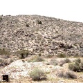
I continue hiking past the end of the road, down into the next wash, then up the next low ridge. I could have chosen a slightly longer, but easier, route that skirts the base of the hills down on the fan, but I like these little ups and downs.
I still don't see my tent down there; it must be hidden by some bushes.

)
)
)
)
)