8/15
Home / Mojave Preserve and Desert bikepacking trips / 2008: Mojave National Preserve Mountain-Bike Camping and Hike / Day 13: Day hike up to Teutonia Peak then looping around the west side of Cima Dome via Deer Spring, Mojave National Preserve /
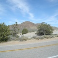
The two-mile trail to Teutonia Peak is one of just two official, maintained trails in the expansive Mojave National Preserve
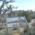
. This photo was taken two years ago (2006), when I stopped briefly here at the trailhead with my bicycle.")
Of course, hundreds of miles of old roads, some of which are no longer open to motor vehicles, serve quite nicely as Mojave National Preserve's de facto trail system.
Despite what you see in this photo, I do not have my bicycle with me right now (I left it at my campsite). This photo was taken two years ago (2006), when I stopped briefly here at the trailhead with my bicycle.
)
)
)
)
)