dryfj.com / drycyclist.com (kevin cook)

5654/7119
Home /

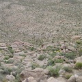
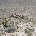
I zigzag across the slope, approaching a drainage that I identify on my GPS as a possible descent route

3644-kelso-peak.jpg The larger rocks on this part of the Kelso Peak slope make for a descent with better footing than I had on the way upThumbnailsLooking down from the Kelso Peak ridge line past a few joshua trees and indigo bushes, I wonder how I made it up here!The larger rocks on this part of the Kelso Peak slope make for a descent with better footing than I had on the way upThumbnailsLooking down from the Kelso Peak ridge line past a few joshua trees and indigo bushes, I wonder how I made it up here!The larger rocks on this part of the Kelso Peak slope make for a descent with better footing than I had on the way upThumbnailsLooking down from the Kelso Peak ridge line past a few joshua trees and indigo bushes, I wonder how I made it up here!The larger rocks on this part of the Kelso Peak slope make for a descent with better footing than I had on the way upThumbnailsLooking down from the Kelso Peak ridge line past a few joshua trees and indigo bushes, I wonder how I made it up here!The larger rocks on this part of the Kelso Peak slope make for a descent with better footing than I had on the way upThumbnailsLooking down from the Kelso Peak ridge line past a few joshua trees and indigo bushes, I wonder how I made it up here!

I frequently consult my Delorme GPS to see contour lines from the USGS maps and how they match up with the actual surfaces here. Despite vertigo, I'm really enjoying being up here; it's just that I can't go any higher.