dryfj.com / drycyclist.com (kevin cook)

5545/7119
Home /

I pass through an old ranch fence and a sign marking the adjacent hiking trail

4501-gold-valley-road.jpg After a short climb to a crest at about 5440 feet elevation, Gold Valley Mine Road begins heading downhillThumbnailsA quarter mile down the road from my campsite at Mid Hills campground, I turn right on Wild Horse Canyon RoadAfter a short climb to a crest at about 5440 feet elevation, Gold Valley Mine Road begins heading downhillThumbnailsA quarter mile down the road from my campsite at Mid Hills campground, I turn right on Wild Horse Canyon RoadAfter a short climb to a crest at about 5440 feet elevation, Gold Valley Mine Road begins heading downhillThumbnailsA quarter mile down the road from my campsite at Mid Hills campground, I turn right on Wild Horse Canyon RoadAfter a short climb to a crest at about 5440 feet elevation, Gold Valley Mine Road begins heading downhillThumbnailsA quarter mile down the road from my campsite at Mid Hills campground, I turn right on Wild Horse Canyon RoadAfter a short climb to a crest at about 5440 feet elevation, Gold Valley Mine Road begins heading downhillThumbnailsA quarter mile down the road from my campsite at Mid Hills campground, I turn right on Wild Horse Canyon Road

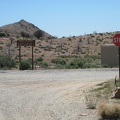
The Mid-Hills-to-Hole-in-the-Wall hiking trail is not all that visible. Perhaps it stood out more before the 2005 brush fires razed much of the plant life.