dryfj.com / drycyclist.com (kevin cook)

6606/7119
Home /

Last chance to spontaneously change my route and walk straight ahead down Beecher Canyon...

02535-barber-canyon.jpg My maps indicate that the summit of Wild Horse Mesa is only a half mile northeast, so I start walking that wayThumbnailsI cross the juniper-studded drainage that is Beecher Canyon's "headwaters" and begin the climb up to Wild Horse MesaMy maps indicate that the summit of Wild Horse Mesa is only a half mile northeast, so I start walking that wayThumbnailsI cross the juniper-studded drainage that is Beecher Canyon's "headwaters" and begin the climb up to Wild Horse MesaMy maps indicate that the summit of Wild Horse Mesa is only a half mile northeast, so I start walking that wayThumbnailsI cross the juniper-studded drainage that is Beecher Canyon's "headwaters" and begin the climb up to Wild Horse MesaMy maps indicate that the summit of Wild Horse Mesa is only a half mile northeast, so I start walking that wayThumbnailsI cross the juniper-studded drainage that is Beecher Canyon's "headwaters" and begin the climb up to Wild Horse MesaMy maps indicate that the summit of Wild Horse Mesa is only a half mile northeast, so I start walking that wayThumbnailsI cross the juniper-studded drainage that is Beecher Canyon's "headwaters" and begin the climb up to Wild Horse Mesa

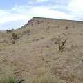
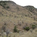
If I walked down that way, instead of up the hill to the left, I'd eventually end up down below the Mitchell Caverns/Providence Mountains State Recreation Area, which I visited in 2000.

That's another nice area that I just haven't gotten around to visiting again.