dryfj.com / drycyclist.com (kevin cook)

4698/7119
Home /

1/2 mile up the road to Old Dominion Mine, I start looking for a good campsite near another road that I also can't locate

7325-crucero-road.jpg Crucero Road by the dry lake turns out to be firm-surfaced (but rough), so I happily ride the final 4 miles at a cool 7 mphThumbnailsAn hour later, past the bottom of the dip in the road, I look back at the Bristol Mountains powerline roadCrucero Road by the dry lake turns out to be firm-surfaced (but rough), so I happily ride the final 4 miles at a cool 7 mphThumbnailsAn hour later, past the bottom of the dip in the road, I look back at the Bristol Mountains powerline roadCrucero Road by the dry lake turns out to be firm-surfaced (but rough), so I happily ride the final 4 miles at a cool 7 mphThumbnailsAn hour later, past the bottom of the dip in the road, I look back at the Bristol Mountains powerline roadCrucero Road by the dry lake turns out to be firm-surfaced (but rough), so I happily ride the final 4 miles at a cool 7 mphThumbnailsAn hour later, past the bottom of the dip in the road, I look back at the Bristol Mountains powerline roadCrucero Road by the dry lake turns out to be firm-surfaced (but rough), so I happily ride the final 4 miles at a cool 7 mphThumbnailsAn hour later, past the bottom of the dip in the road, I look back at the Bristol Mountains powerline road

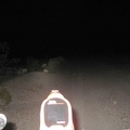
I find a fairly smooth spot in this rocky area and start setting up camp. I go for a short walk to make sure I'm not camping in the road that I can't see, but which is probably right here somewhere, according to the USGS quad overlay on my Delorme GPS.

It will be interesting to see tomorrow, in daylight, where I am.