9/62
Home / Mojave Preserve and Desert bikepacking trips / 2008: Mojave National Preserve Mountain-Bike Camping and Hike / Day 7: Mojave Desert springs: Butcher Knife Spring and Cottonwood Spring day hike, New York Mountains, Mojave National Preserve /
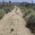
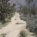
A mile north of my campsite is "the fork" in the road to Cottonwood Canyon and Butcher Knife Canyon

The right fork to Cottonwood Canyon and Cottonwood Spring is my route right now; the left fork leads to Butcher Knife Canyon and Butcher Knife Spring. I'll hike cross-country to Butcher Knife later this afternoon.
)
)
)
)
)