26/43
Home / Mojave Preserve and Desert bikepacking trips / 2010, Mojave National Preserve / Day 3: Kelso Peak area to Mid Hills campground, Mojave National Preserve, by bicycle /
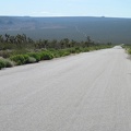
Cedar Canyon Road's famous "pavement ends" sign, Mojave National Preserve

Here at about 4200 feet elevation, a cool breeze tempers the waning sun's heat. Just to the left of the sign is the Eagle Rocks, a landmark visible from miles away. I stop to make a cell-phone call, probably my last reception for the next few days.
)
)
)
)
)