dryfj.com / drycyclist.com (kevin cook)

6/31
Home / Mojave Preserve and Desert bikepacking trips / 2010, Mojave National Preserve / Day 1: Baker, California to Kelso Peak area, Mojave National Preserve /

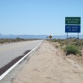
A few miles further up Kelbaker Road is the "watch for tortoises" sign; I still haven't seen one yet

3244-tortoise-watch.jpg Once across the I-15 freeway on Kelbaker Road, this Mojave National Preserve trip is really startingThumbnails10 miles up Kelbaker Road out of Baker, I stop for a break at "the big curve," where the road turns almost 90 degreesOnce across the I-15 freeway on Kelbaker Road, this Mojave National Preserve trip is really startingThumbnails10 miles up Kelbaker Road out of Baker, I stop for a break at "the big curve," where the road turns almost 90 degreesOnce across the I-15 freeway on Kelbaker Road, this Mojave National Preserve trip is really startingThumbnails10 miles up Kelbaker Road out of Baker, I stop for a break at "the big curve," where the road turns almost 90 degreesOnce across the I-15 freeway on Kelbaker Road, this Mojave National Preserve trip is really startingThumbnails10 miles up Kelbaker Road out of Baker, I stop for a break at "the big curve," where the road turns almost 90 degreesOnce across the I-15 freeway on Kelbaker Road, this Mojave National Preserve trip is really startingThumbnails10 miles up Kelbaker Road out of Baker, I stop for a break at "the big curve," where the road turns almost 90 degrees

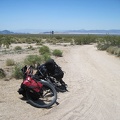
Kelbaker Road is a slow, gentle uphill, and I'll rise 1000 feet during the first 10 miles to reach those low hills ahead. The rise is almost imperceptible to someone driving a car. With close to 100F forecast, I need to get to higher, cooler ground.