dryfj.com / drycyclist.com (kevin cook)

39/75
Home / Mojave Preserve and Desert bikepacking trips / 2010, Mojave National Preserve / Day 14: Brant Hills to Baker by bicycle via Mojave Road, Mojave National Preserve /

Despite the fairly high elevation (over 4000 feet here), Cima Road is apparently subject to flash floods during heavy rains

7852-cima.jpg I start the 1.5-mile ride up Cima Road to the powerline road, passing an abandoned house on the way out of "town"ThumbnailsApproaching the power lines that cross Cima Road, I start looking for the dirt road that I'll follow somewhere at my leftI start the 1.5-mile ride up Cima Road to the powerline road, passing an abandoned house on the way out of "town"ThumbnailsApproaching the power lines that cross Cima Road, I start looking for the dirt road that I'll follow somewhere at my leftI start the 1.5-mile ride up Cima Road to the powerline road, passing an abandoned house on the way out of "town"ThumbnailsApproaching the power lines that cross Cima Road, I start looking for the dirt road that I'll follow somewhere at my leftI start the 1.5-mile ride up Cima Road to the powerline road, passing an abandoned house on the way out of "town"ThumbnailsApproaching the power lines that cross Cima Road, I start looking for the dirt road that I'll follow somewhere at my leftI start the 1.5-mile ride up Cima Road to the powerline road, passing an abandoned house on the way out of "town"ThumbnailsApproaching the power lines that cross Cima Road, I start looking for the dirt road that I'll follow somewhere at my left

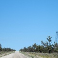
The big outcrop ahead called Teutonia Peak pokes out of Cima Dome. I can see the power lines, where I'll leave pavement again, in front of that landmark.