3/34
Home / Mojave Preserve and Desert bikepacking trips / 2007, Christmas: Mojave National Preserve Mountain-Bike Camping / Day 6: Water in the Mojave Desert! Coyote Springs round trip bicycle ride from Kelso Dunes campsite, Mojave National Preserve /
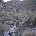
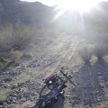
At another junction on the way to Coyote Springs, I pull out my map to look for this fork in the road

I don't have the USGS topography map with me, but the road to the right looks like the correct way to Coyote Springs.
)
)
)
)
)