34/57
Home / Mojave Preserve and Desert bikepacking trips / 2007: Death Valley National Park bikepacking / Day 1: Baker to Tecopa Hot Springs, California, mostly on Highway 127 /
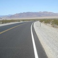
Just before crossing the valley, I stop to ponder Saratoga Springs Road

Saratoga Springs is another desert wetland, located seven miles or so down this dirt road.
I planned the trip so that if I am too tired to climb over Ibex Pass today, I could ride down the flat road to Saratoga Springs and camp there for the night.
Riding is going well, and I don't feel like winding down yet for the day. So, I won't be visiting Saratoga Springs today, and it remains on my future-visit list.
Saratoga Springs lies within the boundaries of Death Valley National Park, at its southern extremity. However, there are no signs around indicating this. The main developed area of Death Valley National Park that most tourists visit is some 75 miles north of here.
)
)
)
)
)