28/46
Home / Mojave Preserve and Desert bikepacking trips / 2009, Spring: Mojave National Preserve / Day 3: Cornfield Spring Road to Mid Hills Campground via Kelso Depot, Mojave National Preserve /
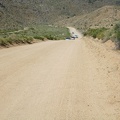
Cedar Canyon Road's famous "pavement ends" sign

This sign signifies that I'm leaving pavement for a week and entering a Mojave National Preserve heartland area. I'm at about 4250 feet elevation and the hot Kelso Valley is well behind me now.
)
)
)
)
)