32/71
Home / Mojave Preserve and Desert bikepacking trips / 2009, Spring: Mojave National Preserve / Day 4: Mid Hills campground hike to Eagle Rocks, Wildcat Spring, Chicken Water Spring and Silver Lead Spring /
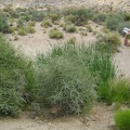
I leave Wildcat Spring and start hiking toward my next stop, Coyote Spring, about 1/2 mile beyond

Note the faded track here of an old road. This is not the same Mojave National Preserve Coyote Springs that I visited during my 2008 Mojave National Preserve trip. That one is situated in the lower Granite Mountains, south of Kelso Depot.

)
)
)
)
)