Home 7119

 OK, it's time to come out from behind this big old barberry bush and walk up there to Cliff Canyon Spring Peak #2
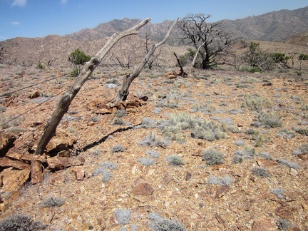 I come across another another one of those old rough-hewn wood fences that I always like
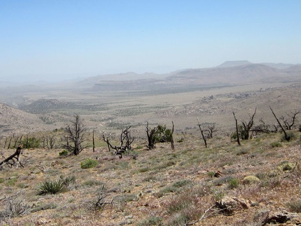 The old range fence crosses the view back down toward my Pinto Valley campsite
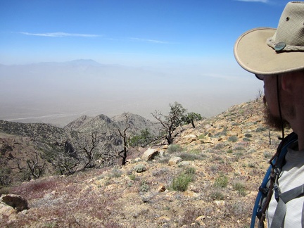 I keep looking back behind me at the saddle that leads down to Cliff Canyon Spring
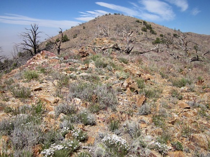 Just a little further until I reach the top...
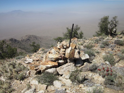 Up on Cliff Canyon Spring Peak #2 at about 6550 feet elevation is a claim marker and lots of low-growing cacti
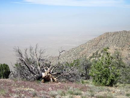 From Cliff Canyon Spring Peak #2 at 6550 feet, I can make out Brant Road along the train tracks below, despite the visiting smog
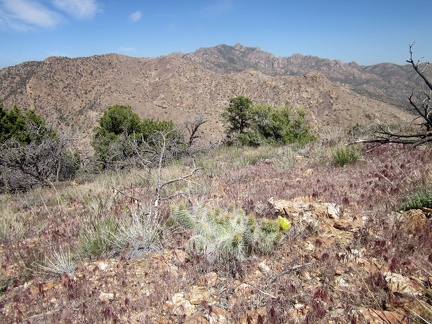 From here, I could continue downhill a few hundred feet and then up over to that next ridge in the New York Mountains
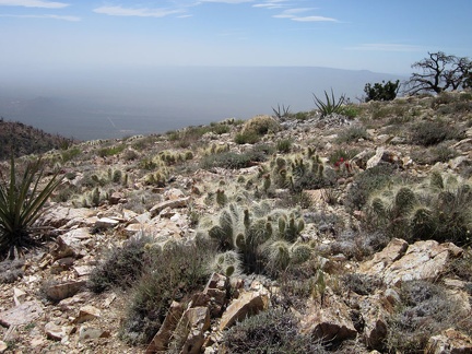 Up on Cliff Canyon Spring Peak #2 are a lot of ankle-high cacti
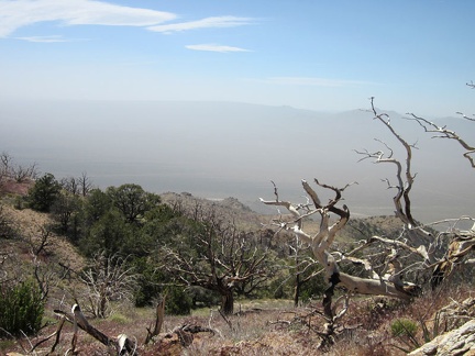 These burned tree skeletons near Cliff Canyon Spring Peak #2 don't care much about the strong winds up here!
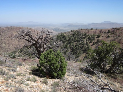 Looking back toward my Pinto Valley campsite, I see a whole hillside that escaped the 2005 brush fires
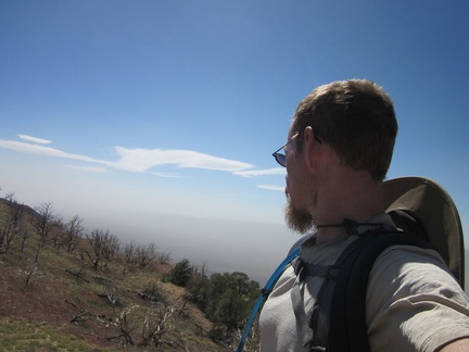 It's a clear sunny day above the smog layer that's blowing across the Ivanpah Valley below
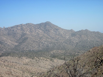 I keep looking across upper Fourth of July Canyon at the New York Mountains peaks
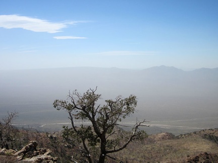 This pinon pine tree appears to have burned a bit during the 2005 brush fires, but not enough for it to die
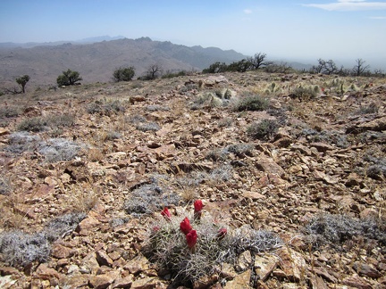 Several Claret-cup cacti up here on the Cliff Canyon Spring Peaks are blooming
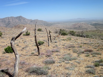 I decide to follow the old range fence for a while as I start my way back down to Pinto Valley
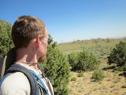 I pass by a few junipers and see that I'm descending into an unusually green-looking little upland valley
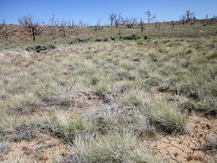 At the bottom of the valley, an uninterrupted patch of grey-green bunch grasses grows
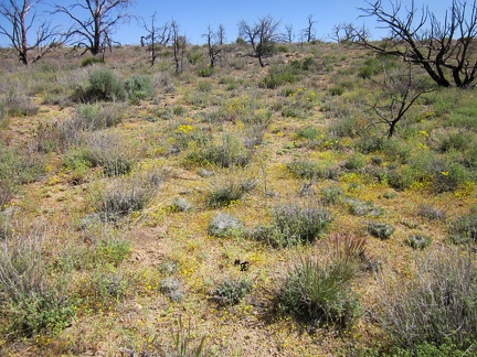 On the edge of the now-dry wet area are lots of tiny yellow flowers
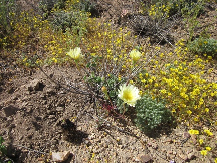 A few larger flowers also grow in this valley, which I think are Desert dandelions (Malacothrix californica)
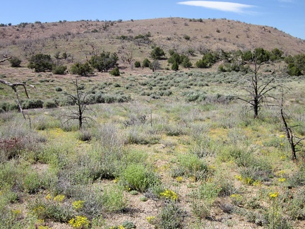 After crossing the little valley, I take a look back up toward the Cliff Canyon Spring Peaks to look at its banded appearance
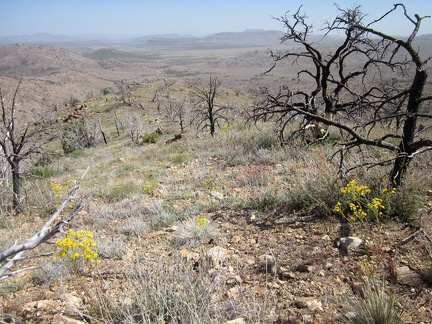 Some yellow Groundsel flowers also decorate the saddle I'm following back down to Pinto Valley
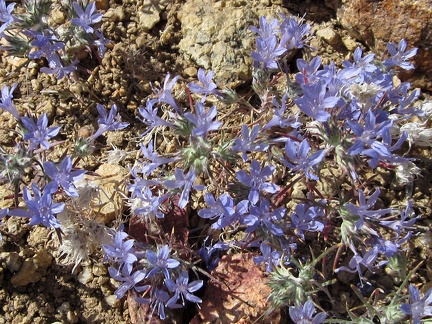 Well, I've just passed through some yellow; now it's time for some purple
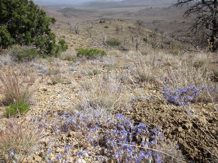 I'm not sure what these purple flowers are
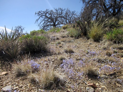 It's interesting to find so many of these purple flowers on just this one hillside in the New York Mountains
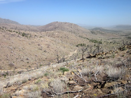 I'm tempted to climb down into the sandy wash as I get closer to Pinto Valley
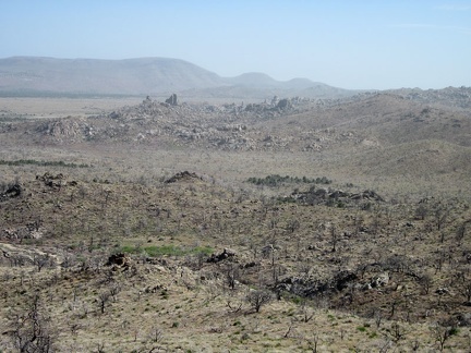 As I hike downhill toward home, I see that some of the smog haze has blown into Pinto Valley as well
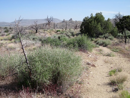 I'm officially at the bottom of the New York Mountains foothills now
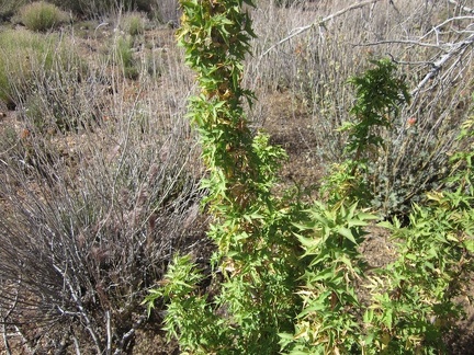 One bush that I encounter occasionally in the Mojave Desert Mountains is the Barberry
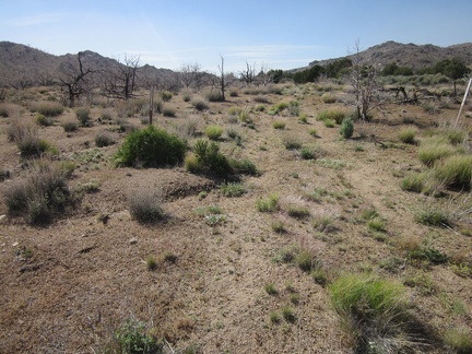 I'm back down in Pinto Valley earlier than expected, so I go for a walk up a barely visible old road on the way back to camp
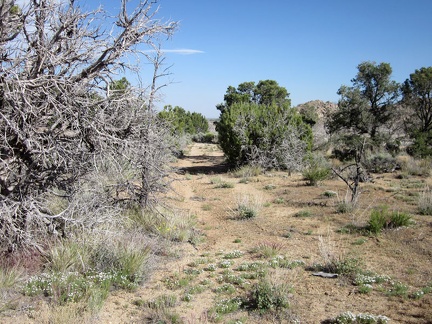 A few stretches of the old road here on the other side of Howe Spring are still well-defined
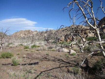 I decide to go climb a few boulders over on the nearby rock pile
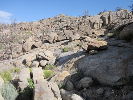 It's fun to hike over the rocks in this quiet corner of Pinto Valley
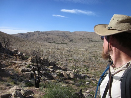 Looking back at the New York Mountains foothills, I realize that today's hike was not too difficult, and worth the effort
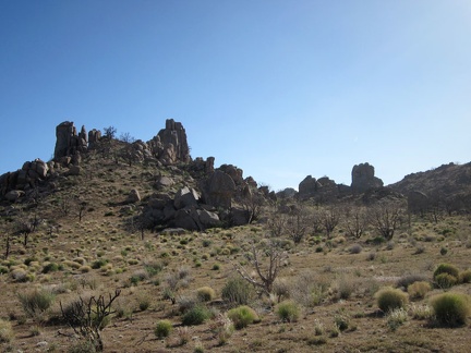 As I walk around the rocks near Howe Spring, I reflect on how I haven't seen another human for almost 4 days
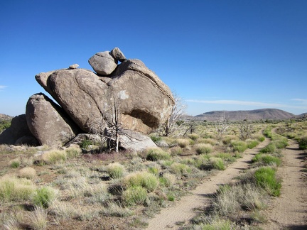 This pile of rocks reminds me of a rabbit viewed in side profile, with its head facing toward the right
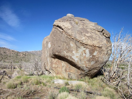 Front-on, these rocks look like a twisted, drunken face
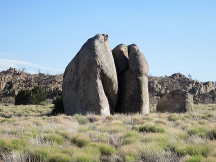 Nearby is another interesting rock outcrop
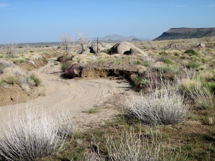 This part of Howe Spring Road follows a sandy, eroded wash
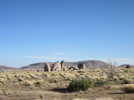 I pass yet another sculptural pile of rocks in Pinto Valley on the way back to my tent
 As I get closer to my tent, I notice my tire tracks and footprints from the past few days here in Pinto Valley
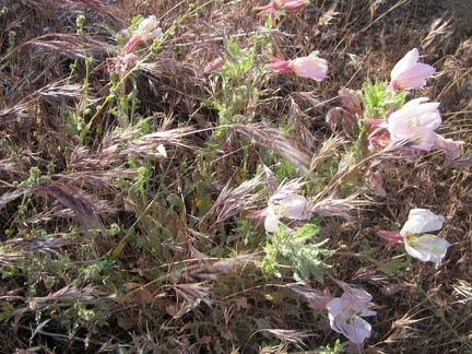 Arriving back at my tent, I take note of the patch of pink Desert primroses near the fire ring
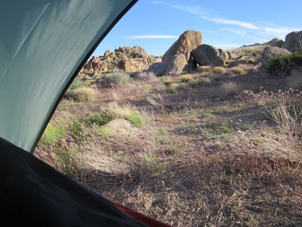 I'm going to boil water for supper on this side of the tent, to shelter my gas flame from the wind
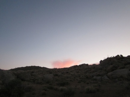 One last sunset at Pinto Valley
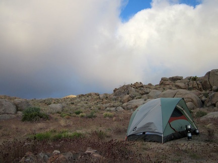 High winds overnight at Pinto Valley kept me from getting much sleep on this final night of the trip: miserable
 I dig one final cat hole in Pinto Valley and no flies drop by to disturb me while I fill it up
 My tent threatens to blow away while I pack it up one last time (until the next trip, of course)
 Everything is packed up and I'm almost ready to leave Pinto Valley after four nights here
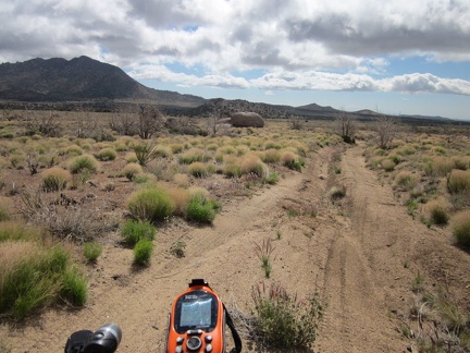 I leave my Pinto Valley campsite at 5650 feet elevation and start coasting down Howe Spring Road around 9h
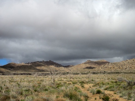 I keep looking back at the ominous clouds behind me as I ride down Howe Spring Road
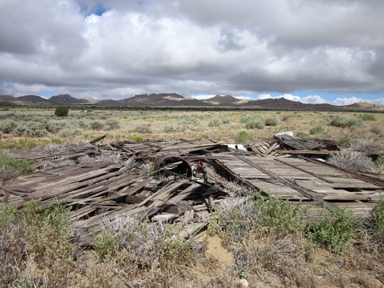 I stop to check out the remains of an old building along Howe Spring Road
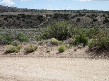 My route ahead will take me across Watson Wash
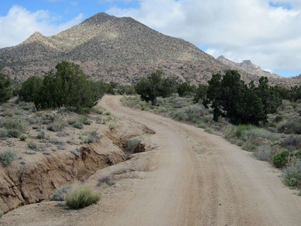 I'm on New York Mountains Road now, and this part of it squiggles toward Drum Peak
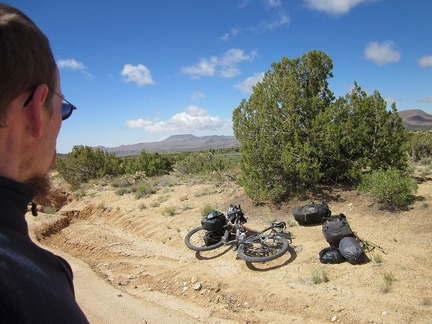 On New York Mountains Road, I notice strange noises coming from the 10-ton bike, so I pull over to see what's wrong
 I pass a few little roads in this scenic area at the foot of the New York Mountains near Carruthers Canyon
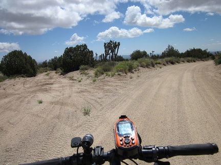 I turn off on an unnamed road, which I'll call the Sagamore Canyon Cut-Off, and leave the better New York Mountains Road behind
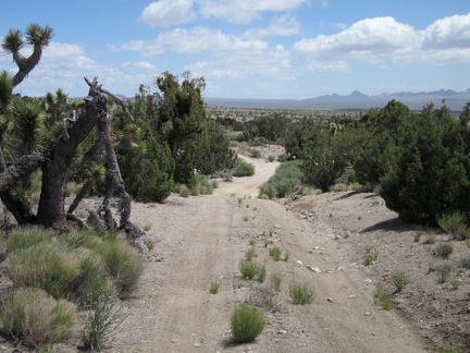 The Sagamore Canyon Cut-Off Road passes through a stand of juniper trees as it begins its gentle descent
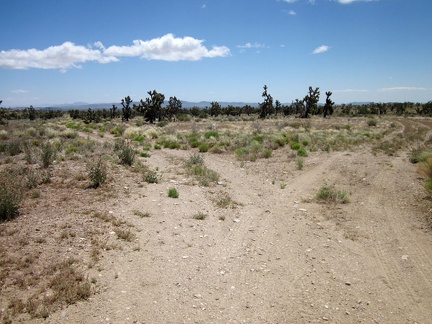 I reach a junction on the five-mile-long Sagamore Canyon Cut-Off Road
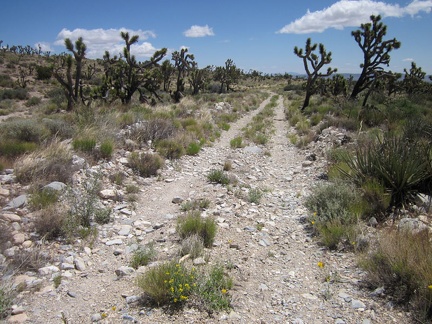 Sagamore Canyon Cut-Off Road is rather rough in places
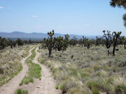 Much of the landscape along Sagamore Canyon Cut-Off Road seems to be quite pristine
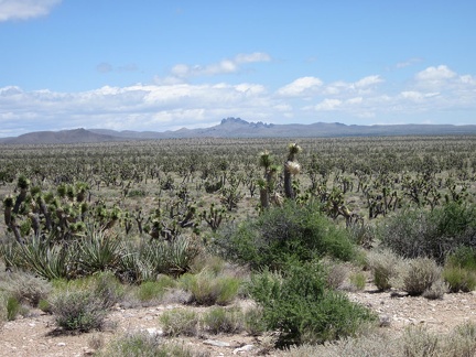 I can see across the eastern end of Lanfair Valley over to the Castle Peaks area, where I spent a few days last week
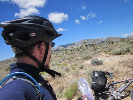 It's time for a short break to enjoy the solitude of Sagamore Canyon Cut-Off Road without the noise of the 10-ton bike
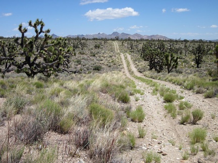 Sagamore Canyon Cut-Off Road rolls over many low humps, since it cuts across drainage areas from the New York Mountains
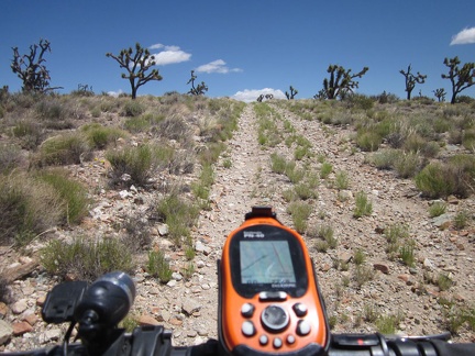 A few short slopes with loose rock on the Sagamore Canyon Cut-Off road force me to get off the bike and walk a bit
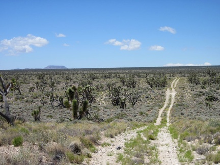 Looking back behind me, I can see all the way across Lanfair Valley to flat-topped Table Mountain
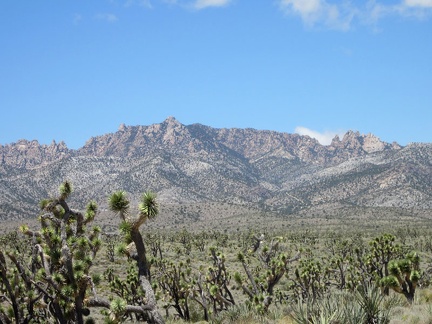 Great views from here across the joshua-tree forest to the New York Mountains peaks
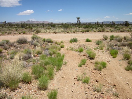 My five-mile ride across the Sagamore Canyon Cut-Off road comes to an end when I reach the bigger Ivanpah Road
 Ivanpah Road is wide and gravelly
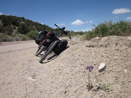 I pull over on Ivanpah Road to check out a couple of Phacelias (Desert canterbury bells) in bloom
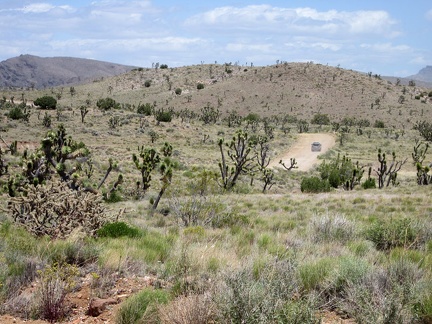 A couple of cars pass me along Ivanpah Road
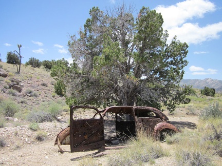 I turn down a side road, just to see what's there, and find this old shot-up car
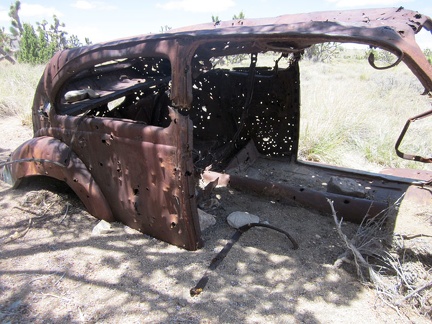 Not only is the old car (1940s?) well-shot-up, but it's well-buried in sand
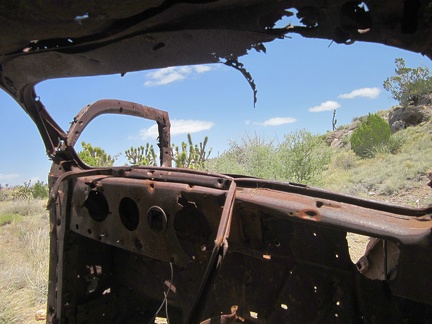 Nice view from the driver's seat!
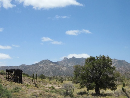 I walk over to that old headframe, or whatever it is, with the New York Mountains backdrop
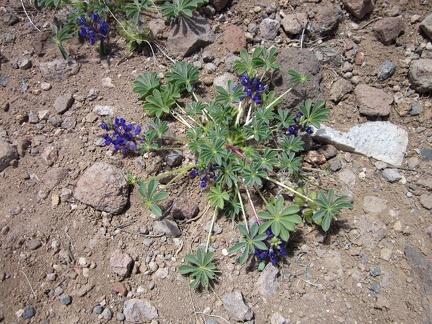 I spot a tiny bit of blue in the landscape!
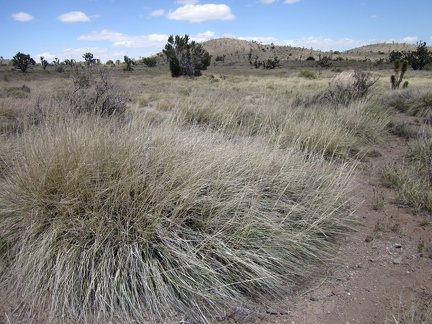 Some of the bunch grasses in this high valley are quite bushy
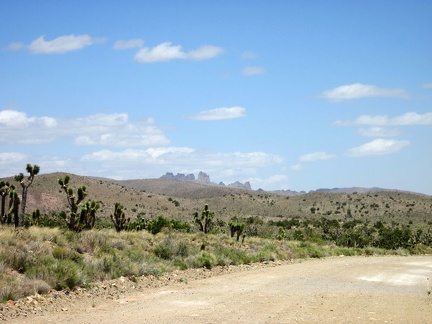 I return to the task of riding back to Primm, Nevada and have views of the Castle Peaks from this part of Ivanpah Road
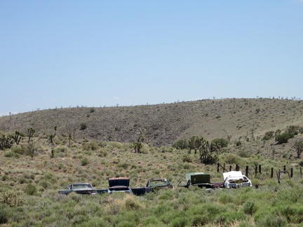 As I ride past Barnwell, I have to take another photo of the lined-up junked cars
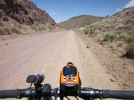 This segment of Ivanpah Road follows the old railway grade from 100 years ago, and thus cuts right through the hills
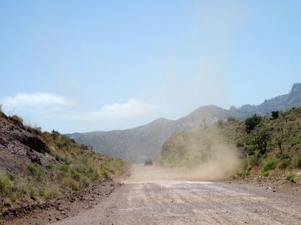 An uphill car passes me as Ivanpah Road begins its descent into Ivanpah Valley
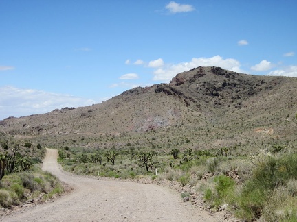 I recognize the Bathtub Spring Peaks area as I ride down Ivanpah Road
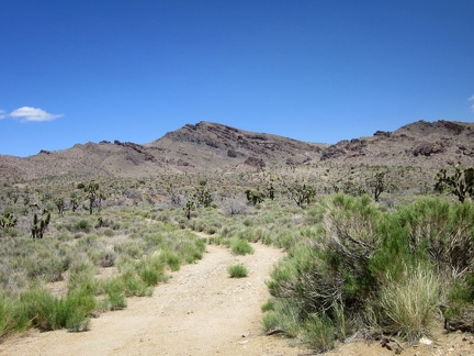 I pause briefly along Ivanpah Road when I pass the dirt track leading up to Bathtub Spring, where I hiked on day 6
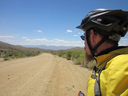 In today's cool weather, I'm wearing my windbreaker over my sweater as I descend slowly into Ivanpah Valley
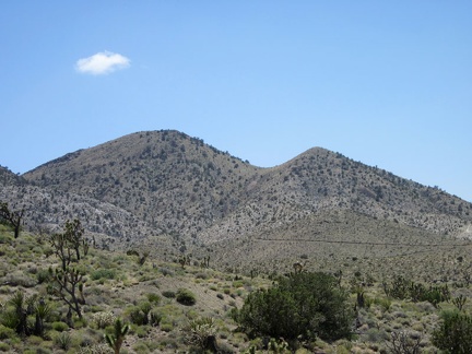 On the west side of Ivanpah Road, I can see roads leading up the hillsides in the Slaughterhouse Spring area
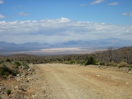 Downhill I ride toward Ivanpah Valley
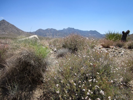 Buckwheats are still flowering along this stretch of Ivanpah Road
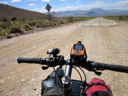 I arrive at the beginning of the pavement on Ivanpah Road
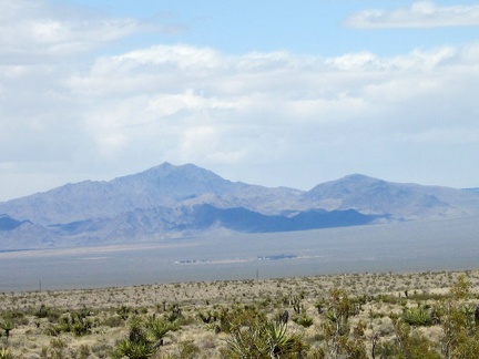 Down there in the middle of Ivanpah Valley is a homestead
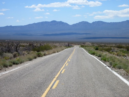 It's fun to be on pavement again for a change, even if it's only for 2.5 miles: especially since it's downhill
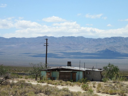 As I approach the train tracks, I pass the old Ivanpah General Store
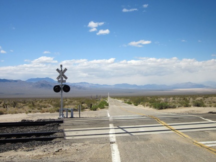 At the Ivanpah Road railroad crossing, I make a right turn toward Nipton on the dirt road (Nipton-Moore Rd) that hugs the tracks
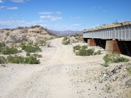 Lonely Nipton-Moore Road dips down to cross numerous drainage washes as it crosses the desert alongside the train tracks
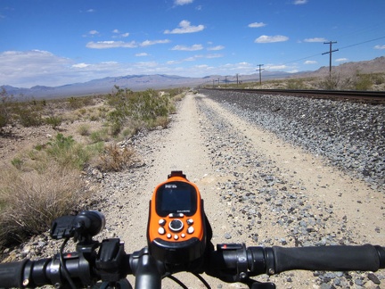 I have almost 20 miles to ride on this road until I reach Primm and end the day (and this year's trip)
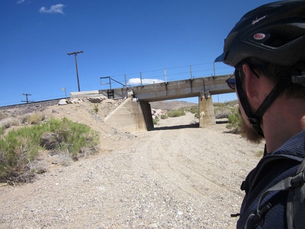 I pass another of these railway bridges and this one has a sandy road running under it, toward Willow Wash
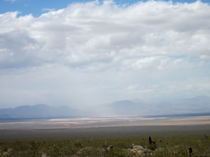 Hmmm... it looks like some light rain is falling further over in Ivanpah Valley
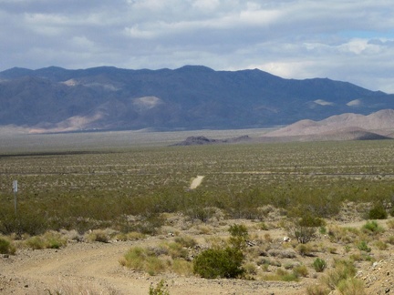 Nipton-Moore Road rises over a few mounds, and from this one, I can see over to a small outcrop I've nicknamed 'Black Palisades'
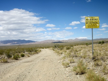 This road is not maintained...
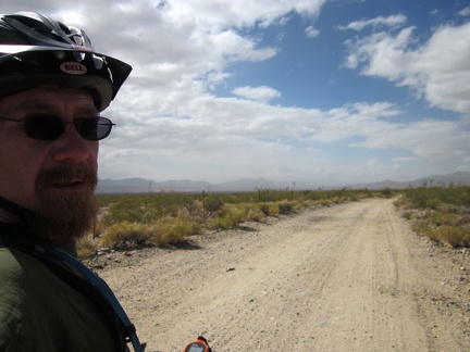 I think I'm riding right into that cloudy area...
 Just another three miles, and I'll arrive at Nipton for my rest stop
 My dirt road crosses the paved Nipton Road, where I get off to visit the general store
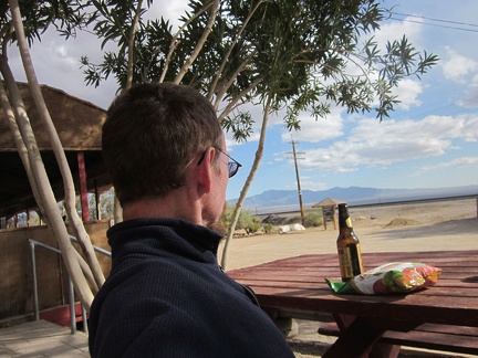 I stop at Nipton for a relaxing 1.5 hours; I eat vegetable chips and have some liquid refreshment
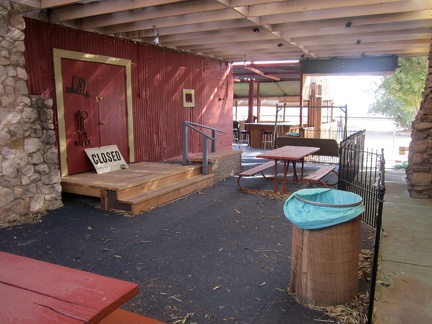 The café at Nipton is closed right now due to plumbing problems
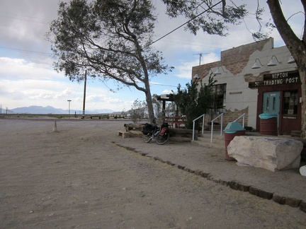 I guess I need to leave Nipton and get on with the final leg of this trip
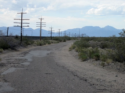 I'm back on the train-track road, but this time a few miles of it are paved, and called Nipton-Desert Road
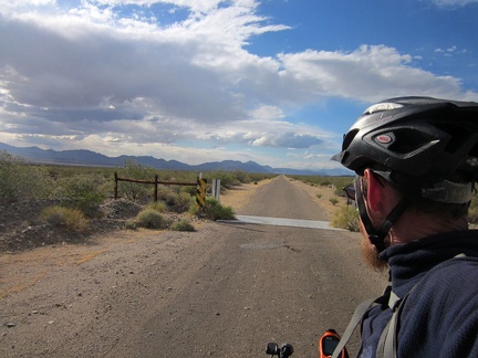 I cross the cattle-guard on Nipton-Desert Road
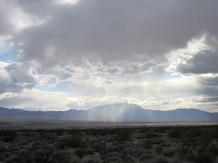 It looks like a few rainy patches are moving around out in the middle of Ivanpah Valley
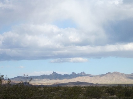 I zoom in behind me for a final glance at the Castle Peaks area of the New York Mountains
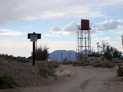 The pavement on Nipton-Desert Road ends at private property and the road turns sharply left to cross under the train tracks
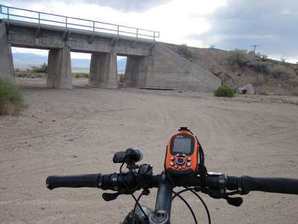 Nipton-Desert Road crosses under the train tracks at the one-house settlement of Desert, California
 I keep looking back at the murky clouds over upper Ivanpah Valley toward Cima and the New York Mountains
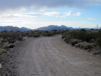 Nipton-Desert Road comes out from under a few dark clouds as I ride toward Primm
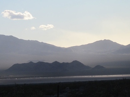 Vehicles on the I-15 freeway, on the other side of Ivanpah Valley, glisten as the setting sun peers through the clouds
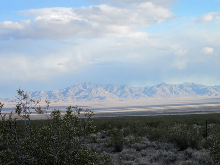 From here, I can see back to the New York Mountains ridge line where I hiked yesterday (Cliff Canyon Springs Peaks)
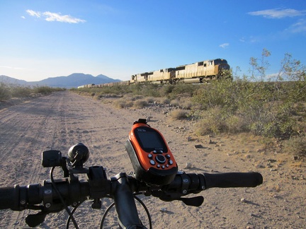 It's always fun when a train passes by while riding these trackside roads in the Mojave Desert
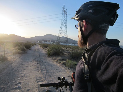 Well, there's Primm, Nevada just ahead; I guess this year's trip is officially over
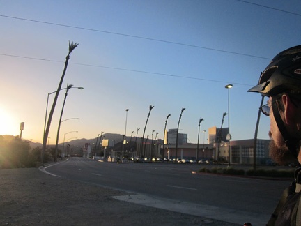 Back on the pavement of Primm, Nevada, where I started two weeks ago
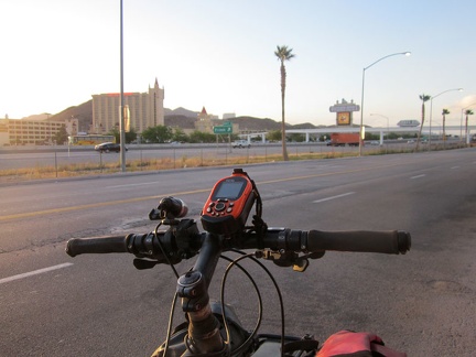 There's Whiskey Pete's Casino and Hotel on the other side of the freeway, where I'll spend this last night; trip over!
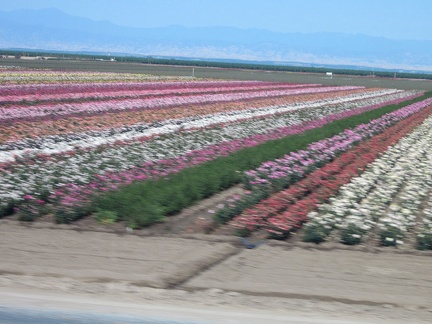 Tomorrow morning, an Amtrak bus will deliver me to the train in Bakersfield, which passes through fields of roses in Wasco
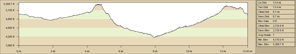 Bathtub Spring Peaks, New York Mountains hiking route elevation profile
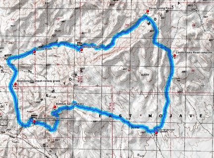 Bathtub Spring Peaks, New York Mountains hiking route
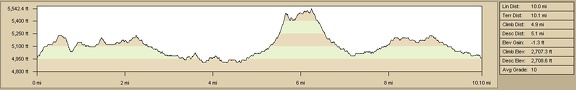 Elevation profile of Castle Peaks hiking route, Mojave National Preserve
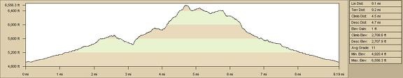 Elevation profile of McCullough Mountains hiking route from Pine Spring area
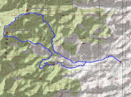 McCullough Mountains hike route from Pine Spring area
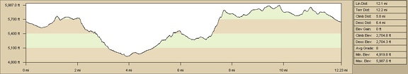 Five-springs hike in the northern Mid Hills/New York Mountains: route
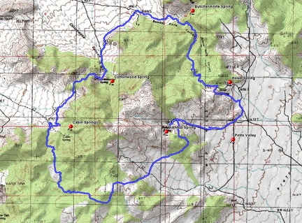 Five-springs hike in the northern Mid Hills/New York Mountains: route
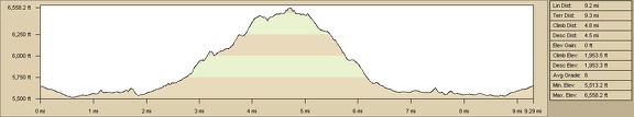 Cliff Canyon Peaks hike, Mojave National Preserve, hiking route
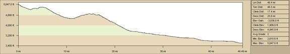 Elevation profile of Pinto Valley to Primm, Nevada bicycle route via Ivanpah Road
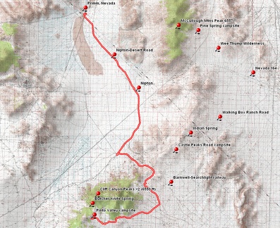 Pinto Valley to Primm, Nevada bicycle route via Ivanpah Road
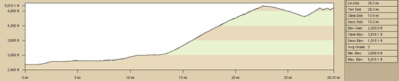 Elevation profile of bicycle route from Primm, Nevada to Pine Spring area, McCullough Mountains
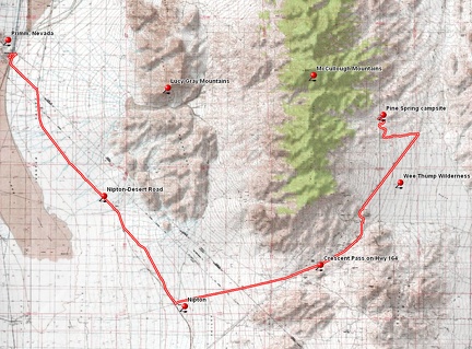 Bicycle route from Primm, Nevada to Pine Spring area, McCullough Mountains, Nevada
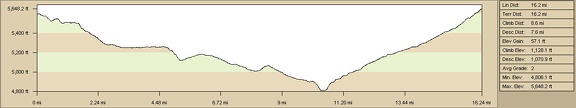 Elevation profile of bicycle route from Mid Hills Campground to Pinto Valley, Mojave National Preserve
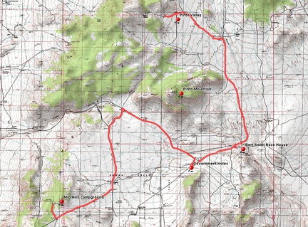 Bicycle route from Mid Hills Campground to Pinto Valley, Mojave National Preserve
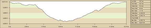 Elevation profile of bicycle route through Gold Valley to Saddle Horse Canyon from Mid Hills campground
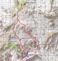 Route of Gold Valley bicycle ride from Mid Hills campground, plus a short hike in Saddle Horse Canyon
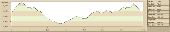 Summit Spring hiking route elevation profile
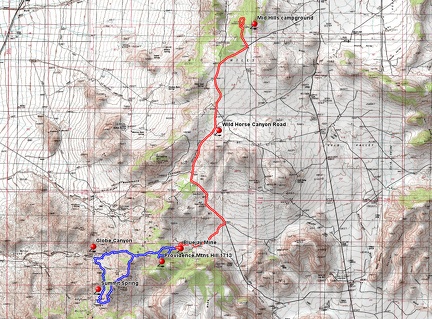 Summit Spring hiking route and Wild Horse Canyon bicycle ride
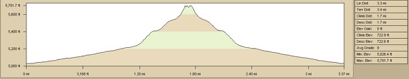 Teutonia Peak Trail, Mojave National Preserve, elevation gain
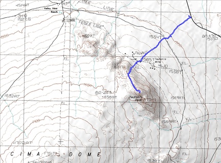 Teutonia Peak Trail, Mojave National Preserve, hiking route
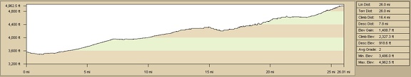 Elevation profile of bicycle route to Castle Peaks, Mojave National Preserve from Searchlight, Nevada
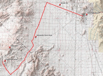 Bicycle route to Castle Peaks, Mojave National Preserve from Searchlight, Nevada
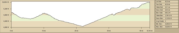 Elevation profile of bicycle route from Castle Peaks campsite to Mid Hills campground via Cedar Canyon Road
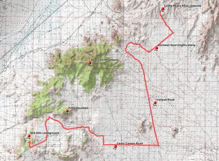 Bicycle route from Castle Peaks campsite to Mid Hills campground via Cedar Canyon Road
 Elevation profile of bicycle route from Pine Spring, McCullough Mountains to Searchlight
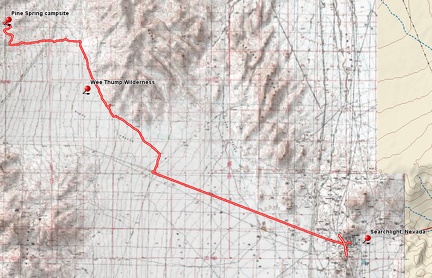 Bicycle route from Pine Spring, McCullough Mountains to Searchlight
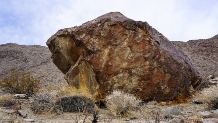 The Boulder
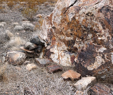 Rock pile
 End of day
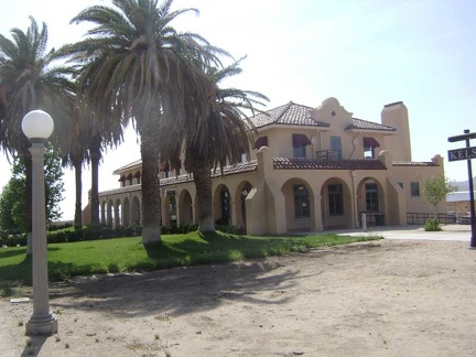 Here I am yet again taking a break at Mojave National Preserve's Kelso Depot visitor center
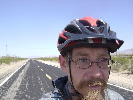 As I descend into the Kelso Valley, it's becoming noticeably warmer
 I start the 19-mile ride down Kelso-Cima Road to Kelso Depot and stop after 5 miles at the junction of Cedar Canyon Road
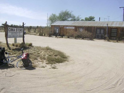 I'm lucky again when I pass the Cima Store because it's open
 Yesterday morning I left San José and took Amtrak train and bus to Baker, California to start the trip
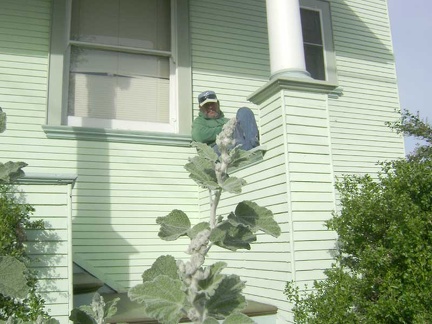 My friend and housesitter hangs out on my front porch as I pull away
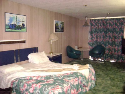 I start this Mojave National Preserve trip by waking up in my kitchy 1980s room at Baker's deteriorating Royal Hawaiian Motel
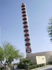 Baker's "world's tallest thermometer," next to the Big Boy restaurant, registers a balmy 71 degrees this morning
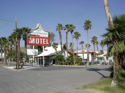 Roadside view of the Royal Hawaiian Motel, my home last night while waiting to begin the bikepacking trip
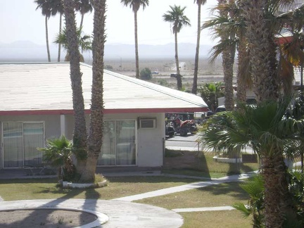 From my balcony at the Royal Hawaiian, I can see Kelbaker Road heading into the cherished emptiness of Mojave National Preserve
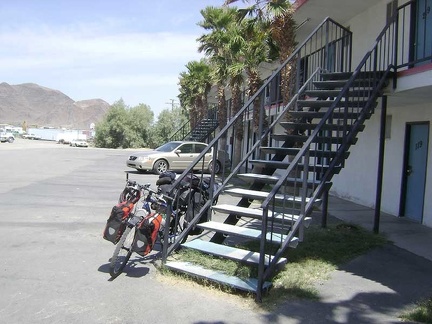 The 10-ton bike is now packed and assembled, ready to leave the Royal Hawaiian and spend two weeks in Mojave National Preserve
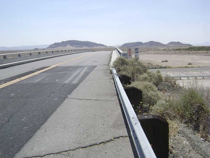 Leaving Baker, the 10-ton bike and I cross the I-15 freeway and head toward Mojave National Preserve
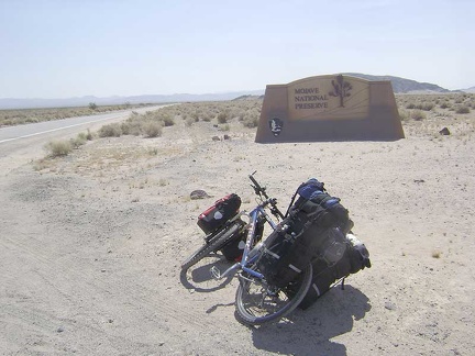 A quarter mile or so beyond the freeway crossing, I reach the Mojave National Preserve entrance marker and leave the past behind
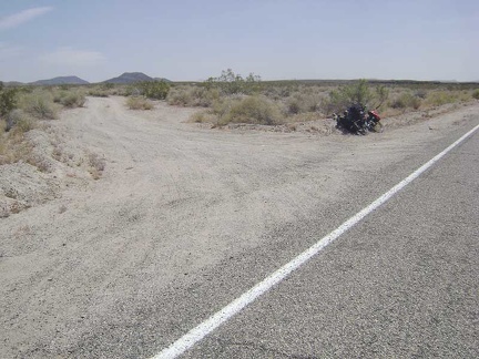 Almost 13 miles up Kelbaker Road, I stop briefly at the rough dirt road to Indian Springs, Mojave National Preserve
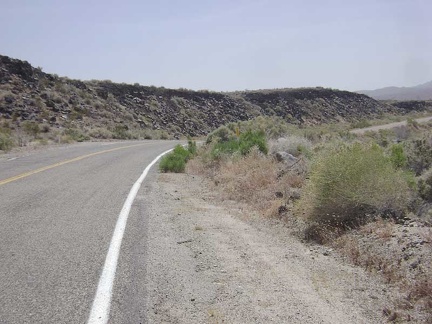 I always enjoy passing the lava flows along Kelbaker Road just beyond the road to Indian Springs
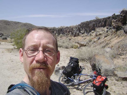 Time for a break: I pause for a Clif bar at Black Tank Wash along the lava flows adjacent to Kelbaker Road
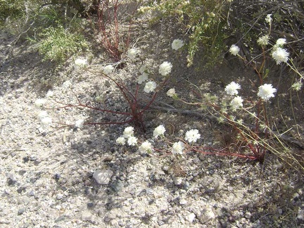 I'm noticing a lot of white-flowered buckwheats along Kelbaker Road on the way up toward the summit
 I keep pedalling slowly up Kelbaker Road, Mojave National Preserve
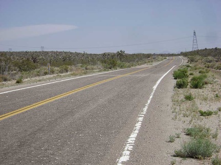 I'm almost at the Kelbaker Road summit now, which is marked by the power lines crossing the road
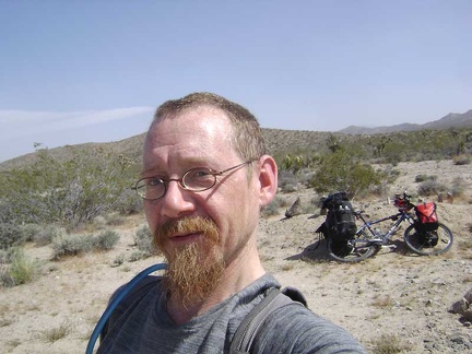 I take another break when I reach the coveted Kelbaker Road summit at about 3800 feet
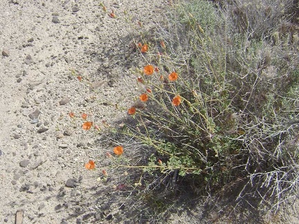 Orange desert mallow flowers at the Kelbaker Road summit, Mojave National Preserve
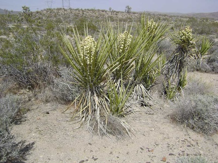 Banana yuccas getting ready to flower at the Kelbaker Road summit, Mojave National Preserve
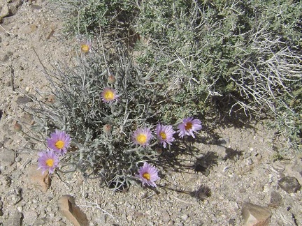 Mojave aster flowers at Kelbaker Road summit, Mojave National Preserve
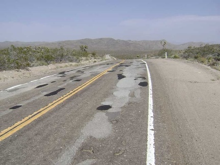 Replenished, I begin the slow 12-mile descent to the Mojave National Preserve Kelso Depot visitor centre 1700 feet below
 Kelbaker Road drops down toward Kelso and the sand piles of the Kelso Dunes become visible in the distance down in the valley
 As I reach the floor of Kelso Valley at 2100 feet, I focus on the small group of buildings ahead that is the town of Kelso
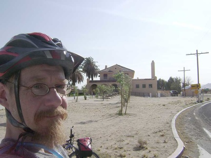 I hang out at the Kelso Depot visitor centre for almost an hour, fill up my water supply, and ask rangers about area conditions
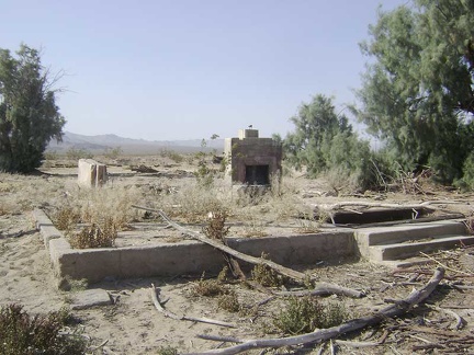 Just before I leave Kelso Depot, I stop to visit the ruins of a house across the road
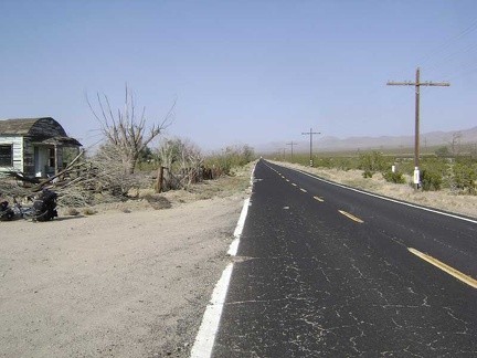 I begin wobbling up the gentle grade of Kelso-Cima Road away from Kelso Depot up to Globe Mine Road
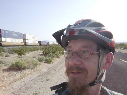 I exchange waves with the conductor of a passing freight train that rises slowly on the tracks along Kelso-Cima Road
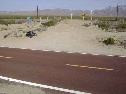 I've been riding on pavement all day (almost 40 miles), but this will end now that I've reached the sign for Globe Mine Road
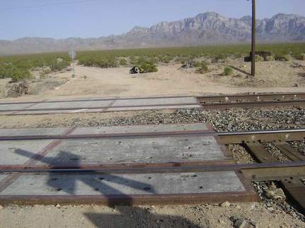 I cross the tracks at Globe Mine Road and it's official: I've just left pavement for a couple of days
 Just beyond the railroad tracks, Globe Mine Road splits into three unnamed roads
 I choose the right (south) fork of Globe Mine Road
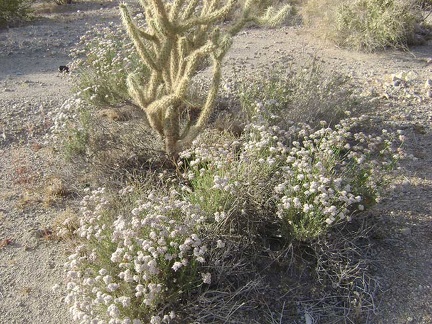 A garden of white buckwheat flowers and cholla cactus along the south fork of Globe Mine Road, Mojave National Preserve
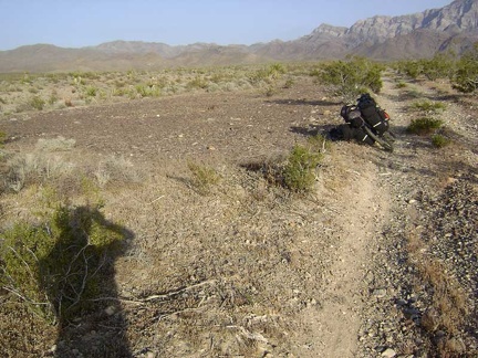 This clearing along the south fork of Globe Mine Road is obviously an old site of something and well-used
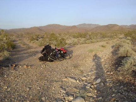 After about two miles, I reach the "shortcut" from the south fork of Globe Mine Road to the middle fork
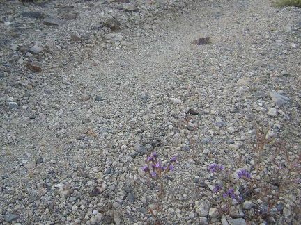 Diminutive phacelia flowers grow in the road on the "shortcut" between Globe Mine Road's south and middle forks
 The "shortcut" road dips down into a wash as it connects from the south fork to the middle fork of Globe Mine Road
 The "shortcut" ends at a junction with the middle fork of Globe Mine Road
 I follow tire tracks up a wash that seems to be the middle fork of Globe Mine Road and drag the bike through the deep sand
 I decide that I don't really need to camp right next to that old mine site, so I pull over here and choose a campsite nearby
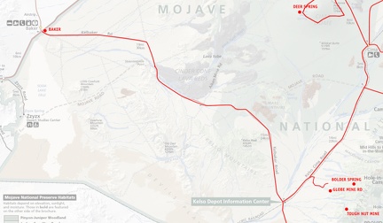 Mojave National Preserve map, Day 1: Baker to Globe Mine Road
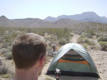 Making coffee outside my tent near the end of the middle fork of Globe Mine Road, Mojave National Preserve
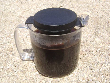 A bluish-grey moth with subtle peach trim visits my cup while coffee is steeping
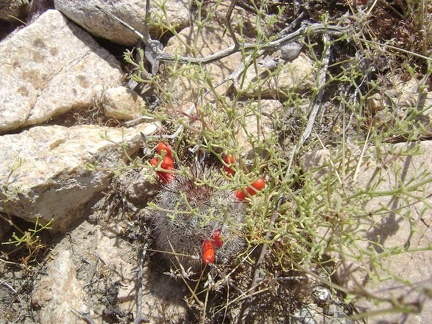 Red cactus flower buds near my tent
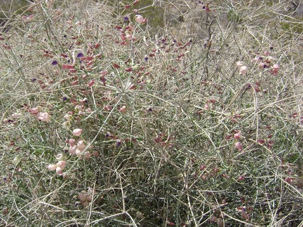 Paper-bag bush (aka salazaria mexicana, bladder sage) growing near my tent
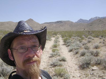 It's 13h and I finally get started on today's hike to Tough Nut Mine
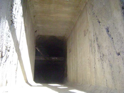 This shaft at the mine site has concrete walls
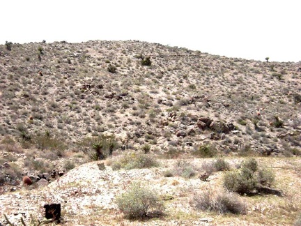 I see what looks like an old road up on the hill above, which is not on my maps
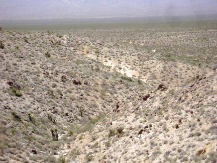 The old remnant of a road ends here on the crest of the hill at a small mine shaft; I continue walking cross-country
 From the top of the next low ridge, I look for an easy descent down to the next wash
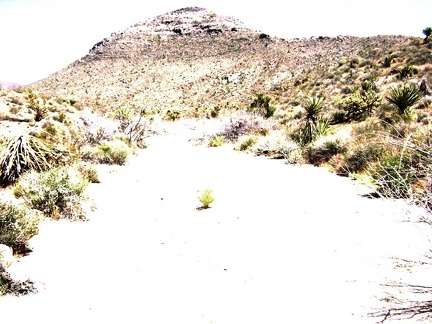 I walk a quarter mile up the wash, looking for signs of the old road to Tough Nut Mine